Davenport, Washington
| Davenport | |
|---|---|
| City | |
| Davenport, Washington | |
 Location of Davenport, Washington | |
| Coordinates: 47°39′4″N 118°9′6″W / 47.65111°N 118.15167°WCoordinates: 47°39′4″N 118°9′6″W / 47.65111°N 118.15167°W | |
| Country | United States |
| State | Washington |
| County | Lincoln |
| Area[1] | |
| • Total | 1.82 sq mi (4.71 km2) |
| • Land | 1.82 sq mi (4.71 km2) |
| • Water | 0 sq mi (0 km2) |
| Elevation | 2,375 ft (724 m) |
| Population (2010)[2] | |
| • Total | 1,734 |
| • Estimate (2015)[3] | 1,672 |
| • Density | 952.7/sq mi (367.8/km2) |
| Time zone | Pacific (PST) (UTC-8) |
| • Summer (DST) | PDT (UTC-7) |
| ZIP code | 99122 |
| Area code(s) | 509 |
| FIPS code | 53-16795[4] |
| GNIS feature ID | 1504329[5] |
| Website | City of Davenport |
Davenport is the county seat of Lincoln County, Washington, United States. The population was 1,734 at the 2010 census.[6]
History
Davenport was first settled in 1880, and was named in 1882 for resident J.C. Davenport.[7] Davenport was officially incorporated on June 9, 1890. Davenport gained early prominence in the north central part of the Columbia Basin of eastern Washington. When the Seattle Lake Shore & Eastern Railway (SLS&E) was building a cross state railroad line running west from Spokane in 1888, it looked to miss Davenport by a few miles to the south. The SLS&E even went so far as to plat the town of Wheatdale to rival Davenport. But when the city of Wheatdale failed to attract residents and the funds to continue building the railroad ran dry, the citizens of Davenport struck a deal with the SLS&E to extend the end of track from Wheatdale north to Davenport in the summer of 1889.
The transcontinental Northern Pacific Railway (NP) saw the SLS&E as a threat and funded the Central Washington Railroad (CW) to build a competing railroad line from Cheney west. The CW railroad reached Davenport in February 1889. Northern Pacific Railway acquired control of the bankrupt SLS&E in early 1890 and for many years operated the former SLS&E is the stub ended Eleanor Branch. Two railroads were not enough for Davenport, and the citizens sought to entice the Great Northern Railway (GN) to build a branchline from Bluestem to Davenport in the 1920s. GN was more than interested and began grading a railroad from Bluestem through Davenport to Peach and Fort Spokane on the Columbia River. But just when it looked like track was going to be laid on the completed grade, government plans for Grand Coulee Dam and the giant Lake Roosevelt drowned any ambition GN had about reaching down Hawk Creek to the Columbia River.
NP and GN became part of Burlington Northern Railroad (BN) in 1970. BN continued the operate freight trains in both directions on the CW, but the Eleanor Branch could not be economically upgraded to handle 3-bay grain hopper railcars coming into widespread use. The branch was abandoned in 1982 and torn up the following year. By the time BN became part of the BNSF Railway in 1994, traffic on the CW was down to three round trips a week when there was wheat to move, but often less busy during the late spring and summer. In 1996 BNSF sold the CW route to the WATCO affiliate Palouse and Coulee City Railroad (PCC). PCC saw further declines in traffic and the railroad was sold to the State of Washington in 2007. Eastern Washington Gateway Railroad was selected as the operator for the CW line in 2008 and has operated through Davenport ever since.
Davenport is centrally located in the northern wheat belt of the Columbia Basin, where dryland wheat farming on the hills not washed away in the great Missoula Floods some 14,000 years ago, is critical to the agricultural economy of the region. Davenport Union Warehouse and Odessa Union Warehouse operate multiple elevators of varying age and design on the southern part of the city. A few of these structures date to the early days of the city. Davenport still serves as a central collection point for wheat, with most of it shipped out by truck or railcar. While most of the wheat goes to export, some of it does find its way to the ADM flour mills in Spokane and Cheney. Locally grown barley also finds it's way to various west coast breweries and other users.
Primary State Highway #2 (a.k.a. "Sunset Highway") closely followed the CW railroad from Coulee City through Davenport to Spokane. The route is now known as U.S. Route 2, but does not follow the original Sunset Highway in many places. Primary State Highway #7 also intersected with PSH #2 in Davenport, and is now part of State Route 28. PSH #22 ran north from Davenport to the Canada–US border near Northport. This is State Route 25 now.
Geography
Davenport is located at 47°39′4″N 118°9′6″W / 47.65111°N 118.15167°W (47.651157, -118.151627).[8]
According to the United States Census Bureau, the city has a total area of 1.82 square miles (4.71 km2), all of it land.[1]
Climate
Davenport experiences a dry-summer continental climate (Köppen Dsb).
| Climate data for Davenport (1971–2000) | |||||||||||||
|---|---|---|---|---|---|---|---|---|---|---|---|---|---|
| Month | Jan | Feb | Mar | Apr | May | Jun | Jul | Aug | Sep | Oct | Nov | Dec | Year |
| Record high °F (°C) | 58 (14) |
60 (16) |
73 (23) |
90 (32) |
94 (34) |
102 (39) |
105 (41) |
103 (39) |
100 (38) |
86 (30) |
68 (20) |
61 (16) |
105 (41) |
| Average high °F (°C) | 31.1 (−0.5) |
37.3 (2.9) |
47.5 (8.6) |
57.2 (14) |
65.8 (18.8) |
73.3 (22.9) |
81.9 (27.7) |
82.8 (28.2) |
72.8 (22.7) |
59.1 (15.1) |
40.7 (4.8) |
31.5 (−0.3) |
56.75 (13.74) |
| Daily mean °F (°C) | 24.9 (−3.9) |
30.2 (−1) |
38.0 (3.3) |
45.0 (7.2) |
52.6 (11.4) |
59.2 (15.1) |
65.8 (18.8) |
66.3 (19.1) |
57.3 (14.1) |
45.8 (7.7) |
33.7 (0.9) |
25.3 (−3.7) |
45.34 (7.42) |
| Average low °F (°C) | 18.6 (−7.4) |
23.0 (−5) |
28.4 (−2) |
32.8 (0.4) |
39.4 (4.1) |
45.0 (7.2) |
49.6 (9.8) |
49.7 (9.8) |
41.8 (5.4) |
32.4 (0.2) |
26.7 (−2.9) |
19.0 (−7.2) |
33.87 (1.03) |
| Record low °F (°C) | −28 (−33) |
−25 (−32) |
−9 (−23) |
18 (−8) |
20 (−7) |
27 (−3) |
29 (−2) |
29 (−2) |
20 (−7) |
−1 (−18) |
−22 (−30) |
−23 (−31) |
−28 (−33) |
| Average precipitation inches (mm) | 1.45 (36.8) |
1.22 (31) |
1.30 (33) |
1.02 (25.9) |
1.41 (35.8) |
1.03 (26.2) |
0.78 (19.8) |
0.54 (13.7) |
0.65 (16.5) |
0.88 (22.4) |
1.90 (48.3) |
1.93 (49) |
14.11 (358.4) |
| Source: NOAA (normals, 1971–2000) [9] | |||||||||||||
Demographics
| Historical population | |||
|---|---|---|---|
| Census | Pop. | %± | |
| 1890 | 390 | — | |
| 1900 | 1,000 | 156.4% | |
| 1910 | 1,229 | 22.9% | |
| 1920 | 1,112 | −9.5% | |
| 1930 | 987 | −11.2% | |
| 1940 | 1,337 | 35.5% | |
| 1950 | 1,417 | 6.0% | |
| 1960 | 1,494 | 5.4% | |
| 1970 | 1,363 | −8.8% | |
| 1980 | 1,559 | 14.4% | |
| 1990 | 1,502 | −3.7% | |
| 2000 | 1,730 | 15.2% | |
| 2010 | 1,734 | 0.2% | |
| Est. 2015 | 1,672 | [10] | −3.6% |
| U.S. Decennial Census[11] 2015 Estimate[3] | |||
2010 census
As of the census[2] of 2010, there were 1,734 people, 694 households, and 445 families residing in the city. The population density was 952.7 inhabitants per square mile (367.8/km2). There were 750 housing units at an average density of 412.1 per square mile (159.1/km2). The racial makeup of the city was 95.3% White, 0.1% African American, 1.2% Native American, 0.1% Asian, 0.1% Pacific Islander, 0.6% from other races, and 2.6% from two or more races. Hispanic or Latino of any race were 2.7% of the population.
There were 694 households of which 31.1% had children under the age of 18 living with them, 46.8% were married couples living together, 13.5% had a female householder with no husband present, 3.7% had a male householder with no wife present, and 35.9% were non-families. 31.6% of all households were made up of individuals and 13.9% had someone living alone who was 65 years of age or older. The average household size was 2.43 and the average family size was 3.03.
The median age in the city was 40 years. 25.5% of residents were under the age of 18; 8.7% were between the ages of 18 and 24; 20.9% were from 25 to 44; 25.9% were from 45 to 64; and 19% were 65 years of age or older. The gender makeup of the city was 47.6% male and 52.4% female.
2000 census
As of the census[4] of 2000, there were 1,730 people, 707 households, and 436 families residing in the city. The population density was 1,143.3 people per square mile (442.4/km²). There were 763 housing units at an average density of 504.3 per square mile (195.1/km²). The racial makeup of the city was 97.17% White, 0.29% African American, 0.98% Native American, 0.29% from other races, and 1.27% from two or more races. Hispanic or Latino of any race were 2.25% of the population. 30.0% were of German, 12.1% American, 10.6% English and 6.2% Irish ancestry according to Census 2000. 98.4% spoke English and 1.6% Spanish as their first language.
There were 707 households out of which 30.8% had children under the age of 18 living with them, 50.1% were married couples living together, 9.2% had a female householder with no husband present, and 38.3% were non-families. 33.8% of all households were made up of individuals and 18.0% had someone living alone who was 65 years of age or older. The average household size was 2.34 and the average family size was 3.01.
In the city the population was spread out with 25.7% under the age of 18, 5.8% from 18 to 24, 24.7% from 25 to 44, 21.7% from 45 to 64, and 22.0% who were 65 years of age or older. The median age was 41 years. For every 100 females there were 85.2 males. For every 100 females age 18 and over, there were 79.7 males.
The median income for a household in the city was $37,900, and the median income for a family was $47,708. Males had a median income of $34,531 versus $21,875 for females. The per capita income for the city was $20,090. About 8.5% of families and 11.2% of the population were below the poverty line, including 12.9% of those under age 18 and 9.9% of those age 65 or over.
Community
The Davenport School District Includes Davenport Elementary, Davenport Middle School, and Davenport Senior High School. The mascot is the Davenport Gorilla.
Transportation
Davenport is served by the Davenport Municipal Airport. Eastern Washington Gateway Railroad, U.S. Route 2, State Route 28, and State Route 25.
See also
References
- 1 2 "US Gazetteer files 2010". United States Census Bureau. Archived from the original on January 24, 2012. Retrieved 2012-12-19.
- 1 2 "American FactFinder". United States Census Bureau. Retrieved 2012-12-19.
- 1 2 "Population Estimates". United States Census Bureau. Retrieved July 12, 2016.
- 1 2 "American FactFinder". United States Census Bureau. Retrieved 2008-01-31.
- ↑ "Davenport". Geographic Names Information System. United States Geological Survey.
- ↑ "Find a County". National Association of Counties. Archived from the original on May 10, 2015. Retrieved 2011-06-07.
- ↑ Majors, Harry M. (1975). Exploring Washington. Van Winkle Publishing Co. p. 106. ISBN 978-0-918664-00-6.
- ↑ "US Gazetteer files: 2010, 2000, and 1990". United States Census Bureau. 2011-02-12. Retrieved 2011-04-23.
- ↑ "Climatography of the United States NO.81" (PDF). National Oceanic and Atmospheric Administration. Retrieved January 11, 2011.
- ↑ "Annual Estimates of the Resident Population for Incorporated Places: April 1, 2010 to July 1, 2015". Retrieved July 2, 2016.
- ↑ United States Census Bureau. "Census of Population and Housing". Archived from the original on May 11, 2015. Retrieved August 31, 2014.
External links
- History of Davenport at HistoryLink
- Lincoln County Heritage - Local history collections from the Lincoln County Historical Museum, created in partnership with the Davenport Public Library.
- Davenport Public Library
- Davenport School District
- City of Davenport
Municipalities and communities of Lincoln County, Washington, United States | ||
|---|---|---|
| Cities | 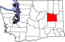 | |
| Towns | ||
| Unincorporated communities | ||
| Ghost town | ||