Raymond, South Dakota
| Raymond, South Dakota | |
|---|---|
| Town | |
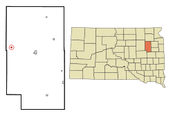 Location in Clark County and the state of South Dakota | |
| Coordinates: 44°54′43″N 97°56′19″W / 44.91194°N 97.93861°WCoordinates: 44°54′43″N 97°56′19″W / 44.91194°N 97.93861°W | |
| Country | United States |
| State | South Dakota |
| County | Clark |
| Incorporated | 1909[1] |
| Area[2] | |
| • Total | 0.26 sq mi (0.67 km2) |
| • Land | 0.26 sq mi (0.67 km2) |
| • Water | 0 sq mi (0 km2) |
| Elevation | 1,457 ft (444 m) |
| Population (2010)[3] | |
| • Total | 50 |
| • Estimate (2012[4]) | 49 |
| • Density | 192.3/sq mi (74.2/km2) |
| Time zone | Central (CST) (UTC-6) |
| • Summer (DST) | CDT (UTC-5) |
| ZIP code | 57258 |
| Area code(s) | 605 |
| FIPS code | 46-53260[5] |
| GNIS feature ID | 1257293[6] |
Raymond is a town in Clark County, South Dakota, United States. The population was 50 at the 2010 census.
History
A post office called Raymond has been in operation since 1882.[7] Raymond was platted in 1883.[8] The town was named for J. M. Raymond, a railroad engineer.[8]
Geography
Raymond is located at 44°54′43″N 97°56′19″W / 44.91194°N 97.93861°W (44.911877, -97.938477).[9]
According to the United States Census Bureau, the town has a total area of 0.26 square miles (0.67 km2), all of it land.[2]
Raymond has been assigned the ZIP code 57258 and the FIPS place code 53260.
Demographics
| Historical population | |||
|---|---|---|---|
| Census | Pop. | %± | |
| 1910 | 241 | — | |
| 1920 | 330 | 36.9% | |
| 1930 | 200 | −39.4% | |
| 1940 | 206 | 3.0% | |
| 1950 | 174 | −15.5% | |
| 1960 | 168 | −3.4% | |
| 1970 | 114 | −32.1% | |
| 1980 | 106 | −7.0% | |
| 1990 | 96 | −9.4% | |
| 2000 | 86 | −10.4% | |
| 2010 | 50 | −41.9% | |
| Est. 2015 | 50 | [10] | 0.0% |
2010 census
As of the census[3] of 2010, there were 50 people, 27 households, and 15 families residing in the town. The population density was 192.3 inhabitants per square mile (74.2/km2). There were 38 housing units at an average density of 146.2 per square mile (56.4/km2). The racial makeup of the town was 98.0% White and 2.0% African American. Hispanic or Latino of any race were 2.0% of the population.
There were 27 households of which 7.4% had children under the age of 18 living with them, 40.7% were married couples living together, 7.4% had a female householder with no husband present, 7.4% had a male householder with no wife present, and 44.4% were non-families. 44.4% of all households were made up of individuals and 33.3% had someone living alone who was 65 years of age or older. The average household size was 1.85 and the average family size was 2.40.
The median age in the town was 58.7 years. 4% of residents were under the age of 18; 4% were between the ages of 18 and 24; 24% were from 25 to 44; 32% were from 45 to 64; and 36% were 65 years of age or older. The gender makeup of the town was 50.0% male and 50.0% female.
2000 census
As of the census[5] of 2000, there were 86 people, 37 households, and 23 families residing in the town. The population density was 328.2 people per square mile (127.7/km²). There were 39 housing units at an average density of 148.8 per square mile (57.9/km²). The racial makeup of the town was 96.51% White, 3.49% from other races. Hispanic or Latino of any race were 4.65% of the population.
There were 37 households out of which 32.4% had children under the age of 18 living with them, 51.4% were married couples living together, 5.4% had a female householder with no husband present, and 37.8% were non-families. 35.1% of all households were made up of individuals and 18.9% had someone living alone who was 65 years of age or older. The average household size was 2.32 and the average family size was 3.09.
In the town the population was spread out with 29.1% under the age of 18, 1.2% from 18 to 24, 27.9% from 25 to 44, 17.4% from 45 to 64, and 24.4% who were 65 years of age or older. The median age was 38 years. For every 100 females there were 104.8 males. For every 100 females age 18 and over, there were 110.3 males.
The median income for a household in the town was $33,750, and the median income for a family was $36,250. Males had a median income of $20,833 versus $15,625 for females. The per capita income for the town was $14,660. There were 13.6% of families and 17.3% of the population living below the poverty line, including 20.8% of under eighteens and 26.7% of those over 64.
Education
Logan Consolidated Schools was located 1 mile east and 3 miles south of Raymond on the Carpenter road. The rural school housed the kindergarten through senior classes. The athletic teams had the mascot of the Arrows. The school was closed in 1962 and the high school enrollment that year consisted of 12 students.
References
- ↑ "SD Towns" (PDF). South Dakota State Historical Society. Retrieved 2010-02-15.
- 1 2 "US Gazetteer files 2010". United States Census Bureau. Retrieved 2012-06-21.
- 1 2 "American FactFinder". United States Census Bureau. Retrieved 2012-06-21.
- ↑ "Population Estimates". United States Census Bureau. Retrieved 2013-05-29.
- 1 2 "American FactFinder". United States Census Bureau. Retrieved 2008-01-31.
- ↑ "US Board on Geographic Names". United States Geological Survey. 2007-10-25. Retrieved 2008-01-31.
- ↑ "Clark County". Jim Forte Postal History. Retrieved 26 March 2015.
- 1 2 Chicago and North Western Railway Company (1908). A History of the Origin of the Place Names Connected with the Chicago & North Western and Chicago, St. Paul, Minneapolis & Omaha Railways. p. 117.
- ↑ "US Gazetteer files: 2010, 2000, and 1990". United States Census Bureau. 2011-02-12. Retrieved 2011-04-23.
- ↑ "Annual Estimates of the Resident Population for Incorporated Places: April 1, 2010 to July 1, 2015". Retrieved July 2, 2016.
- ↑ "Census of Population and Housing". Census.gov. Retrieved June 4, 2015.
Municipalities and communities of Clark County, South Dakota, United States | ||
|---|---|---|
| Cities | 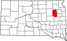 | |
| Towns | ||
| CDP | ||
| Unincorporated communities | ||