Rajauri
| Rajauri | |
|---|---|
| City | |
|
View of old Jhula Bridge at Medina Colony,Rajouri. | |
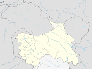 Rajauri  Rajauri Location in Jammu and Kashmir, India | |
| Coordinates: 33°23′N 74°18′E / 33.38°N 74.3°ECoordinates: 33°23′N 74°18′E / 33.38°N 74.3°E | |
| Country |
|
| State | Jammu and Kashmir |
| District | Rajouri |
| Settled | 623 BC |
| Government | |
| • Type | Municipal Council |
| • Body | Rajauri Municipal Council |
| Elevation | 915 m (3,002 ft) |
| Population (2011) | |
| • Total | 41,552 (Including Kheora and Jawahar Nagar), 6,42,415 (in Rajouri district)[1] |
| Languages | |
| • Official | Urdu, Gojri, Dogri |
| Time zone | IST (UTC+5:30) |

Rajauri or Rajouri (rəˈʤɔ:rɪ) (Hindi: राजौरी) is a town and a municipal council in Rajouri district in Jammu and Kashmir. Rajauri is about 155 kilometres (96 mi) from Jammu city on the Poonch Highway. Rajauri is known as the Vale of Lakes as there are many lakes around the city. Baba Ghulam Shah Badshah University is based in the town.

Rajouri is a district in the Jammu & Kashmir state of India. The total area of Rajouri is 2,630 km² including 2,608.11 km² rural area and 21.89 km² urban area. Rajouri has a population of 642,415. There are 130,401 houses in the district.
Rajouri district is further divided into the following Blocks/Tehsils for administrative purposes: 1. Budhal Tehsil 2. Darhal 3. Kalakote 4. Nowshehra 5. Rajauri 6. Sunderbani 7. Thanamandi 8. Manjakote
History
Rajouri district was a region of immense significance in ancient times. The Mahabharata has references to a kingdom known as Panchalya Desha, whose king was Panchal Naresh, and whose daughter Draupadi was married to the Pandavas. Historians identify Panchalya Desha as the area in the Panchal range of mountains. Rajouri was also a part of this kingdom of Panchal Naresh. The region was then known as Rajapuri - 'the land of Kings'. It finds its mention in the travel account of Chinese traveller Hiuen Tsang who visited the town in 632 B.C.E. and described it as a part of Kashmiri territory. Still earlier in the Buddhist period, Rajouri formed a part of Gandhara territory (Afghanistan, Gandhar and Tashkent) and later was incorporated in the province called Darabhisanga which comprised the hilly stretch from Poonch to Kashmir. In those days Laharkote in Poonch district and Rajouri had emerged as two influential states of the area. Several villages, towns, and cities are located in Rajauri, like Saaj.
Rajouri witnessed some of the toughest fighting during Pakistani intervention in Kashmir during Operation Gibraltar. The town was initially captured from the Indian Army by undercover Pakistani commandos with the aid of local Mujahideen but the wider operation failed and, with all-out war with India looming, Pakistan withdrew its troops. Major Malik Munawar Khan Awan, a Pakistani commando officer who led the attack on Rajouri on the night of 15 September 1965, was later entitled with the name "King of Rajouri" by the Government of Pakistan.[2]
Geography
Rajauri is located at 33°23′N 74°18′E / 33.38°N 74.3°E.[3] It has an average elevation of 915 metres (3001 feet).
Climate
The climate of Rajauri is somewhat cooler than the other areas of Duggardesh plains. Summers are short and pleasant. The summer temperature generally does not exceed 41 degrees. Winters are cool and chilly characterized with rainfall due to western disturbances. Snowfall is scanty but may occur in cool months like that of December 2012. Average rainfall is 769 millimetres (26.3 in) in the wettest months.[4]
Demographics
At the 2011 census,[5] Rajouri itself had a population of 37,552 while the population within the municipal limits was 41,552. Males constituted 57% of the population and females 43%. Rajouri had an average literacy rate of 77%, higher than the national average of 75.5%: male literacy was 83% and female literacy was 68%. 12% of the population was under 6 years of age. The people are mostly Gujjars and Paharis.
Muslims make up 55% of the population, Hindus 42% and Sikhs 2.4%.[6]
Population
| Type | Male | Female | Total |
|---|---|---|---|
| Rural | 3,10,748 | 2,79,353 | 5,90,101 |
| Urban | 34,603 | 17,711 | 52,314 |
| Total | 3,45,351 | 2,97,064 | 6,42,415 |
Households
| Rural | Urban | Total |
|---|---|---|
| 122,645 | 7,756 | 130,401 |
Reference
- ↑ http://www.census2011.co.in/census/district/624-rajouri.html
- ↑ Niaz, Anjum (21 April 2013). "The 20-watt fountain of energy". Dawn.
- ↑ Falling Rain Genomics, Inc - Rajouri
- ↑ =IMD
- ↑ "Census of India 2001: Data from the 2001 Census, including cities, villages and towns (Provisional)". Census Commission of India. Archived from the original on 2004-06-16. Retrieved 2008-11-01.
- ↑ "Census of India — Administrative divisions". Censusindia.gov.in. Retrieved 2011-09-19.