Tral
| Tral ترال | |
|---|---|
| town | |
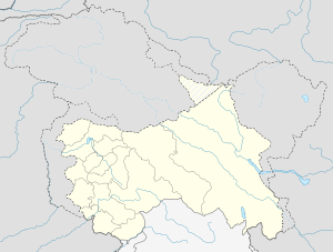
 Tral  Tral Location in Jammu and Kashmir | |
| Coordinates: 33°56′N 75°06′E / 33.93°N 75.1°ECoordinates: 33°56′N 75°06′E / 33.93°N 75.1°E | |
| Country |
|
| State | Jammu and Kashmir |
| District | Pulwama |
| Elevation | 1,662 m (5,453 ft) |
| Population (2011) | |
| • Total | 17,844 |
| Languages | |
| • Spoken | Kashmiri |
| • Official | Urdu |
| Time zone | IST (UTC+5:30) |
| PIN | 192123 |
| Telephone code | 1933 |
Tral (Kashmiri: ترال) is a town and a notified area committee in Pulwama district of Jammu and Kashmir, India, situated 10 km away from National Highway 1A.
Geography
Tral is located at 33°56′N 75°06′E / 33.93°N 75.1°E.[1] It has an average elevation of 1662 metres (5452 ft). The place is having an average area of about 110 km².
Tral is situated at the edge of plateau divided into upper and lower mohallas. The valley is surrounded by the snow peak mountains also famous for its natural springs, dense forests and beautiful villages. Famous picnic spots in the vicinity include Shikargah, Aripal and Hajan. The area is known for its 82 springs, including hot water springs and springs remaining hot in winter and cold in summer.
The houses that are built on this range are mostly made up of bricks (some sun dried and some baked). The roofs are usually made of tin while some are occasionally thatched. Tral is shaded by fine trees. The area possess enormous number of springs located in its 82 villages. Plateau lands on the east side of the town is bare and dry but the slope to the west and to its beneath has a large mass of rice cultivation.
Villages
- Amirabad
- Amlar
- Amliar[2]
- Arigam
- Aripal
- Awanpura
- Baigund
- Bargoum
- Basvin
- Batagund
- Bathnoor
- Branpather
- Brantal
- Buchoo
- Chaan
- Chandrigam
- Chatrugam
- Check
- Chewa
- Dadasara
- Dajeh Khour
- Dar
- Dardgund
- Dhobiwan
- Diver
- Dodehmarg
- Doingund
- Amirabad
- Gadpora
- Gamaraz
- Gang
- Gulshanpora (Khul)
- Gutru
- Hari Pari gam
- Haffu
- Hajan
- Hardumir
- Hundur
- Kahlil
- Kamla
- Kanglooda
- Karmula
- Khangund
- Khankah
- Kharpora
- Khasipora
- Koil
- Kounsarbal
- Kuchmullah
- Kulpohda
- Kunjbal
- Laalgam
- Laam
- Lariyar
- Lalpora
- Laribal
- Loorow
- Lurgam
- Machooma
- Mandoora
- Medoora
- Monghama
- Naagberan
- Nadar
- Nagbal
- Nagnaad
- Nahar
- Naibugh
- Nanar
- Narastan
- Nargistan
- Nowdal
- Nazneenpora (Haayoun)
- Nigeenpora (Reshipora)
- Overigund (Wovergund)
- Panier
- Pinglish
- Pirnaad
- Poonzu
- Prongam
- Rajpora
- Ratherpora
- Rathsun
- Saimooh
- Sail
- Satoora
- Seer
- Shahabad-Bala and Shahabad-Payeen
- Shajan
- Shaldramn
- Sherabad (Bulli)
- Shikaargaah
- Shutlan
- Sofigund
- Soinaad
- Syedabad (Pastuna)
- Taki
- Vazul Kulnar
- Wagad
- Wanibutu
- Yangvin
- Zizbal
- Zradihadan
- Zuwastan
- Aligund
Demographics
As of 2011 India census,[3] Tral had a population of 17,844 with 9,944 males constituting 55.7% of the population and 7,900 females constituting 44.3% of the population.
Education
Tral is considered one of the most educated towns in the district of Pulwama. Tral has a 10,391 literates, among which 6,760 are males and 3,631 are females.[3]
After independence, like the rest of the country, the scenario of tehsil Tral changed a lot. A number of positive developments have taken place in all sectors, especially education, health and employment. According to AINE-TRAL (a collection of historical facts), in 1903 the foundation of a primary school was laid by the government. At that time 70 students were enrolled. During the year 1933 its standard was raised from primary to lower middle school. Then in 1944 its standard was again raised to higher secondary level. At present there are hundreds of educational institutions in Tral, seven higher secondaries (three in Tral Town, one each in Dadasara, Lorgam, Satoora, and Noorpora), degree colleges, ITI institutes, and many more professional institutes. The literacy rate at one time was 1%, and now it has risen to 92%, according to survey conducted by Ikhlas welfare society Tral in June 2009.
Etymology
The name Tral is said to originate from trī lāl (تریہ لال), meaning "Three Pearls".
Security situation
Tral is considered the most volatile area in Jammu & Kashmir and a militancy hotbed. Burhan Muzaffar Wani, commander of Hizbul Mujahideen, hails from Tral.[4] Recently Hizbul Mujahedeen militant Ishaq Ahmad Parray, alias "Newton", was killed in an encounter with the Indian Army at Dadasara Tral, along with his two associates.[5]
References
- ↑ "Maps, Weather, and Airports for Tral, India". fallingrain.com.
- ↑ "Census of India: Search Details". Census of India. Retrieved 31 December 2015.
- 1 2 "Census of India". www.censusindia.gov.in. Ministry of Home Affairs, Government of India. Retrieved 27 July 2014.
- ↑ "Why south Kashmir is becoming the new hotbed of militancy". dailyo.in.
- ↑ "'Newton' among 3 militants killed in Tral gunfight". greaterkashmir.com.