Quebec Route 389
| ||||
|---|---|---|---|---|
 | ||||
| Route information | ||||
| Maintained by Transports Québec | ||||
| Length: | 567.0 km (352.3 mi) | |||
| Major junctions | ||||
| North end: | Route 500 west of Fermont | |||
| South end: |
| |||
| Location | ||||
| Major cities: | Baie-Comeau, Fermont | |||
| Highway system | ||||
| ||||

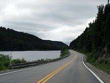


Quebec's Route 389 connects Route 138 adjacent to Baie-Comeau with the Newfoundland and Labrador border, connecting with the Trans-Labrador Highway (Newfoundland and Labrador provincial route 500) to Wabush and Labrador City, and beyond to Goose Bay. On its way it skirts the eastern shore of Manicouagan Reservoir.
Route description
The Québec North Shore Company and Hydro-Québec completed portions from Route 389 to the Manic 5 hydroelectric project site (km 213), now known as the Daniel-Johnson Dam.
From km 213, the highway follows a path traditionally used by aboriginal people and explorers, with access to the Hart Jaune Hydroelectric Complex at km 390. The town of Gagnon, now torn down, was at km 394.
From km 317 (gas station and restaurant), the highway is now paved all the way to km 495.
Starting at km 495, the "Fire Lake Mine Road" section was built by unemployed workers during a labour dispute, influenced by the presence of the railway owned by the Québec Cartier Mining Company. This section of unpaved road is notoriously known as "the trail."
From km 495 to the provincial border at km 567 (352 miles from Baie-Comeau), the road is an accident-prone section notorious for its poor surface and sharp curves (the joke being you can see your own taillights). Local citizens in adjacent Labrador have been urging realignment of this road, a vital work if it were to be the routing to a fixed link to Newfoundland.
On April 9 of 2009, the Quebec government announced that $438 million will be spent for work to improve the highway from the south end as far as Fermont,[1] with major upgrading and repair work. This will include a significant reroute in the Fire Lake-Mont-Wright section far to the southeast between approximately Km 508 and Km 564, rejoining the existing route by way of the Fermont access road and no longer routing through Mont-Wright. Work is expected to take fully 10 years, although planning of improvements to this northernmost section began almost immediately.[2]
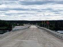
Bridge over the Pékans River (around km 550) is popular starting point for the canoe trips down the Moisie River.[3]
At km 564 is the town of Fermont, a mining town with a population of 2,918, and last Quebec port-of-call before entering Newfoundland and Labrador. Labrador City is 21 km further along what is now Highway 500, Wabush is 6 km south east of that on Highway 503 (which ends in Wabush). The Happy Valley-Goose Bay ferry terminal is located 526 km east of Wabush, along the shores of Lake Melville, with access to the Atlantic Ocean. The Labrador City/Fermont area border crossing is roughly the half-way point of the approximately 16-hour drive between the junction of Routes 138 and 389 in Baie-Comeau and the end of Route 500 (and adjunct Route 520) in Happy Valley – Goose Bay, Newfoundland and Labrador.
Kilometre markers
| Kilometre | Description | Services |
|---|---|---|
| 0 | Junction with route 138 at Baie-Comeau | All services |
| 21 | Jean-Lesage generating station (Manic 2) | Guided tours (summer season) |
| 23 | Camping Manic 2 | Campground |
| 23 | Le repos du passant Motel | Lodging and restaurant |
| 23 | NA | Public payphone |
| 52 | NA | Emergency phone |
| 95 | Relais Manic-Outardes | Restaurant, lodging and Wi-Fi |
| 95 | NA | Emergency phone |
| 165 | NA | Emergency phone |
| 180 | Camp | NA |
| 203 | NA | Emergency phone |
| 211 | Motel de l'énergie | Restaurant, lodging, convenience store and Wi-Fi |
| 213 | Daniel-Johnson Dam (Manic-5) | Guided tours (summer season) |
| 272 | NA | Emergency phone |
| 317 | Rest stop | Garbage bin and picnic table |
| 317 | Relais Gabriel | Outfitter, lodging, restaurant and Wi-Fi |
| 317 | NA | Emergency phone |
| 336 | Uapishka Station | NA (2 km) |
| 365 | NA | Emergency phone |
| 418 | Highway maintenance center | NA |
| 418 | NA | Emergency phone |
| 464 | NA | Emergency phone |
| 495 | NA | Emergency phone |
| 495 | Workers camp | NA |
| 511 | NA | Emergency phone |
| 547 | NA | Emergency phone |
| 547 | Workers camp | NA |
| 564 | Junction with J. C. Ménard boulevard towards Fermont | All services (3 km) |
| 567 | Border between Quebec and Newfoundland and Labrador | NA |
State of the road
| Kilometre | Description* | Description* |
| 0 to 213 | Paved | Correct, narrow winding road |
| 213 to 317 | Gravel | Bad, narrow winding road |
| 317 to 394 | Paved | Correct |
| 394 to 495 | Paved | Correct |
| 495 to 547 | Gravel | Bad, narrow winding road** |
| 547 to 564 | Paved | Good |
| 564 to 567 | Paved | Good |
*As of July 2016
**The road crosses a railway multiple times
Municipalities along Route 389
The road passes through the following municipalities and unorganized territories from south to north:
See also
References
- ↑ "Northern Québec: A new site of sustainable development" (Press release). Prospectors and Developers Association of Canada. 26 March 2009. Retrieved 7 May 2012.
- ↑ "Amélioration de la route 389" (in French). Transports Québec. Retrieved 7 May 2012.
- ↑ Kovac, Lester. "Lower Pékans/Lower Moisie 2006". Archived from the original on 2009-10-27.
External links
| Wikimedia Commons has media related to Quebec Route 389. |
- Provincial Route Map (Courtesy of the Quebec Ministry of Transportation) (French)
- Route 389 on Google Maps
- Trans-Labrador Highway - Virtual Tour: Quebec Hwy 389 - Baie Comeau to Labrador City
Coordinates: 49°45′34″N 68°42′34″W / 49.7594°N 68.7095°W