Pyle
| Pyle | |
| Welsh: Y Pîl | |
 |
|
 Pyle |
|
| Population | 7,405 2011 census[1] |
|---|---|
| OS grid reference | SS825825 |
| Community | Pyle |
| Principal area | Bridgend |
| Ceremonial county | Mid Glamorgan |
| Country | Wales |
| Sovereign state | United Kingdom |
| Post town | BRIDGEND |
| Postcode district | CF33 6xx |
| Dialling code | 01656 |
| Police | South Wales |
| Fire | South Wales |
| Ambulance | Welsh |
| EU Parliament | Wales |
| UK Parliament | Bridgend |
| Welsh Assembly | Bridgend |
Coordinates: 51°31′45″N 3°41′43″W / 51.529146°N 3.695252°W
Pyle (Welsh: Y Pîl) is a village and community in Bridgend county borough, Wales. This large village is served by the A48 road, and lies less than one mile from Junction 37 of the M4 motorway, and is therefore only a half-hour journey from the capital city of Wales, Cardiff; in fact it lies approximately equidistant between the capital (Cardiff) and the second city (Swansea). The nearest town is the seaside resort of Porthcawl. Within the Community, to the northeast of Pyle, is the adjoining settlement of Kenfig Hill.
Etymology
The name "Pyle" is probably derived from the Welsh word pil, meaning a creek, a term found along the Bristol Channel coast of Glamorgan and Monmouthshire. In this instance it probably refers to the mouth of the River Kenfig, which is tidal for its first mile from the sea. An alternative derivation for the name is the English word "pile", a stake, possibly referring to a boundary marker. This explanation seems less likely; the only settlement in the United Kingdom known to have this derivation is the hamlet of Pyle in the Isle of Wight.[2]
Location
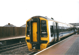
Pyle is located about twenty miles west of Cardiff, four miles west of Bridgend and six mile southeast of Port Talbot. It is on the main A48 road from Cardiff to Swansea and is just north of the M4 motorway which has superseded the trunk road for through traffic. Junction 37 on the motorway is one mile south of Pyle. Other communities in the vicinity are South Cornelly, North Cornelly, Kenfig and Porthcawl. Pyle railway station is on the Cardiff to Swansea section of the London to South Wales Main Line.[3]
Early history
An indication of early settlement is the Croes Siencyn Incised Stone, a Scheduled monument on Marlas Road, (51°31′39″N 3°41′56″W / 51.5275°N 3.6989°W, grid ref: SS822823). This is a weathered stone with an incised cross, dated to 11th or 12th century, moved to its present garden location in 1945 from 'between Kenfig and Pyle'.[4] The early expansion of Pyle was brought about when the ancient borough of Kenfig was abandoned after being overwhelmed by sand during a catastrophic encroachment by the sea in the mid fifteenth-century. The road through Kenfig was diverted one and a half miles inland and brought Pyle to prominence while Kenfig dwindled into a straggle of a few houses. The walls of Pyle St James' parish church are reputed to have been moved stone by stone from the old town, relocated further inland as the sand encroached.[5] This gave rise to the church sometimes being referred to as the upside-down church, because the first stones moved would have been the higher ones in the original church.[6]
Writing in 1870, in the Imperial Gazetteer of England and Wales, John Marius Wilson described the parish of Pyle, including Kenfig and Skerr, to comprise 4,526 acres (1,832 ha) of land and 725 acres (293 ha) of water. In 1861, the population of the village was 1,192 distributed among 251 households. Real property in the village of Pyle was valued at £3,949, of which £1,619 was in mines. Besides the thriving collieries there were also coking plants and ironworks as well as a quarry where good quality building stone was extracted.[7]
Recent History
The street of Longlands Close in Pyle was the site of a coaching inn which was used by passing travelers using the west Wales to London turnpike. Lord Nelson stayed at Pyle Inn on his way to visit to naval installations in Pembrokeshire, as did Isambard Kingdom Brunel during the construction of the Great Western Railway line through South Wales.[6]
Pyle was made a community in 2002, when the Cynffig community was split into two parts (the other being Cornelly), following a recommendation of the Local Government Boundary Commission for Wales.[8][9]
Village facilities
The village has its own leisure centre, swimming pool, supermarket, library and petrol station. The leisure centre is a frequent school trip destination, attracting schools from the Cardiff area. There is also a large industrial estate which hosts some notable names and a garden centre. An area of woodland known as The Collwyn is close to the west side of the village. In 2010 Pyle Community Council were able to buy the strip of woodland, with its stream and old watermill, to ensure its survival and use for the village.[6]
There are three schools in the community: Cynffig Comprehensive School, Mynydd Cynffig Primary School and Pil Primary School.[10] Pyle Rugby Football Club plays in the WRU Swalec League Division 3.[11]
Religion
Kenfig Hill, though a smaller settlement, has four places of worship. St Theodore's (Church in Wales), was built in 1889, and became a parish in 1923.[12] Also in Kenfig Hill are Pisgah Chapel, (Welsh Baptist), Bethal Community Church and St Joseph's Church (Roman Catholic).[13]
Within Pyle itself there is Mount Zion Chapel (English Baptist) and the parish church of St James (Church in Wales) is a Grade I listed building. It was built in around 1471 as is indicated by a carving of the figures on a small wooden shield on a wallplate. It is unclear to what extent the present building adheres to the original structure because there are variations in construction methods and in the stone used. The church is considered to be a fine example of a mainly Perpendicular, two-cell church with a nave and chancel. The tower at the west end bears a clock.[14]
See also
References
- ↑ "Ward population 2011". Retrieved 11 April 2015.
- ↑ Owen, Hywel Wyn; Morgan, Richard (2007). Dictionary of the Place-Names of Wales. Gomer. p. 403. ISBN 978-1-84323-901-7.
- ↑ Concise Road Atlas: Britain. AA Publishing. 2015. pp. 26–27. ISBN 978-0-7495-7743-8.
- ↑ coflein NPRN: 301402. Glamorgan-Gwent Archaeological Trust (search for PRN: 00141m). Cadw SAM: GM036: Pyle Incised Stone
- ↑ Samuel Lewis (1833). A Topographical Dictionary of Wales. Lewis and Company. p. 380.
- 1 2 3 "Pyle community council: History". Pyle Community Council. Retrieved 2 May 2016.
- ↑ "History of Pyle, in Bridgend and Glamorgan". A vision of Britain through time. University of Portsmouth. Retrieved 2 May 2016.
- ↑ See: Boundary commission for Wales
- ↑ See: Welsh Statutory Instrument 2002 No. 1129 (W.117): The Bridgend (Cynffig, Cornelly and Pyle Communities) (Electoral Changes) Order 2002
- ↑ "Pyle Community council: Schools". Pyle Community Council. Retrieved 2 May 2016.
- ↑ "Pyle Rugby Football Club". Retrieved 2 May 2016.
- ↑ History of St Theodore, Kenfig Hill
- ↑ Pyle community council: Places of worship Accessed 13 May 2013
- ↑ "St James: History". Parish of Pyle and Kenfig. Retrieved 2 May 2016.
External links
| Communities |  | |
|---|---|---|
| Towns and villages |
| |
| Castles | ||
| Rivers | ||
| Topics | ||