Putu Phutunqu
| Putu Phutunqu | |
|---|---|
 Putu Phutunqu Location within Bolivia | |
| Highest point | |
| Elevation | 4,112 m (13,491 ft) [1] |
| Coordinates | 17°42′53″S 65°33′02″W / 17.71472°S 65.55056°WCoordinates: 17°42′53″S 65°33′02″W / 17.71472°S 65.55056°W |
| Geography | |
| Location |
Bolivia, Cochabamba Department |
| Parent range | Andes |
Putu Phutunqu (Aymara putu vault, phutunqu hole, pit, crater,[2] also spelled Putu Putuncu) is a 4,112 m (13,491 ft) high mountain in the Bolivian Andes. It is located in the Cochabamba Department, Carrasco Province, Pocona Municipality and in the Mizque Province, Alalay Municipality. Putu Phutunqu lies southeast of Inka Pirqa.[1][3]
References
Capital: Cochabamba | ||
| Provinces | 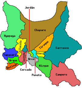 | |
| Municipalities (and seats) |
| |
This article is issued from Wikipedia - version of the 4/7/2016. The text is available under the Creative Commons Attribution/Share Alike but additional terms may apply for the media files.