Public Landing, Maryland
| Public Landing, Maryland | |
|---|---|
| Unincorporated community | |
 Public Landing | |
| Coordinates: 38°08′56″N 75°17′15″W / 38.14889°N 75.28750°WCoordinates: 38°08′56″N 75°17′15″W / 38.14889°N 75.28750°W | |
| Country | United States |
| State | Maryland |
| County | Worcester |
| Elevation | 10 ft (3 m) |
| Time zone | Eastern (EST) (UTC-5) |
| • Summer (DST) | EDT (UTC-4) |
| ZIP code | 21863 |
| Area code(s) | 410, 443, and 667 |
| GNIS feature ID | 586719[1] |
Public Landing is a small unincorporated community 6.5 miles (10 km) east of Snow Hill in Worcester County, Maryland. Public Landing is located on Chincoteague Bay, at the end of Maryland Route 365.
Public Landing enjoyed great popularity during the 1920s and early 1930s, when rides, a bowling alley, and other amusements were open, and the shallowness of Chincoteague Bay permitted public bathing. However, a large hurricane in 1933 destroyed Public Landing's waterfront. Although a pier was rebuilt, and public bathing continued, Public Landing's heyday as a waterfront destination was overtaken by Ocean City.[2][3]
Mansion House was listed on the National Register of Historic Places in 1995.[4]
References
- ↑ "Public Landing". Geographic Names Information System. United States Geological Survey.
- ↑ Touart, Paul Baker, Along the Seaboard Side: The Architectural History of Worcester County, Maryland (1994).
- ↑ Burgoyne, Mindie, Images of America: Snow Hill (2006). Some photographs of Public Landing are available here.
- ↑ National Park Service (2010-07-09). "National Register Information System". National Register of Historic Places. National Park Service.
Municipalities and communities of Worcester County, Maryland, United States | ||
|---|---|---|
| City | 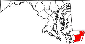 | |
| Towns | ||
| CDPs | ||
| Other communities | ||
| Footnotes | ‡This populated place also has portions in an adjacent county or counties | |
This article is issued from Wikipedia - version of the 11/3/2016. The text is available under the Creative Commons Attribution/Share Alike but additional terms may apply for the media files.