Port Alsworth, Alaska
| Port Alsworth, Alaska | |
|---|---|
| CDP | |
|
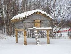
The historic Trefon Dena'ina Fish Cache in Port Alsworth, Alaska | |
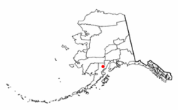 Location of Port Alsworth, Alaska | |
| Coordinates: 60°12′30″N 154°18′24″W / 60.20833°N 154.30667°WCoordinates: 60°12′30″N 154°18′24″W / 60.20833°N 154.30667°W | |
| Country | United States |
| State | Alaska |
| Borough | Lake and Peninsula |
| Government | |
| • Borough mayor | Glen Alsworth, Sr.[1] |
| • State senator | Lyman Hoffman (D) |
| • State rep. | Bryce Edgmon (D) |
| Area | |
| • Total | 22.8 sq mi (59.1 km2) |
| • Land | 22.7 sq mi (58.8 km2) |
| • Water | 0.1 sq mi (0.4 km2) |
| Elevation | 253 ft (77 m) |
| Population (2010) | |
| • Total | 159 |
| • Density | 7.0/sq mi (2.7/km2) |
| Time zone | Alaska (AKST) (UTC-9) |
| • Summer (DST) | AKDT (UTC-8) |
| ZIP code | 99653 |
| Area code(s) | 907 |
| FIPS code | 02-62620 |
| GNIS feature ID | 1408208 |
Port Alsworth is a census-designated place (CDP) in Lake and Peninsula Borough, Alaska, United States. It is one hundred miles southwest of Anchorage. The population was 159 at the 2010 census.
Port Alsworth was founded in 1950 by Babe Alsworth, a missionary and bush pilot, and Mary Alsworth, who was the town's first postmaster.
Port Alsworth is located on private land within Lake Clark National Park and Preserve and the site of the National Park's field headquarters.
Samaritan's Purse has a lodge for wounded American veterans there called Operation Heal Our Patriots (OHOP). There is also a summer Bible camp called Tanalian Bible Camp where youth, ages 8-19, from the surrounding villages can attend.
From the summer of 2013 to the spring of 2014, the local Tanalian School underwent renovation and a dearly needed expansion. The renovation involved tripling school square footage, all new furniture, and doubling the size of the gym.
Geography
Port Alsworth is located at 60°12′30″N 154°18′24″W / 60.20833°N 154.30667°W (60.208281, -154.306586).[2]
According to the United States Census Bureau, the CDP has a total area of 22.8 square miles (59 km2), of which, 22.7 square miles (59 km2) of it is land and 0.1 square miles (0.26 km2) of it (0.61%) is water.
Climate
Port Alsworth has a continental subarctic climate (Köppen Dfc).
| Climate data for Port Alsworth | |||||||||||||
|---|---|---|---|---|---|---|---|---|---|---|---|---|---|
| Month | Jan | Feb | Mar | Apr | May | Jun | Jul | Aug | Sep | Oct | Nov | Dec | Year |
| Record high °F (°C) | 54 (12) |
54 (12) |
56 (13) |
70 (21) |
85 (29) |
89 (32) |
89 (32) |
87 (31) |
75 (24) |
66 (19) |
56 (13) |
53 (12) |
89 (32) |
| Average high °F (°C) | 22.8 (−5.1) |
27 (−3) |
33.3 (0.7) |
43.7 (6.5) |
55.6 (13.1) |
64.1 (17.8) |
67.4 (19.7) |
65 (18) |
56.1 (13.4) |
41.7 (5.4) |
30.7 (−0.7) |
24.5 (−4.2) |
44.3 (6.8) |
| Average low °F (°C) | 5.4 (−14.8) |
7.6 (−13.6) |
11.3 (−11.5) |
24.4 (−4.2) |
34.1 (1.2) |
42.3 (5.7) |
46.8 (8.2) |
45.4 (7.4) |
38.7 (3.7) |
27.3 (−2.6) |
16.4 (−8.7) |
8.9 (−12.8) |
25.7 (−3.5) |
| Record low °F (°C) | −53 (−47) |
−55 (−48) |
−50 (−46) |
−18 (−28) |
13 (−11) |
20 (−7) |
25 (−4) |
22 (−6) |
13 (−11) |
−7 (−22) |
−24 (−31) |
−48 (−44) |
−55 (−48) |
| Average precipitation inches (mm) | 0.82 (20.8) |
0.69 (17.5) |
0.7 (18) |
0.57 (14.5) |
0.52 (13.2) |
1.14 (29) |
1.59 (40.4) |
2.39 (60.7) |
2.35 (59.7) |
1.63 (41.4) |
1.4 (36) |
1.11 (28.2) |
14.91 (378.7) |
| Average snowfall inches (cm) | 13.6 (34.5) |
11.1 (28.2) |
10.7 (27.2) |
5.8 (14.7) |
0.5 (1.3) |
0 (0) |
0 (0) |
0 (0) |
0.1 (0.3) |
4.2 (10.7) |
15.5 (39.4) |
17.6 (44.7) |
79.2 (201.2) |
| Average precipitation days | 8 | 6 | 6 | 6 | 5 | 7 | 9 | 11 | 10 | 9 | 10 | 9 | 96 |
| Source: [3] | |||||||||||||
Demographics
As of the census[4] of 2000, there were 104 people, 34 households, and 24 families residing in the CDP. The population density was 4.6 people per square mile (1.8/km²). There were 70 housing units at an average density of 3.1/sq mi (1.2/km²). The racial makeup of the CDP was 77.88% White, 4.81% Native American, and 17.31% from two or more races.
There were 34 households out of which 47.1% had children under the age of 18 living with them, 67.6% were married couples living together, 2.9% had a female householder with no husband present, and 26.5% were non-families. 23.5% of all households were made up of individuals and none had someone living alone who was 65 years of age or older. The average household size was 3.06 and the average family size was 3.64.
In the CDP the population was spread out with 41.3% under the age of 18, 7.7% from 18 to 24, 28.8% from 25 to 44, 18.3% from 45 to 64, and 3.8% who were 65 years of age or older. The median age was 26 years. For every 100 females there were 85.7 males. For every 100 females age 18 and over, there were 84.8 males.
The median income for a household in the CDP was $58,750.00, and the median income for a family was $62,083. Males had a median income of $50,417 versus $17,083 for females. The per capita income for the CDP was $21,716. There were no families and 6.0% of the population living below the poverty line, including no under eighteens and none of those over 64.
References
- ↑ 2015 Alaska Municipal Officials Directory. Juneau: Alaska Municipal League. 2015. p. 12.
- ↑ "US Gazetteer files: 2010, 2000, and 1990". United States Census Bureau. 2011-02-12. Retrieved 2011-04-23.
- ↑ "PORT ALSWORTH, AK (507570)". Western Regional Climate Center. Retrieved November 22, 2015.
- ↑ "American FactFinder". United States Census Bureau. Retrieved 2008-01-31.
External links
- Subsistence harvests and uses of wild resources in Iliamna, Newhalen, Nondalton, Pedro Bay, and Port Alsworth, Alaska, 2004 / by James A. Fall ... [et al.]. Hosted by Alaska State Publications Program
Municipalities and communities of Lake and Peninsula Borough, Alaska, United States | ||
|---|---|---|
| Cities | 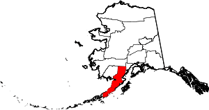 | |
| CDPs | ||
| Ghost town | ||