Egegik, Alaska
| Egegik Igyagiiq | |
|---|---|
| City | |
 Egegik Location in Alaska | |
| Coordinates: 58°13′9″N 157°21′29″W / 58.21917°N 157.35806°WCoordinates: 58°13′9″N 157°21′29″W / 58.21917°N 157.35806°W | |
| Country | United States |
| State | Alaska |
| Borough | Lake and Peninsula |
| Incorporated | 1995[1] |
| Government | |
| • Mayor | Scovi Deigh |
| • State senator | Lyman Hoffman (D) |
| • State rep. | Bryce Edgmon (D) |
| Area | |
| • Total | 134 sq mi (347 km2) |
| • Land | 32.8 sq mi (84.9 km2) |
| • Water | 101.2 sq mi (262.1 km2) |
| Elevation | 13 ft (4 m) |
| Population (2007)[2] | |
| • Total | 74 |
| Time zone | Alaska (AKST) (UTC-9) |
| • Summer (DST) | AKDT (UTC-8) |
| ZIP code | 99579 |
| Area code | 907 |
| FIPS code | 02-21150 |
Egegik (Igyagiiq in Central Alaskan Yup'ik) is a city in Lake and Peninsula Borough, Alaska, United States. As of the 2010 census, the population of the city is 109.
Geography
Egegik is at 58°13′9″N 157°21′29″W / 58.21917°N 157.35806°W (58.219292, -157.357989)[3] on the eastern shores of both Bristol Bay and, more locally, of Egegik Bay. The village is on a high bluff along the southern shore of the Egegik River at the upper extent of Egegik Bay.
According to the United States Census Bureau, the city has an area of 134.0 square miles (347 km2), of which, 32.8 square miles (85 km2) is land and 101.2 square miles (262 km2) (75.54%) is water.
Demographics
| Historical population | |||
|---|---|---|---|
| Census | Pop. | %± | |
| 1920 | 83 | — | |
| 1930 | 86 | 3.6% | |
| 1940 | 125 | 45.3% | |
| 1950 | 119 | −4.8% | |
| 1960 | 150 | 26.1% | |
| 1970 | 148 | −1.3% | |
| 1980 | 75 | −49.3% | |
| 1990 | 122 | 62.7% | |
| 2000 | 116 | −4.9% | |
| 2010 | 109 | −6.0% | |
| Est. 2015 | 106 | [4] | −2.8% |
As of the census[6] of 2000, there were 64 people, 44 households, and 2 1/2 families residing in the city. The population density was 3.5 people per square mile (1.4/km²). There were 286 housing units at an average density of 8.7 per square mile (3.4/km²). The racial makeup of the city was 18.97% White, 57.76% Native American, 0.86% Asian, and 22.41% from two or more races. 6.90% of the population were Hispanic or Latino of any race.
There were 44 households out of which 29.5% had children under the age of 18 living with them, 36.4% were married couples living together, 2.3% had a female householder with no husband present, and 47.7% were non-families. 36.4% of all households were made up of individuals and none had someone living alone who was 65 years of age or older. The average household size was 2.64 and the average family size was 3.74.
In the city the age distribution of the population shows 32.8% under the age of 18, 7.8% from 18 to 24, 35.3% from 25 to 44, 20.7% from 45 to 64, and 3.4% who were 65 years of age or older. The median age was 35 years. For every 100 females there were 146.8 males. For every 100 females age 18 and over, there were 116.7 males.
The median income for a household in the city was $46,000, and the median income for a family was $59,583. Males had a median income of $39,375 versus $40,000 for females. The per capita income for the city was $16,352. There were no families and 6.9% of the population living below the poverty line, including no under eighteens and none of those over 64.
References
- ↑ 1996 Alaska Municipal Officials Directory. Juneau: Alaska Municipal League/Alaska Department of Community and Regional Affairs. January 1996. p. 51.
- ↑ "Annual Estimates of the Population for Incorporated Places in Alaska". United States Census Bureau. 2008-07-10. Retrieved 2008-07-14.
- ↑ "US Gazetteer files: 2010, 2000, and 1990". United States Census Bureau. 2011-02-12. Retrieved 2011-04-23.
- ↑ "Annual Estimates of the Resident Population for Incorporated Places: April 1, 2010 to July 1, 2015". Retrieved July 2, 2016.
- ↑ "Census of Population and Housing". Census.gov. Retrieved June 4, 2015.
- ↑ "American FactFinder". United States Census Bureau. Retrieved 2008-01-31.
Municipalities and communities of Lake and Peninsula Borough, Alaska, United States | ||
|---|---|---|
| Cities | 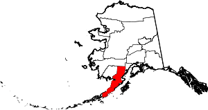 | |
| CDPs | ||
| Ghost town | ||