Podington
| Podington | |
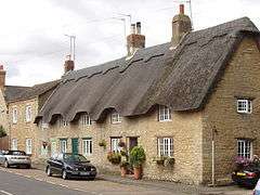 Thatched cottages in Podington |
|
 Podington |
|
| Population | 435 (2011 Census including Farndish & Hinwick)[1] |
|---|---|
| OS grid reference | SP940626 |
| Civil parish | Podington |
| Unitary authority | Bedford |
| Ceremonial county | Bedfordshire |
| Region | East |
| Country | England |
| Sovereign state | United Kingdom |
| Post town | WELLINGBOROUGH |
| Postcode district | NN29 |
| Dialling code | 01234 |
| Police | Bedfordshire |
| Fire | Bedfordshire and Luton |
| Ambulance | East of England |
| EU Parliament | East of England |
| UK Parliament | North East Bedfordshire) |
|
|
Coordinates: 52°15′14″N 0°37′23″W / 52.254°N 0.623°W
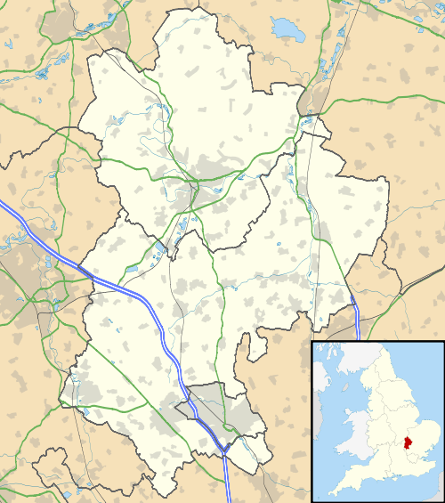
Podington is a village and civil parish in Bedfordshire, England, United Kingdom. The village is within the electoral ward of Harrold in the Borough of Bedford. Podington lies around 16 km (9.9 mi) northwest of Bedford and is about 2 km (1.2 mi) east of the county border with Northamptonshire. Podington is a small picturesque rural village; many of its buildings are stone cottages dating from the 18th century, and some even earlier. Nearby there is paintballing and Podington Garden Centre can be found in the High Street. Podington was included in the Domesday Book 1086; and has been recorded as "Podintone" and "Potintone" from the 13th century and later as "Puddington".[2] Today it is sometimes spelt (or misspelt) "Poddington". Located around 3 km (1.9 mi) southeast of the village are RAF Podington and Santa Pod Raceway. Hinwick House is found at a crossroads under 1 km (0.62 mi) south of the village.
Church of St Mary is a Grade I listed church in Podington. It became a listed building on 13 July 1964.[3] Some surviving architectural elements date back at least to the early 13th century. Richard Orlebar the High Sheriff for Bedfordshire and his wife the culinary writer Diana Astry, were both buried here in the 1700s.[3]
Civil parish
The civil parish covering Podington also encompasses Hinwick and Farndish; although in the past Farndish had its own civil parish, it experienced depopulation and it was absorbed into the Podington parish. In the past and present the civil parish is usually referred to as "Podington and Hinwick" but sometimes "Podington with Hinwick" or just "Podington". the parish is within the historic Hundred of Willey.
Nearby places
Less than 1.5 km (0.93 mi) to the south is the hamlet of Hinwick; the closest nearby villages between 1.5 and 3 km (1 and 2 miles) away include Farndish to the northwest and Wymington to the northeast. Nearby larger settlements include Rushden to the north, Irchester to the northwest and Wollaston to the west, all around 5 km (3.1 mi) away. Wellingborough, which is 7 km (4.3 mi) northwest of Podington, is the village's post town.
See also
References
- ↑ "Civil Parish population 2011". Neighbourhood Statistics. Office for National Statistics. Retrieved 7 November 2016.
- ↑ British History Online - Older spellings - 1700s stone cottages
- 1 2 "Church of St Mary, Podington". British Listed Buildings. Retrieved 1 December 2011.
External links
![]() Media related to Podington at Wikimedia Commons
Media related to Podington at Wikimedia Commons