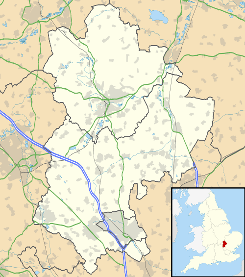
Harrowden, Bedfordshire
| Harrowden | |
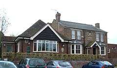 The Gate public house in 2008 (subsequently closed; current status not determined) |
|
 Harrowden |
|
| Population | 15 |
|---|---|
| OS grid reference | TL068894 |
| Civil parish | Eastcotts |
| Unitary authority | Bedford |
| Ceremonial county | Bedfordshire |
| Region | East |
| Country | England |
| Sovereign state | United Kingdom |
| Post town | BEDFORD |
| Postcode district | MK42 |
| Dialling code | 01234 |
| Police | Bedfordshire |
| Fire | Bedfordshire and Luton |
| Ambulance | East of England |
| EU Parliament | East of England |
| UK Parliament | North East Bedfordshire |
|
|
Coordinates: 52°06′45″N 0°26′31″W / 52.112569°N 0.441993°W
Harrowden is a one-street hamlet in the English county of Bedfordshire. Harrowden is mentioned in the Domesday Survey of 1086 when it appears as “Herghetone” or “Hergentone”. This comes from the Anglo-Saxon. “hearg-dun”: “hearg” means a place of heathen worship with some form of sacred grove or shrine, while “dun” refers to the slight rise in the ground here. At the 2011 Census the population was included in the civil parish of Eastcotts.
The street runs from east to west parallel and to the south of the A421 Bedford Southern Bypass, and 200 metres to the north of the village of Shortstown. There is a path at the west side of Harrowden named Bumpy Lane that leads to Abbey Fields. Like Shortstown, Harrowden is in the Eastcotts parish, of the Borough of Bedford.
Other
- John Bunyan, the noted Christian writer, was born in Harrowden. (See also Slough of Despond).
- The name of the hamlet comes from the Old English Hearg-dūn, meaning "Temple Hill".
External links
| Wikimedia Commons has media related to Harrowden, Bedfordshire. |
- Map sources for Harrowden, Bedfordshire