Pocono Summit, Pennsylvania
| Pocono Summit | |
| Unincorporated area | |
 Pocono Summit Railroad Station | |
| Country | United States |
|---|---|
| State | Pennsylvania |
| County | Monroe |
| Townships | Coolbaugh/Tobyhanna |
| Elevation | 1,804 ft (549.9 m) |
| Coordinates | 41°06′39″N 75°23′09″W / 41.11083°N 75.38583°WCoordinates: 41°06′39″N 75°23′09″W / 41.11083°N 75.38583°W |
| Area | 16.1 sq mi (41.7 km2) |
| - land | 15.4 sq mi (40 km2) |
| - water | .7 sq mi (2 km2), 4.35% |
| Population | 2,964 (2010) |
| Density | 184.1/sq mi (71.1/km2) |
| Timezone | EST (UTC-5) |
| - summer (DST) | EDT (UTC-4) |
| ZIP Code | 18346 |
| Area code | 570 |
 Location of Pocono Summit in Pennsylvania | |
 Location of Pennsylvania in the United States | |
Pocono Summit is a small town (Census Class Code U6) located in Monroe County, Pennsylvania, United States. Parts of Pocono Summit are located in the municipalities of Coolbaugh and Tobyhanna townships.
Geography
Pocono Summit is located at 41°6′39″N 75°23′09″W / 41.11083°N 75.38583°W (41.111, -75.386).
According to the United States Census Bureau, the CDP has a total area of 16.1 square miles (41.7 km²), 95% of it land. Pocono Summit is home to Stillwater Lake and Pocono Summit Lake.
Demographics
As of the census of 2010, there were 2,964 people residing in the area.
Education
The Pocono Mountain School District's Sullivan Trail campus is located in Pocono Summit; the campus includes Pocono Mountain West High School and Pocono Mountain West Junior High School.[1]
Recreation
Pocono Summit is home to Camp Minsi, a Boy Scout camp located on the western shores of Stillwater Lake. The camp was first opened in 1949 and encompasses more than 1,200 acres (490 ha).[2]
The area also includes portions of Pennsylvania State Game Lands 127.
References
- ↑ "Pocono Mountain West High School". Pocono Mountain School District. Retrieved 2010-05-11.
- ↑ "Campminsi.org". Camp Minsi. Retrieved 2010-05-11.
Municipalities and communities of Monroe County, Pennsylvania, United States | ||
|---|---|---|
| Boroughs | 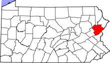 | |
| Townships | ||
| CDPs | ||
| Unincorporated communities |
| |
| Footnotes | ‡This populated place also has portions in an adjacent county | |