Pennfield Charter Township, Michigan
| Pennfield Charter Township, Michigan | |
|---|---|
| Charter township | |
 Pennfield Charter Township Location within the state of Michigan | |
| Coordinates: 42°21′40″N 85°8′28″W / 42.36111°N 85.14111°WCoordinates: 42°21′40″N 85°8′28″W / 42.36111°N 85.14111°W | |
| Country | United States |
| State | Michigan |
| County | Calhoun |
| Government | |
| • Type | Charter Township |
| • Supervisor | Rob Behnke |
| • Treasurer | Barb Phillips |
| • Clerk | Kathy Case |
| • Permits Clerk | Cheri Ambroso |
| • Assessor | Dan Brunner |
| Area | |
| • Total | 35.1 sq mi (90.9 km2) |
| • Land | 34.2 sq mi (88.7 km2) |
| • Water | 0.8 sq mi (2.2 km2) |
| Elevation | 837 ft (255 m) |
| Population (2010) | |
| • Total | 9,001 |
| • Density | 263/sq mi (101.4/km2) |
| Time zone | Eastern (EST) (UTC-5) |
| • Summer (DST) | EDT (UTC-4) |
| ZIP | 49017 |
| FIPS code | 26-63440[1] |
| GNIS feature ID | 1626891[2] |
| Website |
www |
Pennfield Charter Township is a charter township of Calhoun County in the U.S. state of Michigan. It is part of the Battle Creek, Michigan Metropolitan Statistical Area. The population was 9,001 at the 2010 census.[3]
Geography
According to the United States Census Bureau, the township has a total area of 35.1 square miles (90.9 km2), of which 34.2 square miles (88.7 km2) is land and 0.85 square miles (2.2 km2), or 2.38%, is water.[3]
Demographics
| Historical population | |||
|---|---|---|---|
| Census | Pop. | %± | |
| 1960 | 6,626 | — | |
| 1970 | 8,290 | 25.1% | |
| 1980 | 8,743 | 5.5% | |
| 1990 | 8,386 | −4.1% | |
| 2000 | 8,913 | 6.3% | |
| 2010 | 9,001 | 1.0% | |
| Source: Census Bureau. Census 1960- 2000, 2010. | |||
As of the census[1] of 2000, there were 8,913 people, 3,532 households, and 2,468 families residing in the township. The population density was 256.3 per square mile (98.9/km²). There were 3,764 housing units at an average density of 108.2 per square mile (41.8/km²). The racial makeup of the township was 92.80% White, 4.35% African American, 0.47% Native American, 0.55% Asian, 0.03% Pacific Islander, 0.48% from other races, and 1.31% from two or more races. Hispanic or Latino of any race were 1.65% of the population.
There were 3,532 households out of which 31.5% had children under the age of 18 living with them, 56.9% were married couples living together, 9.4% had a female householder with no husband present, and 30.1% were non-families. 25.5% of all households were made up of individuals and 9.1% had someone living alone who was 65 years of age or older. The average household size was 2.52 and the average family size was 3.01.
In the township the population was spread out with 25.2% under the age of 18, 7.9% from 18 to 24, 27.9% from 25 to 44, 25.9% from 45 to 64, and 13.2% who were 65 years of age or older. The median age was 39 years. For every 100 females there were 96.7 males. For every 100 females age 18 and over, there were 93.4 males.
The median income for a household in the township was $44,277, and the median income for a family was $53,690. Males had a median income of $40,315 versus $27,318 for females. The per capita income for the township was $20,846. About 5.5% of families and 7.3% of the population were below the poverty line, including 8.4% of those under age 18 and 5.3% of those age 65 or over.
Schools
- Pennfield High School - Enrollment 678 (2009), Grades 9-12
- Pennfield Middle School - Grades 6-8
- Dunlap Elementary - Grades 4-5
- Purdy Elementary - Grades K-3
- North Pennfield Elementary - Grades K-3
References
- 1 2 "American FactFinder". United States Census Bureau. Retrieved 2008-01-31.
- ↑ U.S. Geological Survey Geographic Names Information System: Pennfield Charter Township, Michigan
- 1 2 "Geographic Identifiers: 2010 Demographic Profile Data (G001): Pennfield charter township, Calhoun County, Michigan". U.S. Census Bureau, American Factfinder. Retrieved August 26, 2014.
External links
Municipalities and communities of Calhoun County, Michigan, United States | ||
|---|---|---|
| Cities | 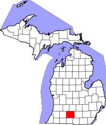 | |
| Villages | ||
| Charter townships | ||
| General law townships | ||
| CDPs | ||
| Other unincorporated communities | ||
| Footnotes | ‡This populated place also has portions in an adjacent county or counties | |