Brownlee Park, Michigan
| Brownlee Park, Michigan | |
|---|---|
| Census-designated place & Unincorporated community | |
 Location of Brownlee Park, Michigan | |
| Coordinates: 42°19′32″N 85°8′8″W / 42.32556°N 85.13556°WCoordinates: 42°19′32″N 85°8′8″W / 42.32556°N 85.13556°W | |
| Country | United States |
| State | Michigan |
| County | Calhoun |
| Township |
Emmett, Pennfield |
| Area | |
| • Total | 2.03 sq mi (5.27 km2) |
| • Land | 2.01 sq mi (5.20 km2) |
| • Water | 0.03 sq mi (0.07 km2) |
| Elevation[1] | 876 ft (267 m) |
| Population (2010) | |
| • Total | 2,108 |
| • Density | 1,051/sq mi (405.7/km2) |
| Time zone | Eastern (EST) (UTC-5) |
| • Summer (DST) | EDT (UTC-4) |
| FIPS code | 26-11200[2] |
| GNIS feature ID | 2393352[1] |
Brownlee Park is an unincorporated community in Calhoun County in the U.S. state of Michigan. It is also a census-designated place (CDP) for statistical purposes. The population was 2,108 at the 2010 census.[3] The CDP is immediately east of the city of Battle Creek and is part of the Battle Creek Metropolitan Statistical Area.
The CDP includes both Brownlee Park and the adjacent community of Greenfield Park:
- Brownlee Park is within Emmett Charter Township, mostly east of Raymond Road and north of Michigan Avenue, at 42°19′08″N 85°08′33″W / 42.31889°N 85.14250°W.[4]
- Greenfield Park is mostly within Pennfield Charter Township, just north of Verona Road, centered on 42°20′06″N 85°08′14″W / 42.33500°N 85.13722°W.[5]
Geography
According to the United States Census Bureau, the CDP has a total area of 2.03 square miles (5.27 km2), of which 2.01 square miles (5.20 km2) is land and 0.03 square miles (0.07 km2), or 1.39%, is water.[3]
Demographics
As of the census[2] of 2000, there were 2,588 people, 1,027 households, and 659 families residing in the CDP. The population density was 1,297.7 per square mile (502.1/km²). There were 1,194 housing units at an average density of 598.7 per square mile (231.7/km²). The racial makeup of the CDP was 91.11% White, 2.70% Black or African American, 1.00% Native American, 0.66% Asian, 0.08% Pacific Islander, 1.51% from other races, and 2.94% from two or more races. Hispanic or Latino of any race were 4.21% of the population.
There were 1,027 households out of which 32.3% had children under the age of 18 living with them, 39.5% were married couples living together, 19.8% had a female householder with no husband present, and 35.8% were non-families. 29.0% of all households were made up of individuals and 10.1% had someone living alone who was 65 years of age or older. The average household size was 2.50 and the average family size was 3.05.
In the CDP the population was spread out with 27.7% under the age of 18, 9.4% from 18 to 24, 31.4% from 25 to 44, 20.9% from 45 to 64, and 10.5% who were 65 years of age or older. The median age was 34 years. For every 100 females there were 90.4 males. For every 100 females age 18 and over, there were 87.7 males.
The median income for a household in the CDP was $26,694, and the median income for a family was $32,644. Males had a median income of $27,400 versus $20,813 for females. The per capita income for the CDP was $17,026. About 16.0% of families and 19.0% of the population were below the poverty line, including 30.3% of those under age 18 and 9.7% of those age 65 or over.
References
- 1 2 U.S. Geological Survey Geographic Names Information System: Brownlee Park Census Designated Place
- 1 2 "American FactFinder". United States Census Bureau. Archived from the original on 2013-09-11. Retrieved 2008-01-31.
- 1 2 "Geographic Identifiers: 2010 Demographic Profile Data (G001): Brownlee Park CDP, Michigan". U.S. Census Bureau, American Factfinder. Retrieved August 28, 2014.
- ↑ U.S. Geological Survey Geographic Names Information System: Brownlee Park, Michigan
- ↑ U.S. Geological Survey Geographic Names Information System: Greenfield Park, Michigan
Municipalities and communities of Calhoun County, Michigan, United States | ||
|---|---|---|
| Cities | 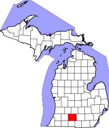 | |
| Villages | ||
| Charter townships | ||
| General law townships | ||
| CDPs | ||
| Other unincorporated communities | ||
| Footnotes | ‡This populated place also has portions in an adjacent county or counties | |