Peggs, Oklahoma
| Peggs, Oklahoma | |
|---|---|
| Census-designated place | |
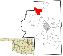 Location within Cherokee County and the state of Oklahoma | |
| Coordinates: 36°4′51″N 95°5′58″W / 36.08083°N 95.09944°WCoordinates: 36°4′51″N 95°5′58″W / 36.08083°N 95.09944°W | |
| Country | United States |
| State | Oklahoma |
| County | Cherokee |
| Area | |
| • Total | 15.3 sq mi (39.7 km2) |
| • Land | 15.3 sq mi (39.7 km2) |
| • Water | 0 sq mi (0 km2) |
| Population (2010) | |
| • Total | 813 |
| • Density | 53/sq mi (20.5/km2) |
| Time zone | Central (CST) (UTC-6) |
| • Summer (DST) | CDT (UTC-5) |
| ZIP codes | 74452 |
| FIPS code | 40-57950 |
| GNIS feature ID | 1096535 |
Peggs is an unincorporated community and census-designated place (CDP) in Cherokee County, Oklahoma, United States.[1] It had a population of 813 at the 2010 census, compared to 814 at the 2000 census.[2] A large minority of its residents are Native American, most of them members of 10 tribal groups such as the Cherokee Nation and the Muscogee Creek Nation.
History
The post office was established December 6, 1899. It was named for Thomas Pegg, acting principal chief of the Cherokee Nation during the Civil War.[3]
A tornado hit Peggs on May 2, 1920, killing 71 people, about 30 percent of the population and devastated the town, At the time, it was considered one of Oklahoma's deadliest tornados.[4]
Geography
Peggs is located in northwestern Cherokee County, along Oklahoma State Highway 82, which leads southeast 15 miles (24 km) to Tahlequah, the county seat, and northwest 10 miles (16 km) to Locust Grove in Mayes County.
According to the U.S. Census Bureau, the Peggs CDP has an area of 15.3 square miles (39.7 km2), all of it land.[5]
Economy
There are three convenience stores and one post office in the small community. There is also a senior community center serving noon meals to senior citizens.
Education
Peggs currently has one elementary (K-8) school, with 9-12 grade either going to neighboring Tahlequah, Hulbert, or Locust Grove to high school.
References
- ↑ U.S. Geological Survey Geographic Names Information System: Peggs, Oklahoma
- ↑ CensusViewer:Peggs, Oklahoma Population. Retrieved October 13, 2013.
- ↑ Muskogee Phoenix. "How places got their names." June 5, 2007. Retrieved October 11, 2013.
- ↑ National Weather Service. "Today's Weather Trivia." Retrieved July 31, 2014.
- ↑ "Geographic Identifiers: 2010 Demographic Profile Data (G001): Peggs CDP, Oklahoma". U.S. Census Bureau, American Factfinder. Retrieved February 19, 2015.
Municipalities and communities of Cherokee County, Oklahoma, United States | ||
|---|---|---|
| City |  | |
| Towns | ||
| CDPs | ||
| Other unincorporated communities | ||
| Footnotes | ‡This populated place also has portions in an adjacent county or counties | |