Paxton, Florida
| Paxton, Florida | |
|---|---|
| Town | |
|
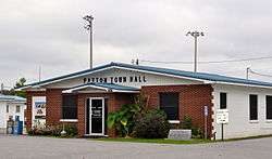
Paxton Town Hall, September 2014. | |
 Location in Walton County and the state of Florida | |
| Coordinates: 30°58′43″N 86°18′42″W / 30.97861°N 86.31167°WCoordinates: 30°58′43″N 86°18′42″W / 30.97861°N 86.31167°W | |
| Country |
|
| State |
|
| County | Walton |
| Area | |
| • Total | 4 sq mi (10.3 km2) |
| • Land | 3.9 sq mi (10.1 km2) |
| • Water | 0.1 sq mi (0.2 km2) |
| Elevation | 318 ft (97 m) |
| Population (2000) | |
| • Total | 656 |
| • Density | 164/sq mi (63.7/km2) |
| Time zone | Central (CST) (UTC-6) |
| • Summer (DST) | CDT (UTC-5) |
| ZIP code | 32538 |
| Area code(s) | 850 |
| FIPS code | 12-55475[1] |
| GNIS feature ID | 0288591[2] |
Paxton is a town in Walton County, Florida, United States. The population was 656 at the 2000 census. As of 2004, the population recorded by the U.S. Census Bureau is 753. Located near Britton Hill, the town has the highest elevation of any in Florida.
Geography

Paxton is located at 30°58′43″N 86°18′42″W / 30.978662°N 86.311780°W.[3]
According to the United States Census Bureau, the town has a total area of 4.0 square miles (10 km2), of which 3.9 square miles (10 km2) is land and 0.1 square miles (0.26 km2) (1.76%) is water.
Demographics
| Historical population | |||
|---|---|---|---|
| Census | Pop. | %± | |
| 1960 | 215 | — | |
| 1970 | 243 | 13.0% | |
| 1980 | 659 | 171.2% | |
| 1990 | 600 | −9.0% | |
| 2000 | 656 | 9.3% | |
| 2010 | 644 | −1.8% | |
| Est. 2015 | 749 | [4] | 16.3% |
As of the census[1] of 2000, there were 656 people, 263 households, and 185 families residing in the town. The population density was 167.9 people per square mile (64.8/km²). There were 298 housing units at an average density of 76.3 per square mile (29.4/km²). The racial makeup of the town was 94.05% White, 1.68% African American, 2.90% Native American, 0.15% from other races, and 1.22% from two or more races. Hispanic or Latino of any race were 1.68% of the population.
There were 263 households out of which 28.5% had children under the age of 18 living with them, 51.7% were married couples living together, 13.7% had a female householder with no husband present, and 29.3% were non-families. 27.0% of all households were made up of individuals and 12.9% had someone living alone who was 65 years of age or older. The average household size was 2.49 and the average family size was 2.96.
In the town the population was spread out with 25.5% under the age of 18, 6.7% from 18 to 24, 25.2% from 25 to 44, 26.7% from 45 to 64, and 16.0% who were 65 years of age or older. The median age was 39 years. For every 100 females there were 88.0 males. For every 100 females age 18 and over, there were 82.5 males.
The median income for a household in the town was $24,625, and the median income for a family was $35,000. Males had a median income of $25,781 versus $21,375 for females. The per capita income for the town was $14,108. About 7.1% of families and 12.3% of the population were below the poverty line, including 15.6% of those under age 18 and 12.1% of those age 65 or over.
References
- 1 2 "American FactFinder". United States Census Bureau. Retrieved 2008-01-31.
- ↑ "US Board on Geographic Names". United States Geological Survey. 2007-10-25. Retrieved 2008-01-31.
- ↑ "US Gazetteer files: 2010, 2000, and 1990". United States Census Bureau. 2011-02-12. Retrieved 2011-04-23.
- ↑ "Annual Estimates of the Resident Population for Incorporated Places: April 1, 2010 to July 1, 2015". Retrieved July 2, 2016.
- ↑ "Census of Population and Housing". Census.gov. Archived from the original on May 11, 2015. Retrieved June 4, 2015.
Municipalities and communities of Walton County, Florida, United States | ||
|---|---|---|
| Cities | 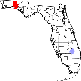 | |
| Town | ||
| CDP | ||
| Unincorporated communities | ||