Miramar Beach, Florida
| Miramar Beach, Florida | |
|---|---|
| CDP | |
|
Oceanfront at Miramar Beach, Florida, September 2014. | |
 Location in Walton County and the state of Florida | |
| Coordinates: 30°22′58″N 86°21′21″W / 30.38278°N 86.35583°WCoordinates: 30°22′58″N 86°21′21″W / 30.38278°N 86.35583°W | |
| Country |
|
| State |
|
| County | Walton |
| Area | |
| • Total | 4.7 sq mi (12.2 km2) |
| • Land | 4.6 sq mi (11.9 km2) |
| • Water | 0.1 sq mi (0.3 km2) |
| Elevation | 20 ft (6 m) |
| Population (2010) | |
| • Total | 6,146 |
| • Density | 518.1/sq mi (199.6/km2) |
| Time zone | Central (CST) (UTC-6) |
| • Summer (DST) | CDT (UTC-5) |
| ZIP code | 32550 |
| Area code(s) | 850 |
| FIPS code | 12-46000[1] |
| GNIS feature ID | 0286975[2] |

Miramar Beach is a census-designated place (CDP) in Walton County, Florida, United States. The population was 6,146 at the 2010 census. Although many other localities in Florida have appended "Beach" to their names to distinguish themselves from an adjacent inland or cross-bay municipality – such as Miami Beach, St. Pete Beach, Pensacola Beach, Melbourne Beach, Cocoa Beach, and Jacksonville Beach – the city of Miramar, Florida is actually over 600 miles (970 km) away in South Florida. There are other Miramar Beaches in Goa, India and in Santa Barbara, California.
Geography
Miramar Beach is located at 30°22′58″N 86°21′21″W / 30.38278°N 86.35583°W (30.382698, -86.355962).[3]
According to the United States Census Bureau, the total area of 4.7 square miles (12 km2), of which 4.6 square miles (12 km2) is land and 0.1 square miles (0.26 km2) (2.54%) is water.
Demographics
As of the census[1] of 2000, there were 2,435 people, 1,214 households, and 713 families residing in the CDP. The population density was 529.6 people per square mile (204.4/km²). There were 6,558 housing units at an average density of 1,426.3/sq mi (550.4/km²). The racial makeup of the CDP was 96.63% White, 0.62% African American, 0.70% Native American, 0.94% Asian, 0.21% from other races, and 0.90% from two or more races. Hispanic or Latino of any race were 1.36% of the population.
There were 1,214 households out of which 12.4% had children under the age of 18 living with them, 52.6% were married couples living together, 4.0% had a female householder with no husband present, and 41.2% were non-families. 33.3% of all households were made up of individuals and 11.7% had someone living alone who was 65 years of age or older. The average household size was 1.93 and the average family size was 2.39.
In the CDP the population was spread out with 9.9% under the age of 18, 5.0% from 18 to 24, 24.3% from 25 to 44, 33.9% from 45 to 64, and 26.9% who were 65 years of age or older. The median age was 52 years. For every 100 females there were 98.0 males. For every 100 females age 18 and over, there were 97.6 males.
The median income for a household in the CDP was $46,535, and the median income for a family was $60,156. Males had a median income of $45,294 versus $26,419 for females. The per capita income for the CDP was $29,493. About 4.6% of families and 6.9% of the population were below the poverty line, including none of those under age 18 and 3.8% of those age 65 or over.
References
- 1 2 "American FactFinder". United States Census Bureau. Retrieved 2008-01-31.
- ↑ "US Board on Geographic Names". United States Geological Survey. 2007-10-25. Retrieved 2008-01-31.
- ↑ "US Gazetteer files: 2010, 2000, and 1990". United States Census Bureau. 2011-02-12. Retrieved 2011-04-23.
Municipalities and communities of Walton County, Florida, United States | ||
|---|---|---|
| Cities | 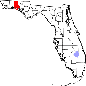 | |
| Town | ||
| CDP | ||
| Unincorporated communities | ||
Also home of Sandestin Golf and Beach Resort