Pangil River
| Pangil River | |
|---|---|
 | |
| Country | Philippines |
| Basin | |
| River mouth |
Northern Tip of the Easternmost Lobe of Laguna de Bay less than 2 m (6.6 ft) above sea level |
| Basin size | 51.14 km2 (19.75 sq mi) |
The Pangil River (Tagalog: Ilog ng Pangil), also known as the Bambang Hari River, is a river system that runs through Pangil, Laguna in the Philippines. It is one of 21 River tributaries of Laguna de Bay and is regularly monitored by the Laguna Lake Development Authority(LLDA) through one of its 15 river monitoring stations.
The Pangil River sub-basin has a drainage area of 51.14 square kilometers.[1]
How it got named Bambang Hari
Part of the river is referred to as the Bambang Hari - which, when translated, means "riverbank of the king" - because in the mid-18th century, King Carlos III of Spain visited Pangil when he was still a prince, and it was said that he used to frequent river often. [2]
When he was crowned king, he sent the images of the Santo Niño de la O and the Birhen de la O to Pangil in gratitude. the Birhen de la O, which shows a pregnant Virgin Mary, is believed to be miraculous.[3]
Conservation
In the latest (December 2005[4]) Water Quality Status Report listed on the Laguna Lake Development Authority's site, the Pangil River was listed as "Worse than Class D." It also indicated that this status had been "maintained" since the river was last monitored.
According to the Water Usage & Classification for Fresh Water system used by the Philippines' Department of Environment and Natural Resources, Class D Quality freshwater is suitable for agriculture, irrigation, livestock watering and industrial water supply class II. "Worse than Class D" implies that the Pangil River is not suitable for any of those functions.
In 1980, International Rice Research Institute (IRRI) researcher DA Vaughan documented six populations of Oryza minuta Presl. - a wild rice species known to be resistant to bacterial blight, bacterial blast, green planthopper, and brown planthopper - along a stream which is a tributary of the Pangil river.
A 2004 survey noted with alarm that all the populations were gone. The report attributed the disappearance of the rare and useful species of rice to human activities, particularly "livestock raising, farming, and road construction, which destroy the natural vegetation within the vicinity."
Scientists have noted that further studies are needed to prevent the local extinction of this species.[5]
Gallery
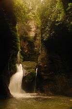 Ambon-Ambon Falls
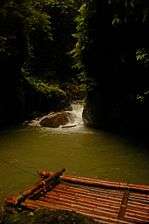
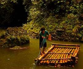 Ferryman using Bamboo raft, on the Pangil river
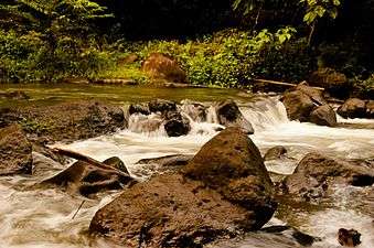
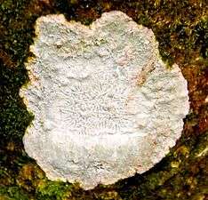 Tree fungus
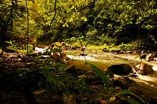
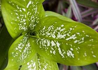 Flora along the Pangil River
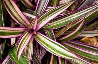 Flora along the Pangil River
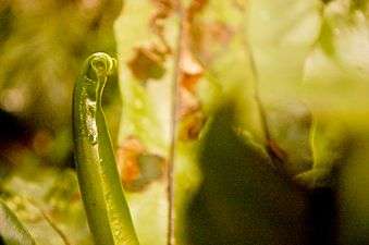 Flora along the Pangil River
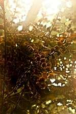
See also
Coordinates: 14°24′N 121°27′E / 14.400°N 121.450°E
References
- ↑ Liongson, Leonardo; Guillermo Q. Tabios III and Antonio Daño (2005), "Laguna Lake's Tributary River Watersheds", in Lasco, Rodel D.; Espaldon, Ma. Victoria O., Ecosystems and People: the Philippine Millennium Ecosystem Assessment (MA) Sub-global Assessment (PDF), Environmental Forestry Programme, College of Forestry and Natural Resources, University of the Philippines Los Baños Cite uses deprecated parameter
|coauthors=(help) - ↑ Labay Cagoco, Josefa (2 November 2005), "Taking a ride around Laguna de Bay", BusinessWorld
- ↑ Miranda, Gil R. "Driving Through Laguna's History: A Laguna Travelogue". Provincial Government of Laguna. Retrieved 2007-06-02.
- ↑ "Monthly Water Quality Status Report December 2005" (Press release). Laguna Lake Development Authority. December 2005 1url=http://www.llda.gov.ph/SD_Mondriaan/MonthlyReport_files/2005/December_Home.htm. Check date values in:
|date=(help); - ↑ Banaticla; Almazan (2004), "Vanishing populations of Oryza minuta Presl. in Pangil, Laguna, Philippines" (PDF), International Rice Research Notes, Vol. 29 (No. 2): 94–95
External links
| Wikimedia Commons has media related to Pangil River. |
"The Largest Lake in the Philippines" | |||||||||||
| Location |  | ||||||||||
| Basin country | |||||||||||
| Islands | |||||||||||
| Primary outflow | |||||||||||
| Primary inflows |
| ||||||||||
| Settlements | |||||||||||