Pali, Nepal
| Pali, Nepal पाली | |
|---|---|
| Village development committee | |
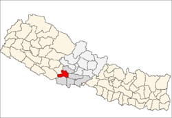
 Pali, Nepal Location in Nepal | |
| Coordinates: 27°56′N 83°15′E / 27.933°N 83.250°ECoordinates: 27°56′N 83°15′E / 27.933°N 83.250°E | |
| Country |
|
| Zone | Lumbini Zone |
| District | Arghakhanchi District |
| Population (1991) | |
| • Total | 4,016 |
| • Religions | Hindu |
| Time zone | Nepal Time (UTC+5:45) |
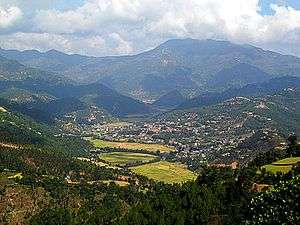
Pali is a small town in Arghakhanchi District in the Lumbini Zone of southern Nepal. At the time of the 1991 Nepal census it had a population of 4,016 and had 804 houses in the town.[1]
References
- ↑ "Nepal Census 2001". Nepal's Village Development Committees. Digital Himalaya. Retrieved 2008-08-23.
This article is issued from Wikipedia - version of the 9/10/2014. The text is available under the Creative Commons Attribution/Share Alike but additional terms may apply for the media files.