Owensville, Missouri
| Owensville, Missouri | |
|---|---|
| City | |
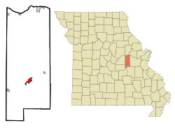 Location of Owensville, Missouri | |
| Coordinates: 38°20′48″N 91°30′0″W / 38.34667°N 91.50000°WCoordinates: 38°20′48″N 91°30′0″W / 38.34667°N 91.50000°W | |
| Country | United States |
| State | Missouri |
| County | Gasconade |
| Government | |
| • Mayor | John Kamler |
| Area[1] | |
| • Total | 2.64 sq mi (6.84 km2) |
| • Land | 2.64 sq mi (6.84 km2) |
| • Water | 0 sq mi (0 km2) |
| Elevation | 948 ft (289 m) |
| Population (2010)[2] | |
| • Total | 2,676 |
| • Estimate (2012[3]) | 2,635 |
| • Density | 1,013.6/sq mi (391.4/km2) |
| Time zone | Central (CST) (UTC-6) |
| • Summer (DST) | CDT (UTC-5) |
| ZIP code | 65066 |
| Area code(s) | 573 |
| FIPS code | 29-55640[4] |
| GNIS feature ID | 0723913[5] |
| Website | www.cityofowensville.com |
- For communities with a similar name, see Owensville (disambiguation).
Owensville is a city in Gasconade County, Missouri, United States. The population was 2,676 at the 2010 census.
History
Owensville was named for a pioneer settler.[6]
Geography
According to the United States Census Bureau, the city has a total area of 2.64 square miles (6.84 km2), all of it land.[1]
The City is approximately 70.8 miles southwest of St. Louis, 55.5 miles southeast of Jefferson City, and 22.3 miles north of Cuba (I-44). Missouri Highways 28 and 19 serve Owensville. In addition the City is 22 miles north of Interstate 44.
Demographics
| Historical population | |||
|---|---|---|---|
| Census | Pop. | %± | |
| 1910 | 677 | — | |
| 1920 | 777 | 14.8% | |
| 1930 | 1,424 | 83.3% | |
| 1940 | 1,439 | 1.1% | |
| 1950 | 1,946 | 35.2% | |
| 1960 | 2,379 | 22.3% | |
| 1970 | 2,416 | 1.6% | |
| 1980 | 2,241 | −7.2% | |
| 1990 | 2,325 | 3.7% | |
| 2000 | 2,500 | 7.5% | |
| 2010 | 2,676 | 7.0% | |
| Est. 2015 | 2,627 | [7] | −1.8% |
2010 census
As of the census[2] of 2010, there were 2,676 people, 1,081 households, and 680 families residing in the city. The population density was 1,013.6 inhabitants per square mile (391.4/km2). There were 1,280 housing units at an average density of 484.8 per square mile (187.2/km2). The racial makeup of the city was 97.9% White, 0.2% African American, 0.2% Native American, 0.4% Asian, 0.1% from other races, and 1.1% from two or more races. Hispanic or Latino of any race were 1.1% of the population.
There were 1,081 households of which 31.5% had children under the age of 18 living with them, 44.1% were married couples living together, 14.2% had a female householder with no husband present, 4.6% had a male householder with no wife present, and 37.1% were non-families. 33.0% of all households were made up of individuals and 16.5% had someone living alone who was 65 years of age or older. The average household size was 2.33 and the average family size was 2.90.
The median age in the city was 41.2 years. 23.1% of residents were under the age of 18; 8.7% were between the ages of 18 and 24; 22.3% were from 25 to 44; 23.2% were from 45 to 64; and 22.6% were 65 years of age or older. The gender makeup of the city was 45.1% male and 54.9% female.
2000 census
As of the census[4] of 2000, there were 2,500 people, 1,059 households, and 655 families residing in the city. The population density was 1,237.5 people per square mile (477.8/km²). There were 1,202 housing units at an average density of 595.0 per square mile (229.7/km²). The racial makeup of the city was 98.44% White, 0.08% African American, 0.24% Native American, 0.16% Asian, 0.08% from other races, and 1.00% from two or more races. Hispanic or Latino of any race were 0.36% of the population.
There were 1,059 households out of which 30.5% had children under the age of 18 living with them, 47.8% were married couples living together, 11.0% had a female householder with no husband present, and 38.1% were non-families. 34.0% of all households were made up of individuals and 21.1% had someone living alone who was 65 years of age or older. The average household size was 2.30 and the average family size was 2.97.
In the city the population was spread out with 25.8% under the age of 18, 7.8% from 18 to 24, 25.7% from 25 to 44, 18.4% from 45 to 64, and 22.3% who were 65 years of age or older. The median age was 39 years. For every 100 females there were 82.9 males. For every 100 females age 18 and over, there were 79.3 males.
The median income for a household in the city was $26,913, and the median income for a family was $33,109. Males had a median income of $30,162 versus $20,068 for females. The per capita income for the city was $15,208. About 11.0% of families and 15.6% of the population were below the poverty line, including 19.4% of those under age 18 and 13.6% of those age 65 or over.
Government
Owensville is a fourth-class municipality incorporated under Missouri law. Owensville's government is organized under a Mayor and a four-member City Council. The Council is elected from two wards on an alternating basis. The mayor is elected at-large for a two-year term. Other municipal officials include the City Administrator, City Attorney, City Judge, City Collector, City Clerk, City Marshal, and the administrative heads of the City departments.
Friendship city
Owensville is a friendship city with:
References
- 1 2 "US Gazetteer files 2010". United States Census Bureau. Retrieved 2012-07-08.
- 1 2 "American FactFinder". United States Census Bureau. Retrieved 2012-07-08.
- ↑ "Population Estimates". United States Census Bureau. Retrieved 2013-05-30.
- 1 2 "American FactFinder". United States Census Bureau. Retrieved 2008-01-31.
- ↑ "US Board on Geographic Names". United States Geological Survey. 2007-10-25. Retrieved 2008-01-31.
- ↑ Eaton, David Wolfe (1916). How Missouri Counties, Towns and Streams Were Named. The State Historical Society of Missouri. p. 169.
- ↑ "Annual Estimates of the Resident Population for Incorporated Places: April 1, 2010 to July 1, 2015". Retrieved July 2, 2016.
- ↑ "Census of Population and Housing". Census.gov. Retrieved June 4, 2015.
External links
Municipalities and communities of Gasconade County, Missouri, United States | ||
|---|---|---|
| Cities | 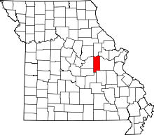 | |
| Townships | ||
| Unincorporated community | ||
| Ghost towns | ||
| Footnotes | ‡This populated place also has portions in an adjacent county or counties | |