Bland, Missouri
| Bland, Missouri | |
|---|---|
| City | |
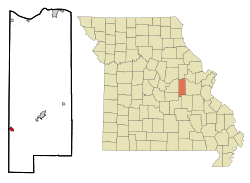 Location of Bland, Missouri | |
| Coordinates: 38°18′9″N 91°38′3″W / 38.30250°N 91.63417°WCoordinates: 38°18′9″N 91°38′3″W / 38.30250°N 91.63417°W | |
| Country | United States |
| State | Missouri |
| Counties | Gasconade, Osage |
| Area[1] | |
| • Total | 0.65 sq mi (1.68 km2) |
| • Land | 0.65 sq mi (1.68 km2) |
| • Water | 0 sq mi (0 km2) |
| Elevation | 1,014 ft (309 m) |
| Population (2010)[2] | |
| • Total | 539 |
| • Estimate (2012[3]) | 529 |
| • Density | 829.2/sq mi (320.2/km2) |
| Time zone | Central (CST) (UTC-6) |
| • Summer (DST) | CDT (UTC-5) |
| ZIP codes | 65014, 65062 |
| Area code(s) | 573 |
| FIPS code | 29-06256[4] |
| GNIS feature ID | 0714352[5] |
Bland is a city in Gasconade and Osage counties in the U.S. state of Missouri. The population was 539 at the 2010 census.
The Osage County portion of Bland is part of the Jefferson City, Missouri Metropolitan Statistical Area.
Geography
Bland is located at 38°18′9″N 91°38′3″W / 38.30250°N 91.63417°W (38.302510, -91.634232),[6] primarily within Gasconade County.
According to the United States Census Bureau, the city has a total area of 0.65 square miles (1.68 km2), all of it land.[1]
History
A post office called Bland has been in operation since 1877.[7] The town is named in honor of U.S. Congressman Richard Parks Bland, a United States Representative from various districts in southcentral Missouri.[8] Bland was a practicing attorney in Rolla, Missouri in neighboring Phelps County.
Demographics
| Historical population | |||
|---|---|---|---|
| Census | Pop. | %± | |
| 1910 | 359 | — | |
| 1920 | 470 | 30.9% | |
| 1930 | 577 | 22.8% | |
| 1940 | 565 | −2.1% | |
| 1950 | 596 | 5.5% | |
| 1960 | 654 | 9.7% | |
| 1970 | 621 | −5.0% | |
| 1980 | 662 | 6.6% | |
| 1990 | 651 | −1.7% | |
| 2000 | 565 | −13.2% | |
| 2010 | 539 | −4.6% | |
| Est. 2015 | 522 | [9] | −3.2% |
2010 census
As of the census[2] of 2010, there were 539 people, 230 households, and 142 families residing in the city. The population density was 829.2 inhabitants per square mile (320.2/km2). There were 292 housing units at an average density of 449.2 per square mile (173.4/km2). The racial makeup of the city was 97.6% White, 0.6% Native American, 0.6% Asian, 0.2% from other races, and 1.1% from two or more races. Hispanic or Latino of any race were 0.6% of the population.
There were 230 households of which 29.1% had children under the age of 18 living with them, 41.7% were married couples living together, 15.2% had a female householder with no husband present, 4.8% had a male householder with no wife present, and 38.3% were non-families. 33.0% of all households were made up of individuals and 13.5% had someone living alone who was 65 years of age or older. The average household size was 2.34 and the average family size was 2.96.
The median age in the city was 41.9 years. 23.6% of residents were under the age of 18; 8.4% were between the ages of 18 and 24; 20.7% were from 25 to 44; 30.6% were from 45 to 64; and 16.7% were 65 years of age or older. The gender makeup of the city was 51.8% male and 48.2% female.
2000 census
As of the census[4] of 2000, there were 565 people, 247 households, and 142 families residing in the city. The population density was 880.6 people per square mile (340.9/km²). There were 299 housing units at an average density of 466.0 per square mile (180.4/km²). The racial makeup of the city was 97.88% White, 0.18% African American, 0.18% from other races, and 1.77% from two or more races.
There were 247 households out of which 29.1% had children under the age of 18 living with them, 44.9% were married couples living together, 10.9% had a female householder with no husband present, and 42.5% were non-families. 37.2% of all households were made up of individuals and 21.5% had someone living alone who was 65 years of age or older. The average household size was 2.26 and the average family size was 2.94.
In the city the population was spread out with 24.1% under the age of 18, 8.0% from 18 to 24, 28.7% from 25 to 44, 22.3% from 45 to 64, and 17.0% who were 65 years of age or older. The median age was 39 years. For every 100 females there were 92.2 males. For every 100 females age 18 and over, there were 94.1 males.
The median income for a household in the city was $26,667, and the median income for a family was $34,659. Males had a median income of $24,286 versus $18,977 for females. The per capita income for the city was $13,102. About 5.3% of families and 11.5% of the population were below the poverty line, including 12.8% of those under age 18 and 21.8% of those age 65 or over.
City services
With a membership of about 20 volunteer firefighters, the Bland Fire Protection District operates firehouses in Bland and neighboring Redbird.
References
- 1 2 "US Gazetteer files 2010". United States Census Bureau. Archived from the original on 2012-01-24. Retrieved 2012-07-08.
- 1 2 "American FactFinder". United States Census Bureau. Retrieved 2012-07-08.
- ↑ "Population Estimates". United States Census Bureau. Archived from the original on 2013-06-17. Retrieved 2013-05-30.
- 1 2 "American FactFinder". United States Census Bureau. Archived from the original on 2013-09-11. Retrieved 2008-01-31.
- ↑ "US Board on Geographic Names". United States Geological Survey. 2007-10-25. Retrieved 2008-01-31.
- ↑ "US Gazetteer files: 2010, 2000, and 1990". United States Census Bureau. 2011-02-12. Retrieved 2011-04-23.
- ↑ "Post Offices". Jim Forte Postal History. Retrieved 2 October 2016.
- ↑ Eaton, David Wolfe (1916). How Missouri Counties, Towns and Streams Were Named. The State Historical Society of Missouri. p. 169.
- ↑ "Annual Estimates of the Resident Population for Incorporated Places: April 1, 2010 to July 1, 2015". Retrieved July 2, 2016.
- ↑ "Census of Population and Housing". Census.gov. Archived from the original on May 11, 2015. Retrieved June 4, 2015.
External links
- Bland on Gasconade County Website
- Bland Fire Protection District Website
- Historic maps of Bland in the Sanborn Maps of Missouri Collection at the University of Missouri
Municipalities and communities of Gasconade County, Missouri, United States | ||
|---|---|---|
| Cities | 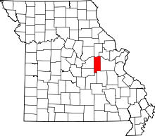 | |
| Townships | ||
| Unincorporated community | ||
| Ghost towns | ||
| Footnotes | ‡This populated place also has portions in an adjacent county or counties | |
Municipalities and communities of Osage County, Missouri, United States | ||
|---|---|---|
| Cities | 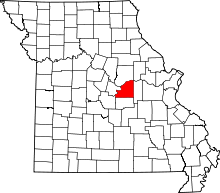 | |
| Villages | ||
| Townships | ||
| Unincorporated communities | ||
| Ghost towns | ||
| Footnotes | ‡This populated place also has portions in an adjacent county or counties | |