Ouled Naïl Range
| Ouled Naïl Range سلسلة جبال أولاد نايل | |
|---|---|
 Landscape of the range in the winter with the Djebel Selat near Bou Saada | |
| Highest point | |
| Peak | Djebel Lazrag |
| Elevation | 1,491 m (4,892 ft) |
| Coordinates | 34°40′0″N 3°24′0″E / 34.66667°N 3.40000°ECoordinates: 34°40′0″N 3°24′0″E / 34.66667°N 3.40000°E [1] |
| Dimensions | |
| Length | 180 km (110 mi) ENE/WSW |
| Width | 70 km (43 mi) NNW/SSE |
| Geography | |
 Ouled Naïl Range سلسلة جبال أولاد نايل | |
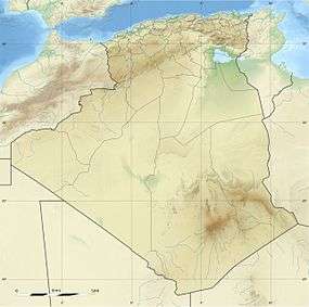
| Country | Algeria |
| States/Provinces | M'Sila Province, Djelfa Province and Laghouat Province |
| Parent range | Saharan Atlas |
| Geology | |
| Orogeny | Alpine orogeny |
| Age of rock | Early Tertiary |
The Ouled Naïl Range (Arabic: سلسلة جبال أولاد نايل, French: Monts des Ouled Naïl) is a mountain range in Algeria, part of the Saharan Atlas of the greater Atlas Mountain System. The range is named after a confederation of nomadic and semi-nomadic tribes, all of which claim to hail from Arab ancestors that arrived in the mountains in the eleventh century.
Geography
The Ouled Naïl mountain range is formed by parallel ridges rising between the level 850 m high terrain of the Hodna region of the Hautes Plaines in the north and the 600 m of the southern plain of the Dayas. It is located in the eastern zone of the Saharan Atlas, with the Amour Range in the western and the Zab Range at the eastern end.
The range is formed by mountains created by folds of the early Tertiary which remained relatively undisturbed after formation but have been heavily eroded. Their altitude is relatively moderate, the highest point of the range, Djebel Lazrag (جبل الأزرق), not even reaching 1,500 m. However, towards the south the look of the highest ridges is quite spectacular, with jagged sandstone or limestone outcrops and almost vertical walls. The part facing the Sahara has a less encumbered terrain with smooth mountaintops separated by water gaps.[2]
The climate is dry in all the surrounding areas, but the rainfall is slightly better on the mountains. Therefore cereal cultivation is possible in the heights, although with rather irregular results.[3] Date palms are mostly absent throughout the range owing to the prevailing cold temperatures. They only grow in the few places at the feet of the Ouled Naïl mountains that are at an altitude below 600 m, such as near Bou Saada and the Oued Djedi.[2]
Human presence
Two important towns are located in the immediate area of the range, Bou-Saada to the north at the feet of the mountains and Djelfa in the middle of the range at an elevation of 1,208 m. North of Djelfa town there is an imposing physical feature known as Salt Rock (Rocher de Sel) that resulted from the erosion of rock salts and marls by rain, and to the west of the town Megalithic funerary structures are found. Neolithic art is widespread in different caves and walls throughout the range.[4]
The range is well known for the Ouled Naïl people living in its cold highlands. Djelfa is an important market centre for the Ouled Naïl who live in black-and-red striped tents and claim ancient Arab descent. These semi-nomadic or nomadic people have traditionally reared cattle in the mountain grasslands.[5] The years of drought and years with prolonged, cold winters are hard times for the Ouled Nail; in 1944 and 1947 about 50% of their livestock died.[2]
Features
 A flat-topped hill near Bou-Saada. |
 Satellite image of the eastern end of the range south of Bou Saâda. |
 Ouled Nail people dancing. |
See also
References
- ↑ Google Earth
- 1 2 3 Géographie de l'Afrique du Nord - L'Atlas Saharien
- ↑ Étude de la situation météorologique au Sahara en janvier 1958
- ↑ Henri Lhote, F. de Villaret, Les gravures rupestres de l'Atlas saharien: monts des Ouled-Nail et région de Djelfa. 1984
- ↑ A Different Perspective of Algeria
External links
 Media related to Ouled Naïl Range at Wikimedia Commons
- Algeria - Biodiversity
- A. Bernard, Les régions naturelles de l'Algérie
| Tell Atlas |
|
|---|---|
| Saharan Atlas |
|
| Saharan massifs | |
| Peaks |
|