Osborn, Missouri
| Osborgn, Missouri | |
|---|---|
| City | |
 Location of Osborn, Missouri | |
| Coordinates: 39°44′56″N 94°21′23″W / 39.74889°N 94.35639°WCoordinates: 39°44′56″N 94°21′23″W / 39.74889°N 94.35639°W | |
| Country | United States |
| State | Missouri |
| Counties | DeKalb, Clinton |
| Area[1] | |
| • Total | 0.57 sq mi (1.48 km2) |
| • Land | 0.57 sq mi (1.48 km2) |
| • Water | 0 sq mi (0 km2) |
| Elevation | 1,037 ft (316 m) |
| Population (2010)[2] | |
| • Total | 423 |
| • Estimate (2012[3]) | 422 |
| • Density | 742.1/sq mi (286.5/km2) |
| Time zone | Central (CST) (UTC-6) |
| • Summer (DST) | CDT (UTC-5) |
| ZIP code | 64474 |
| Area code(s) | 816 |
| FIPS code | 29-55352[4] |
| GNIS feature ID | 0729597[5] |
Osborn is a city in Clinton and De Kalb Counties in the U.S. state of Missouri. The population was 423 at the 2010 census.
The Clinton County portion of Osborn is part of the Kansas City, MO–KS Metropolitan Statistical Area, while the DeKalb County portion is part of the St. Joseph, MO–KS Metropolitan Statistical Area. The Clinton County portion of Osborn lies in Platte Township. The DeKalb Country portion of Osborn lies in Colfax Township.
History
Osborn had its start by the building of the Hannibal and St. Joseph Railroad through that territory. It was named for Col. William Osborn of Waterville, New York.[6] Col. Osborn, born in Sangerfield, New York on May 9, 1809, was an Oneida National Bank and Trust Company of Central New York commissioner and farmer who, in 1845, relocated to Missouri where he partnered with the Hannibal and St. Joseph Railroad Company, the firm that constructed the Hannibal and St. Joseph Railroad.
Geography
Osborn is located at 39°44′56″N 94°21′23″W / 39.74889°N 94.35639°W (39.748936, -94.356321).[7]
According to the United States Census Bureau, the city has a total area of 0.57 square miles (1.48 km2), all of it land.[1]
Osborn is south of U.S. Route 36.
Demographics
| Historical population | |||
|---|---|---|---|
| Census | Pop. | %± | |
| 1880 | 412 | — | |
| 1890 | 373 | −9.5% | |
| 1900 | 386 | 3.5% | |
| 1910 | 360 | −6.7% | |
| 1920 | 354 | −1.7% | |
| 1930 | 381 | 7.6% | |
| 1940 | 315 | −17.3% | |
| 1950 | 237 | −24.8% | |
| 1960 | 274 | 15.6% | |
| 1970 | 338 | 23.4% | |
| 1980 | 381 | 12.7% | |
| 1990 | 400 | 5.0% | |
| 2000 | 455 | 13.8% | |
| 2010 | 423 | −7.0% | |
| Est. 2015 | 413 | [8] | −2.4% |
2010 census
As of the census[2] of 2010, there were 423 people, 192 households, and 114 families residing in the city. The population density was 742.1 inhabitants per square mile (286.5/km2). There were 209 housing units at an average density of 366.7 per square mile (141.6/km2). The racial makeup of the city was 98.3% White, 0.7% Native American, 0.2% from other races, and 0.7% from two or more races. Hispanic or Latino of any race were 1.2% of the population.
There were 192 households of which 23.4% had children under the age of 18 living with them, 45.8% were married couples living together, 9.9% had a female householder with no husband present, 3.6% had a male householder with no wife present, and 40.6% were non-families. 37.0% of all households were made up of individuals and 13.6% had someone living alone who was 65 years of age or older. The average household size was 2.20 and the average family size was 2.86.
The median age in the city was 44.4 years. 20.1% of residents were under the age of 18; 10.2% were between the ages of 18 and 24; 20.4% were from 25 to 44; 30.7% were from 45 to 64; and 18.7% were 65 years of age or older. The gender makeup of the city was 49.6% male and 50.4% female.
2000 census
At the 2000 census, there were 455 people, 183 households, and 129 families residing in the city.[10] The population density was 794.5 people per square mile (308.2/km²). There were 195 housing units at an average density of 340.5 per square mile (132.1/km²). The racial makeup of the city was 98.90% White, 0.22% African American, and 0.88% from two or more races. Hispanic or Latino of any race were 0.44% of the population.
There were 183 households of which 35.0% had children under the age of 18, 57.9% were married couples living together, 9.8% had a female householder with no husband present, and 29.5% were non-families. 26.8% of all households were made up of individuals and 14.2% had someone living alone who was 65 years of age or older. The average household size was 2.49 and the average family size was 3.03.
The age distribution was 28.8% under the age of 18, 8.1% from 18 to 24, 25.1% from 25 to 44, 22.4% from 45 to 64, and 15.6% who were 65 years of age or older. The median age was 37 years. For every 100 females there were 86.5 males. For every 100 females age 18 and over, there were 88.4 males.
The median income for a household in the city was $32,344, and the median income for a family was $44,205. Males had a median income of $29,792 versus $18,214 for females. The per capita income for the city was $16,230. About 4.0% of families and 9.9% of the population were below the poverty line, including 11.5% of those under age 18 and 25.8% of those age 65 or over.
Famous people from Osborn include Travis Hartman, professional boxer with more than 150 amateur fights. He has a professional record of 12-18-1. He is dating professional women's tennis player Irina Falconi.
References
- 1 2 "US Gazetteer files 2010". United States Census Bureau. Retrieved 2013-08-04.
- 1 2 "American FactFinder". United States Census Bureau. Retrieved 2012-07-08.
- ↑ "Population Estimates". United States Census Bureau. Retrieved 2013-05-30.
- ↑ "American FactFinder". United States Census Bureau. Retrieved 2011-05-14.
- ↑ "US Board on Geographic Names". United States Geological Survey. 2007-10-25. Retrieved 2008-01-31.
- ↑ Eaton, David Wolfe (1916). How Missouri Counties, Towns and Streams Were Named. The State Historical Society of Missouri. p. 284.
- ↑ "US Gazetteer files: 2010, 2000, and 1990". United States Census Bureau. 2011-02-12. Retrieved 2011-04-23.
- ↑ "Annual Estimates of the Resident Population for Incorporated Places: April 1, 2010 to July 1, 2015". Retrieved July 2, 2016.
- ↑ "Census of Population and Housing". Census.gov. Retrieved June 4, 2015.
- ↑ 2000 census Retrieved August 4, 2013
Municipalities and communities of Clinton County, Missouri, United States | ||
|---|---|---|
| Cities | 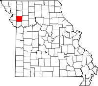 | |
| Village | ||
| Townships | ||
| Unincorporated communities | ||
| Footnotes | ‡This populated place also has portions in an adjacent county or counties | |
Municipalities and communities of DeKalb County, Missouri, United States | ||
|---|---|---|
| Cities | 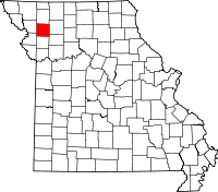 | |
| Villages | ||
| Townships | ||
| Unincorporated communities | ||
| Ghost towns | ||
| Footnotes | ‡This populated place also has portions in an adjacent county or counties | |