Holt, Missouri
| Holt, Missouri | |
|---|---|
| City | |
| Coordinates: 39°27′25″N 94°20′12″W / 39.45694°N 94.33667°WCoordinates: 39°27′25″N 94°20′12″W / 39.45694°N 94.33667°W | |
| Country | United States |
| State | Missouri |
| Counties | Clay, Clinton |
| Area[1] | |
| • Total | 0.45 sq mi (1.17 km2) |
| • Land | 0.45 sq mi (1.17 km2) |
| • Water | 0 sq mi (0 km2) |
| Elevation | 863 ft (263 m) |
| Population (2010)[2] | |
| • Total | 447 |
| • Estimate (2012[3]) | 455 |
| • Density | 993.3/sq mi (383.5/km2) |
| Time zone | Central (CST) (UTC-6) |
| • Summer (DST) | CDT (UTC-5) |
| ZIP code | 64048 |
| Area code(s) | 816 |
| FIPS code | 29-32752[4] |
| GNIS feature ID | 0719735[5] |
Holt is a city in Clay and Clinton counties in the U.S. state of Missouri. The population was 447 at the 2010 census.
History
Holt was platted in 1867.[6] The city was named for Jeremiah Abel Holt (1811-1886), who donated the land in 1837 and who was one of the first settlers in the area, a native of Orange County, North Carolina.[7]
Holt has the distinction of holding the world record for the fastest accumulation of rainfall. On June 22, 1947, Holt had 12 inches (300 mm) of rain in 42 minutes.[8][9]
Geography
Holt is located at 39°27′25″N 94°20′12″W / 39.45694°N 94.33667°W (39.456809, -94.336741).[10]
According to the United States Census Bureau, the city has a total area of 0.45 square miles (1.17 km2), all of it land.[1]
Demographics
| Historical population | |||
|---|---|---|---|
| Census | Pop. | %± | |
| 1880 | 162 | — | |
| 1890 | 259 | 59.9% | |
| 1900 | 339 | 30.9% | |
| 1910 | 336 | −0.9% | |
| 1920 | 398 | 18.5% | |
| 1930 | 357 | −10.3% | |
| 1940 | 320 | −10.4% | |
| 1950 | 270 | −15.6% | |
| 1960 | 281 | 4.1% | |
| 1970 | 319 | 13.5% | |
| 1980 | 276 | −13.5% | |
| 1990 | 311 | 12.7% | |
| 2000 | 405 | 30.2% | |
| 2010 | 447 | 10.4% | |
| Est. 2015 | 471 | [11] | 5.4% |
2010 census
As of the census[2] of 2010, there were 447 people, 176 households, and 119 families residing in the city. The population density was 993.3 inhabitants per square mile (383.5/km2). There were 193 housing units at an average density of 428.9 per square mile (165.6/km2). The racial makeup of the city was 92.4% White, 0.7% African American, 1.6% Native American, 1.1% Asian, 0.4% from other races, and 3.8% from two or more races. Hispanic or Latino of any race were 4.3% of the population.
There were 176 households of which 38.6% had children under the age of 18 living with them, 52.3% were married couples living together, 10.8% had a female householder with no husband present, 4.5% had a male householder with no wife present, and 32.4% were non-families. 28.4% of all households were made up of individuals and 15.9% had someone living alone who was 65 years of age or older. The average household size was 2.54 and the average family size was 3.08.
The median age in the city was 34.3 years. 28.4% of residents were under the age of 18; 6.3% were between the ages of 18 and 24; 28.1% were from 25 to 44; 24.6% were from 45 to 64; and 12.5% were 65 years of age or older. The gender makeup of the city was 48.1% male and 51.9% female.
2000 census
As of the census[4] of 2000, there were 405 people, 152 households, and 100 families residing in the city. The population density was 1,119.4 people per square mile (434.4/km²). There were 165 housing units at an average density of 456.0 per square mile (177.0/km²). The racial makeup of the city was 97.28% White, 0.74% African American, 0.49% Native American, 1.23% from other races, and 0.25% from two or more races. Hispanic or Latino of any race were 0.99% of the population.
There were 152 households out of which 34.9% had children under the age of 18 living with them, 57.2% were married couples living together, 3.9% had a female householder with no husband present, and 34.2% were non-families. 30.9% of all households were made up of individuals and 18.4% had someone living alone who was 65 years of age or older. The average household size was 2.66 and the average family size was 3.31.
In the city the population was spread out with 30.9% under the age of 18, 9.4% from 18 to 24, 30.6% from 25 to 44, 16.5% from 45 to 64, and 12.6% who were 65 years of age or older. The median age was 33 years. For every 100 females there were 96.6 males. For every 100 females age 18 and over, there were 95.8 males.
The median income for a household in the city was $38,438, and the median income for a family was $55,375. Males had a median income of $35,556 versus $21,111 for females. The per capita income for the city was $16,841. About 10.1% of families and 16.6% of the population were below the poverty line, including 33.6% of those under age 18 and 8.5% of those age 65 or over.
References
- 1 2 "US Gazetteer files 2010". United States Census Bureau. Retrieved 2012-07-08.
- 1 2 "American FactFinder". United States Census Bureau. Retrieved 2012-07-08.
- ↑ "Population Estimates". United States Census Bureau. Retrieved 2013-05-30.
- 1 2 "American FactFinder". United States Census Bureau. Retrieved 2008-01-31.
- ↑ "US Board on Geographic Names". United States Geological Survey. 2007-10-25. Retrieved 2008-01-31.
- ↑ "Clinton County Place Names, 1928–1945 (archived)". The State Historical Society of Missouri. Retrieved 21 September 2016.
- ↑ Eaton, David Wolfe (1916). How Missouri Counties, Towns and Streams Were Named. The State Historical Society of Missouri. p. 277.
- ↑ John D. Locatelli and Peter V. Hobbs "A World Record Rainfall Rate at Holt, Missouri: Was It Due to Cold Frontogenesis Aloft?" Weather and Forecasting, Volume 10, Issue 4 (December 1995)
- ↑ George A. Lott "The World-Record 42-Minute Holt, Missouri, Rainstorm" Monthly Weather Review, Volume 82, Issue 2 (February 1954)
- ↑ "US Gazetteer files: 2010, 2000, and 1990". United States Census Bureau. 2011-02-12. Retrieved 2011-04-23.
- ↑ "Annual Estimates of the Resident Population for Incorporated Places: April 1, 2010 to July 1, 2015". Retrieved July 2, 2016.
- ↑ "Census of Population and Housing". Census.gov. Retrieved June 4, 2015.
External links
- Historic maps of Holt in the Sanborn Maps of Missouri Collection at the University of Missouri
- Private Community of Lake Arrowhead
Municipalities and communities of Clay County, Missouri, United States | ||
|---|---|---|
| Cities | 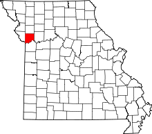 | |
| Villages | ||
| Townships |
| |
| Unincorporated communities | ||
| Footnotes | ‡This populated place also has portions in an adjacent county or counties | |
Municipalities and communities of Clinton County, Missouri, United States | ||
|---|---|---|
| Cities | 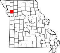 | |
| Village | ||
| Townships | ||
| Unincorporated communities | ||
| Footnotes | ‡This populated place also has portions in an adjacent county or counties | |