Orpington Urban District
| Orpington | |
|---|---|
| Area | |
| • 1951/1961 | 20,842 acres |
| Population | |
| • 1939 | 49,500 |
| • 1951 | 63,364 |
| • 1961 | 80,293 |
| History | |
| • Origin | Kent Review Order 1934 |
| • Created | 1934 |
| • Abolished | 1965 |
| • Succeeded by | London Borough of Bromley |
| Status |
Urban district Civil parish |
| Government | Orpington Urban District Council |
Orpington was a local government district in north west Kent from 1934 to 1965 around the town of Orpington, England. It was a suburb of London, but formed part of the Metropolitan Police District. Most of the former area of the urban district is now part of the London Borough of Bromley in Greater London.
History
It was created as an urban district in 1934 from parts of the abolished districts of Bromley Rural District and Chislehurst Urban District, taking in the entirety of Chelsfield, Cudham, and Knockholt parishes, and most of Farnborough, part of Keston, most of Orpington, most of St Mary Cray, part of St Paul's Cray and part of West Wickham.
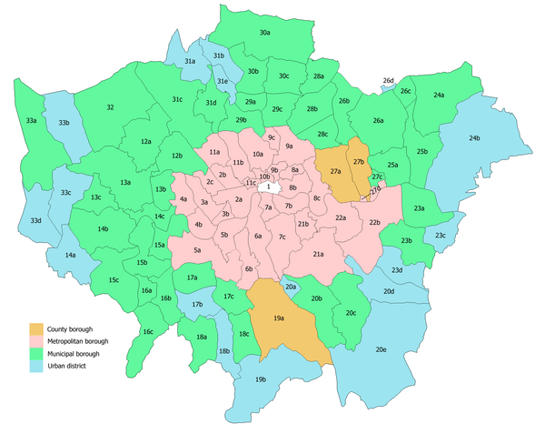
The urban district was within the Metropolitan Police District and part of the review area of the Royal Commission on Local Government in Greater London.[1] In 1965 it was abolished by the London Government Act 1963 and its former area transferred to Greater London Council from Kent County Council. Its former area was combined with that of other districts to form the London Borough of Bromley.
References
External links
Local government districts abolished or transferred by the London Government Act 1963 | ||
|---|---|---|
| London | ||
| Essex | ||
| Hertfordshire | ||
| Middlesex, CC | ||
| Kent | ||
| Surrey | ||
| Transfers | Middlesex to Hertfordshire: Potters Bar
| |
Coordinates: 51°24′N 0°7′E / 51.400°N 0.117°E