Orfordville, Wisconsin
| Orfordville, Wisconsin | |
|---|---|
| Village | |
|
Orfordville village hall | |
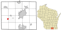 Location in Rock County and the state of Wisconsin. | |
| Coordinates: 42°37′45″N 89°15′24″W / 42.62917°N 89.25667°WCoordinates: 42°37′45″N 89°15′24″W / 42.62917°N 89.25667°W | |
| Country | United States |
| State | Wisconsin |
| County | Rock |
| Area[1] | |
| • Total | 1.17 sq mi (3.03 km2) |
| • Land | 1.17 sq mi (3.03 km2) |
| • Water | 0 sq mi (0 km2) |
| Elevation[2] | 889 ft (271 m) |
| Population (2010)[3] | |
| • Total | 1,442 |
| • Estimate (2012[4]) | 1,461 |
| • Density | 1,232.5/sq mi (475.9/km2) |
| Time zone | Central (CST) (UTC-6) |
| • Summer (DST) | CDT (UTC-5) |
| FIPS code | 55-60250[5] |
| GNIS feature ID | 1570857[2] |
| Website | http://www.orfordville.org |

Orfordville is a village in Rock County, Wisconsin, United States, at the intersection of Highway 11, Highway 213, and the Wisconsin and Southern Railroad. The population was 1,272 at the 2000 census, and was 1,442 at the 2010 census.
History
The origin of its name came when a surveyor suggested Orford after a town in New Hampshire. It remained that until the establishment of a post office, when it was confused with Oxford, Wisconsin. The name was then changed to Orfordville at the suggestion of the postmaster general.[6]
Geography
Orfordville is located at 42°37′45″N 89°15′24″W / 42.62917°N 89.25667°W (42.629300, −89.256755).[7] The elevation is 889 feet (271 m).
According to the United States Census Bureau, the village has a total area of 1.17 square miles (3.03 km2), all of it land.[1]
Demographics
| Historical population | |||
|---|---|---|---|
| Census | Pop. | %± | |
| 1880 | 153 | — | |
| 1910 | 449 | — | |
| 1920 | 496 | 10.5% | |
| 1930 | 502 | 1.2% | |
| 1940 | 510 | 1.6% | |
| 1950 | 543 | 6.5% | |
| 1960 | 665 | 22.5% | |
| 1970 | 888 | 33.5% | |
| 1980 | 1,143 | 28.7% | |
| 1990 | 1,219 | 6.6% | |
| 2000 | 1,272 | 4.3% | |
| 2010 | 1,442 | 13.4% | |
| Est. 2015 | 1,495 | [8] | 3.7% |
2010 census
As of the census[3] of 2010, there were 1,442 people, 542 households, and 394 families residing in the village. The population density was 1,232.5 inhabitants per square mile (475.9/km2). There were 575 housing units at an average density of 491.5 per square mile (189.8/km2). The racial makeup of the village was 96.1% White, 0.6% African American, 0.1% Native American, 0.3% Asian, 1.9% from other races, and 1.0% from two or more races. Hispanic or Latino of any race were 4.4% of the population.
There were 542 households of which 41.0% had children under the age of 18 living with them, 55.2% were married couples living together, 10.5% had a female householder with no husband present, 7.0% had a male householder with no wife present, and 27.3% were non-families. 23.1% of all households were made up of individuals and 10.3% had someone living alone who was 65 years of age or older. The average household size was 2.66 and the average family size was 3.11.
The median age in the village was 37.1 years. 29.3% of residents were under the age of 18; 6.7% were between the ages of 18 and 24; 27.5% were from 25 to 44; 25.3% were from 45 to 64; and 11.2% were 65 years of age or older. The gender makeup of the village was 47.3% male and 52.7% female.
2000 census
As of the census[5] of 2000, there were 1,272 people, 455 households, and 348 families residing in the village. The population density was 1,093.5 people per square mile (423.4/km²). There were 469 housing units at an average density of 403.2 per square mile (156.1/km²). The racial makeup of the village was 97.41% White, 0.55% African American, 0.08% Native American, 0.94% from other races, and 1.02% from two or more races. Hispanic or Latino of any race were 2.28% of the population.
There were 455 households out of which 41.5% had children under the age of 18 living with them, 59.6% were married couples living together, 11.9% had a female householder with no husband present, and 23.5% were non-families. 17.8% of all households were made up of individuals and 6.8% had someone living alone who was 65 years of age or older. The average household size was 2.78 and the average family size was 3.14.
In the village the population was spread out with 31.0% under the age of 18, 7.8% from 18 to 24, 30.4% from 25 to 44, 20.2% from 45 to 64, and 10.6% who were 65 years of age or older. The median age was 33 years. For every 100 females there were 94.5 males. For every 100 females age 18 and over, there were 93.0 males.
The median income for a household in the village was $46,875, and the median income for a family was $50,192. Males had a median income of $38,125 versus $25,050 for females. The per capita income for the village was $18,169. About 6.0% of families and 5.9% of the population were below the poverty line, including 7.2% of those under age 18 and 7.0% of those age 65 or over.
Education
Orfordville is the home of the Parkview School District's high school, Parkview High School. The school is sometimes referred to as Orfordville-Parkview. The village is also home to one of Parkview's two grade schools, Parkview Elementary School. After the 2014 School Referendum passed, a new high school will be built and the high school will be remodeled to become Parkview Elementary. When the construction ends in 2015, all schools in the Parkview district will be located in Orfordville.[10]
Notable people
- Realf Ottesen Brandt, noted Lutheran minister
- Frederick Curtice Davis, Navy Cross recipient, the USS Frederick C. Davis (DE-136) was named after him.
- Olin J. Eggen, astronomer
- Ole P. Gaarder, Wisconsin State Assemblyman
- Gilbert N. Haugen, U.S. Representative from Iowa
- Ole J. Kvale, U.S. Representative from Minnesota
- Paul John Kvale, U.S. Representative from Minnesota
References
- 1 2 "US Gazetteer files 2010". United States Census Bureau. Archived from the original on January 24, 2012. Retrieved 2012-11-18.
- 1 2 "US Board on Geographic Names". United States Geological Survey. 2007-10-25. Retrieved 2008-01-31.
- 1 2 "American FactFinder". United States Census Bureau. Retrieved 2012-11-18.
- ↑ "Population Estimates". United States Census Bureau. Archived from the original on June 17, 2013. Retrieved 2013-06-24.
- 1 2 "American FactFinder". United States Census Bureau. Retrieved 2008-01-31.
- ↑ Orfordville, Wisconsin-Territory Layout.
- ↑ "US Gazetteer files: 2010, 2000, and 1990". United States Census Bureau. 2011-02-12. Retrieved 2011-04-23.
- ↑ "Annual Estimates of the Resident Population for Incorporated Places: April 1, 2010 to July 1, 2015". Retrieved July 2, 2016.
- ↑ "Census of Population and Housing". Census.gov. Archived from the original on May 11, 2015. Retrieved June 4, 2015.
- ↑ http://www.parkview.k12.wi.us/Referendum2014.cfm
External links
- Village of Orfordville
- Orfordville Public Library
- Parkview School District
- Sanborn fire insurance maps: 1894 1904 1919
Municipalities and communities of Rock County, Wisconsin, United States | ||
|---|---|---|
| Cities |  | |
| Villages | ||
| Towns | ||
| CDP | ||
| Unincorporated communities |
| |
| Ghost towns | ||
| Footnotes | ‡This populated place also has portions in an adjacent county or counties | |