Ontario Municipal Airport
| Ontario Municipal Airport | |||||||||||
|---|---|---|---|---|---|---|---|---|---|---|---|
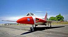 A Douglas F5D Skylancer at the airport | |||||||||||
| IATA: ONO – ICAO: KONO – FAA LID: ONO | |||||||||||
| Summary | |||||||||||
| Airport type | Public | ||||||||||
| Owner | City of Ontario | ||||||||||
| Serves | Ontario, Oregon | ||||||||||
| Elevation AMSL | 2,193 ft / 668 m | ||||||||||
| Coordinates | 44°01′10″N 117°00′47″W / 44.01944°N 117.01306°WCoordinates: 44°01′10″N 117°00′47″W / 44.01944°N 117.01306°W | ||||||||||
| Map | |||||||||||
 ONO Location of airport in Oregon | |||||||||||
| Runways | |||||||||||
| |||||||||||
| Statistics (2010) | |||||||||||
| |||||||||||
Ontario Municipal Airport (IATA: ONO, ICAO: KONO, FAA LID: ONO) is a city owned, public use airport located three nautical miles (6 km) west of the central business district of Ontario, a city in Malheur County, Oregon, United States.[1] It is included in the National Plan of Integrated Airport Systems for 2011–2015, which categorized it as a general aviation facility.[2]
Facilities and aircraft
Ontario Municipal Airport covers an area of 480 acres (194 ha) at an elevation of 2,193 feet (668 m) above mean sea level. It has one runway designated 14/32 with an asphalt surface measuring 5,011 by 100 feet (1,527 x 30 m).[1]
For the 12-month period ending July 13, 2010, the airport had 12,930 general aviation aircraft operations, an average of 35 per day. At that time there were 69 aircraft based at this airport: 90% single-engine, 3% multi-engine, 4% jet, and 3% helicopter.[1]
References
- 1 2 3 4 FAA Airport Master Record for ONO (Form 5010 PDF). Federal Aviation Administration. Effective May 31, 2012.
- ↑ "2011–2015 NPIAS Report, Appendix A" (PDF, 2.03 MB). National Plan of Integrated Airport Systems. Federal Aviation Administration. October 4, 2010. External link in
|work=(help)
External links
- Airport page at City of Ontario website
- Aerial image as of May 1994 from USGS The National Map
- FAA Terminal Procedures for ONO, effective December 8, 2016
- Resources for this airport:
- FAA airport information for ONO
- AirNav airport information for KONO
- ASN accident history for ONO
- FlightAware airport information and live flight tracker
- NOAA/NWS latest weather observations
- SkyVector aeronautical chart, Terminal Procedures