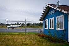
Florence Municipal Airport
| Florence Municipal Airport | |||||||||||
|---|---|---|---|---|---|---|---|---|---|---|---|
 | |||||||||||
| IATA: FMU – ICAO: none – FAA LID: 6S2 | |||||||||||
| Summary | |||||||||||
| Airport type | Public | ||||||||||
| Owner | City Of Florence | ||||||||||
| Operator | City of Florence | ||||||||||
| Serves | Florence, Oregon | ||||||||||
| Location | Florence, Oregon | ||||||||||
| Elevation AMSL | 51 ft / 15.5 m | ||||||||||
| Coordinates | 43°58′58.1400″N 124°06′40.93″W / 43.982816667°N 124.1113694°WCoordinates: 43°58′58.1400″N 124°06′40.93″W / 43.982816667°N 124.1113694°W | ||||||||||
| Website | http://www.ci.florence.or.us/airport | ||||||||||
| Runways | |||||||||||
| |||||||||||
Florence Municipal Airport (IATA: FMU, FAA LID: 6S2), is a public airport located in the city of Florence in Lane County, Oregon, USA. It is mostly used for general aviation.
Facilities and Aircraft
Florence Municipal Airport contains one asphalt paved runway, 15/33 which measures 3000 x 60 ft (914.4 x 18.3 m).[1] There is no air traffic control tower located on the airfield.
There are 13 aircraft based on the field. 11 single-engines and 2 multi-engine aircraft.[2]
The airport has an average of 134 flights a week. This includes 70% general aviation, 21% military and 9% air taxi.[3]
Cargo Carriers
| Airlines | Destinations |
|---|---|
| Ameriflight | Newport, Portland, Salem |
References
- ↑ "Florence Municipal Airport (6S2) Information". Airport-Data.com.
- ↑ "Florence Muni Airport Overview (Florence, OR) [6S2]". FlightAware.com.
External links
- Resources for this airport:
- FAA airport information for 6S2
- AirNav airport information for 6S2
- FlightAware airport information and live flight tracker
- SkyVector aeronautical chart for 6S2
This article is issued from Wikipedia - version of the 11/4/2015. The text is available under the Creative Commons Attribution/Share Alike but additional terms may apply for the media files.