Nyakahita–Kazo–Kamwenge–Fort Portal Road
| Nyakahita–Kazo–Kamwenge–Fort Portal Road | |
|---|---|
| Route information | |
| Length: | 129 mi (208 km) |
| History: |
Designation in 2011 Completion expected in 2016 |
| Major junctions | |
| South end: | Nyakahita |
|
Kazo Ibanda Kamwenge | |
| North end: | Fort Portal |
The Nyakahita–Kazo–Kamwenge–Fort Portal Road is a road in the Western Region of Uganda, connecting the towns of Nyakahita and Kazo in Kiruhura District, Ibanda in Ibanda District, Kamwenge in Kamwenge District, and Fort Portal in Kabarole District.[1]
Location
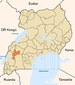
The road starts at Nyakahita, on the Masaka-Mbarara highway, about 60 kilometres (37 mi) east of Mbarara, the largest city in the Ankole sub-region.[2] The road continues through four western Ugandan districts to end at Fort Portal, a total of about 208 kilometres (129 mi).[3] The coordinates of the road near Kamwenge are 0°11'09.0"N, 30°27'14.0"E (Latitude:0.185833; Longitude:30.453889).[4]
Upgrading to bitumen
Before 2011, the entire road was poor grade gravel surface. In that year, the upgrading of the road to bitumen was divided into three sections: Nyakahita–Kazo 68 kilometres (42 mi), Kazo–Kamwenge 75 kilometres (47 mi), and Kamwenge–Fort Portal 66 kilometres (41 mi).[5]
The Nyakahita–Kazo section was contracted to the China Communications Construction Company for USh:134 billion. The consulting engineers on the project were J. Burrow. This section was completed in June 2013.[5] The Kazo–Kamwenge section was contracted to the China Railway Seventh Group for USh:167 billion. The Canadian engineering firm SNC Lavalin performed the consulting and supervision. Construction on these two sections began in May 2011. Funding was sourced from the African Development Bank and the Ugandan government.[6][7] Work on the Kazo–Kamwenge Road ended in June 2014.[5]
Work to upgrade the 66 kilometres (41 mi) Kamwenge–Fort Portal section was assigned to the China Railway Seventh Group. The USh:120 billion cost is funded jointly by the government of Uganda and the International Development Association. Work began in February 2015,[1] and is expected to end in July 2016.[5]
See also
References
- 1 2 Press Release (27 February 2015). "President Launches Construction of Kamwenge–Fort Portal Road". Uganda Media Centre. Retrieved 25 July 2015.
- ↑ GFC (25 July 2015). "Map Showing Mbarara And Nyakahita With Route Marker". Globefeed.com (GFC). Retrieved 25 July 2015.
- ↑ URSSI (2012). "Ongoing Major Projects". Uganda Road Support Sector Initiative (URSSI). Retrieved 25 July 2015.
- ↑ Google (25 July 2015). "Location of Nyakahita–Kazo–Kamwenge–Fort Portal Road At Google Maps" (Map). Google Maps. Google. Retrieved 25 July 2015.
- 1 2 3 4 EAAB (January 2015). "Implementation of The NRM Manifesto 2011-2016". East Africa Agribusiness (EAAB). Retrieved 25 July 2015.
- ↑ UNRA (May 2011). "Nyakahita-Kazo-Kamwenge Road Works Launched". Uganda National Roads Authority (UNRA). Retrieved 25 July 2015.
- ↑ Dibele, Denis (18 May 2011). "Nyakahita-Kamwenge Road Construction Starts". New Vision. Kampala. Retrieved 25 July 2015.
External links
- Uganda National Road Authority Homepage
- Regional Imbalance: The Story of Road Construction In Uganda
Capital: Kabarole | ||
| Counties and sub-counties |
|  |
| Towns and villages |
| |
| Geography | ||
| Economy | ||
| Notable landmarks | ||
| Health | ||
| Education | ||
| Transport | ||
| Notable people | ||
Capital: Kamwenge | ||
| Counties and sub-counties |
|  |
| Towns and villages | ||
| Economy | ||
| Energy | ||
| Transport | ||
| Notable landmarks |
| |
| Notable people | ||
Capital: Ibanda | ||
| Towns and villages | ||
| Economy | ||
| Health |
| |
| Transport | ||
| Notable landmarks | ||
| Notable people | ||
Capital: Kiruhura | |
| Counties and sub-counties |
|
| Towns and villages | |
| Economy | |
| Transport | |
| Health | |
| Notable landmarks | |
| Notable people |
|
Coordinates: 00°22′27″S 31°16′17″E / 0.37417°S 31.27139°E