Kamwenge
| Kamwenge | |
|---|---|
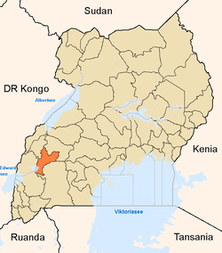
 Kamwenge Location in Uganda | |
| Coordinates: 00°11′10″N 30°27′14″E / 0.18611°N 30.45389°E | |
| Country |
|
| Region | Western Uganda |
| Sub-region | Toro sub-region |
| District | Kamwenge District |
| Elevation | 4,200 ft (1,280 m) |
| Population (2014 Census) | |
| • Total | 19,240[1] |
Kamwenge is a town in the Western Region of Uganda. It is the site of the Kamwenge District headquarters.
Location
Kamwenge is approximately 300 kilometres (190 mi), by road, west of Kampala, Uganda's capital and largest city.[2] This is approximately 70 kilometres (43 mi), by road, southeast of Fort Portal, the largest town in the Toro sub-region.[3] The coordinates of the town are 0°11'10.0"N, 30°27'14.0"E (Latitude:0.186111; Longitude:30.453889).[4]
Population
The 2002 population of Kamwenge was recorded at about 13,320 by the national population census. In 2010, the Uganda Bureau of Statistics (UBOS) estimated the population at 16,100. In 2011, UBOS estimated the population at 16,300.[5] During the 2014 national population census, the population was put at 19,240.[1]
Points of interest
The following additional points of interest lie within the town or near its borders:
- headquarters of Kamwenge District Administration
- offices of Kamwenge Town Council
- Kamwenge central market
- Kamwenge Campus of Uganda Pentecostal University
- Mpanga Power Station, located at Mpanga, approximately 18 kilometres (11 mi), by road, southwest of town
- Nyakahita–Kazo–Kamwenge–Fort Portal Road - the 208 kilometres (129 mi) road passes through the town.[6]
See also
References
- 1 2 UBOS, . (27 August 2014). "The Population of The Regions of the Republic of Uganda And All Cities And Towns of More Than 15,000 Inhabitants". Citypopulation.de Quoting Uganda Bureau of Statistics (UBOS). Retrieved 25 February 2015.
- ↑ "Distance Between Kampala And Kamwenge With Map". Globefeed.com. Retrieved 6 June 2014.
- ↑ "Map Showing Fort Portal And Kamwenge With Distance Marker". Globefeed.com. Retrieved 6 June 2014.
- ↑ Google (12 July 2015). "Location of Kamwenge At Google Maps" (Map). Google Maps. Google. Retrieved 12 July 2015.
- ↑ UBOS, . "Estimated Population of Kamwenge In 2002, 2010, 2011" (PDF). Uganda Bureau of Statistics (UBOS). Retrieved 6 June 2014.
- ↑ Press Release (27 February 2015). "President Launches Construction of Kamwenge–Fort Portal Road". Uganda Media Centre. Retrieved 18 December 2015.
External links
Capital: Kamwenge | ||
| Counties and sub-counties |
|  |
| Towns and villages | ||
| Economy | ||
| Energy | ||
| Transport | ||
| Notable landmarks |
| |
| Notable people | ||
Coordinates: 00°11′10″N 30°27′14″E / 0.18611°N 30.45389°E