Nuevo Mundo volcano
| Jatun Mundo Quri Warani | |
|---|---|
 Jatun Mundo Quri Warani Location in Bolivia | |
| Highest point | |
| Elevation | 5,438 m (17,841 ft) [1] |
| Prominence | 738 m (2,421 ft) |
| Coordinates | 19°46′27″S 66°28′42″W / 19.77417°S 66.47833°WCoordinates: 19°46′27″S 66°28′42″W / 19.77417°S 66.47833°W |
| Geography | |
| Location | Bolivia |
| Parent range | Cordillera Oriental |
| Geology | |
| Age of rock | Holocene |
| Mountain type | Stratovolcano |
| Last eruption | c. 1400 |
Jatun Mundo Quri Warani (hispanicized spellings Jatun Mundo Khori Huarani, Jatun Mundo Khorihuarani),[1][2] also known as Nuevo Mundo, is a stratovolcano, lava dome and a lava flow complex between Potosí and Uyuni, Bolivia, in the Andes rising to a peak at 5,438 m (17,841 ft). It is located in the Potosí Department, Antonio Quijarro Province, Tomave Municipality.[3] It lies northeast of the peaks of Uyuni, Kuntur Chukuña and Chuqi Warani and south of Sirk'i.
Name
The term Jatun Mundo Quri Warani contains Quechua and/or Aymara words (jatun "big", quri "gold", warani "the one with a scepter" or "constellation").[4][5] Mundo (Spanish for "world") is possibly a hispanicized or a broken word of native origin. As it is an unusually long name it may erroneously be composed of two alternate names, either Jatun Mundo or Quri Warani, as it occurred with Pacha Qullu (or Kimsa Misa) which is also sometimes regarded as Pacha Kkollu Quimsa Misa.
To denominate this mountain the Bolivian government only uses the native term[1][2][3] and not 'Nuevo Mundo'.
Nuevo Mundo according to the maps of the Bolivian Instituto Geográfico Militar (IGM) is another peak at 21°56′11″S 66°55′09″W / 21.93639°S 66.91917°W southwest of the Lípez volcano (5,933 m (19,465 ft)) which reaches a height of approximately 5,500 m (18,000 ft).[6][7]
History
The first mountaineering in the area was before 1903, by a Frenchman, Georges Courty, whose notes led to the mysterious entry in the 1987 book Mountaineering in the Andes by Jill Neate, "Nuevo Mundo, 6020 m, location uncertain."[8]
The German geologist Frederic Ahlfeld, an avid mountaineer, moved to Bolivia in 1924. He began exploring the mountains in Potosí Department after World War II, climbing a number of the peaks. In a letter to the historian and mountaineer Evelio Echevarría in 1962, Ahlfeld stated that because of the supposed height of Nuevo Mundo one of the two Lípez peaks might be a possible candidate for Monsieur Courty’s mysterious mountain.[9] In 1969, in Ahlfeld's book Geografia Fisica de Bolivia,[10] Ahlfeld presented a drawing[11] of a Nuevo Mundo (5438 m.) with its description,[12] and at a location southwest of Potosí and just north of the small village of Potoco, far away from Cerro Lípez - as was supposed.
At the end of the 1990s, Toto Aramayo, Yossi Brain and Dakin Cook undertook the search for Ahlfeld's Nuevo Mundo, and they thought they had found it at Latitude:19°47'0"S, Longitude: 66°29'0"W.[9]
There have been doubts that Ahlfeld's Nuevo Mundo lies in the Lípez area because it did not seem to be congruent to his descriptions according to which the mountain that he had visited was southwest of Potosí and immediately north of a village named Potoco.[13] However, the current maps of the IGM seem to confirm it. Even the toponym putuku (the name for a type of conical house) occurs in the corresponding maps of the Lípez area: The mountain southwest of Nuevo Mundo is named Putuku K'uchu (Potoco Khuchu), and the river from this mountain along the southern slopes of Nuevo Mundo is named Pocota Abra in the map (abra means "pass" in Spanish), possibly a broken word. Further to the south there is a region named Putukuyuq (Quechua, meaning "the one with a putuku (or putuku houses)", also spelled Potokheyoj).[6][14]
Some maps[15] as of 2013 labeled the Lípez volcano as Nuevo Mundo.
Geology
Jatun Mundo Quri Warani is a complex eruption center on the edge of the Los Frailes Plateau with a stratovolcano which is capped by cinder cones (mostly of ash and pumice).[16] At the base level there are two lava flows (of a viscous dacite) that erupted along a north-south fault. Apparently at the same time there were block-and-ash flows to the east.[17] Later a highly explosive Plinian eruption produced an ash fall that extended over 200 km to the east, as far as Potosí. This eruption was quite recent, but it predated the arrival of the Spanish in 1533. While earlier eruption centers, such as the Khari Khari caldera, Wila Qullu, Kuntur Nasa, Villacolo, Cerro Wanapa Pampa created the Los Frailes Plateau, Jatun Mundo Quri Warani overlaid those Los Frailes plateau deposits in the Holocene with huge ignimbrite deposits, which are mostly pyroclastic dacite and andesite.[18][19]
See also
Notes
- 1 2 3 Bolivian IGM map 1:50,000 Estación Yura 6334-IV
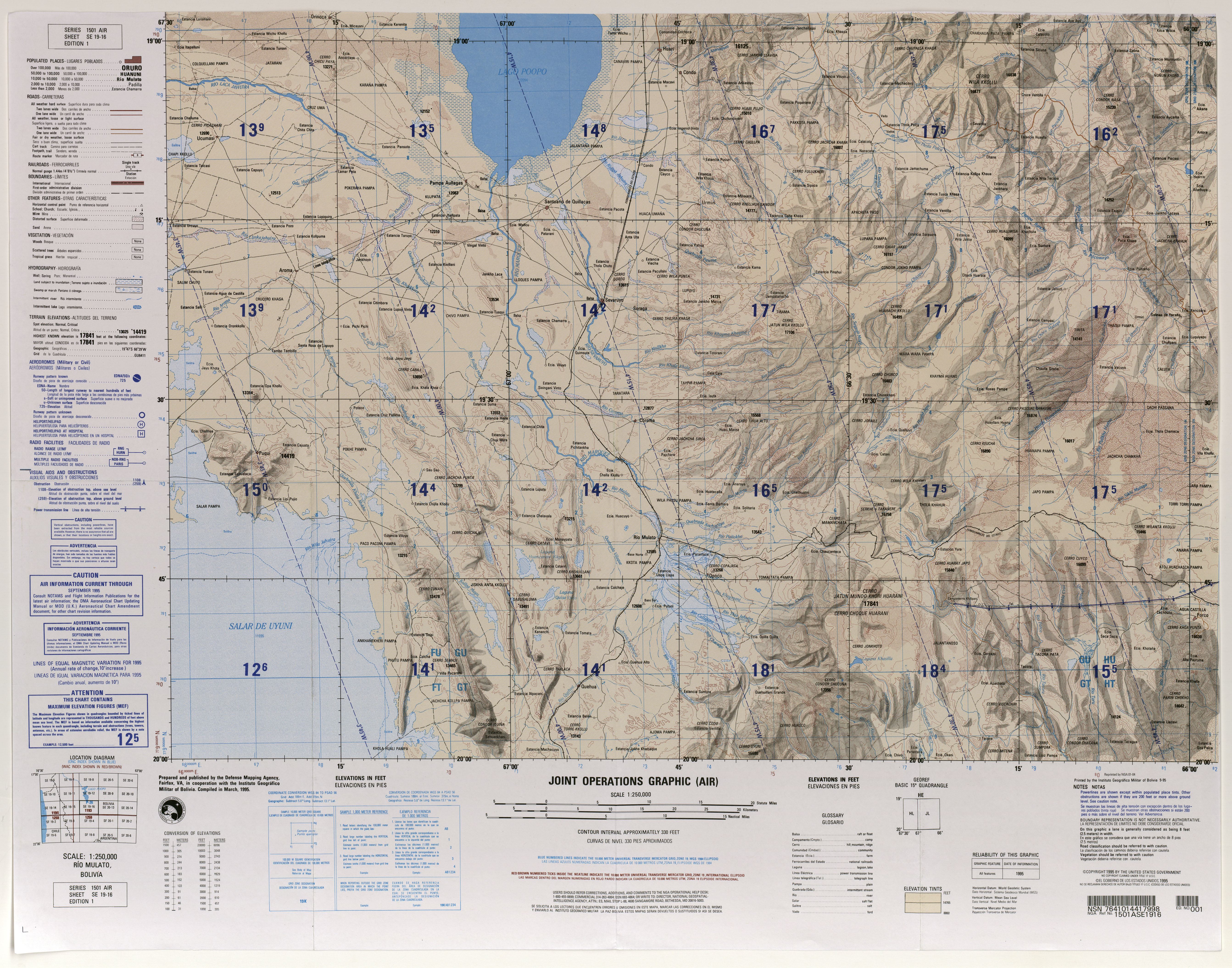
- 1 2 Río Mulato, Bolivia, Sheet SE 19-16 (topographic map, scale 1:250,000), Series 1501 Air, United States Defense Mapping Agency, March 1995
- 1 2 "Tomave". Retrieved January 27, 2016.
- ↑ Teofilo Laime Ajacopa, Diccionario Bilingüe Iskay simipi yuyayk'ancha, La Paz, 2007 (Quechua-Spanish dictionary)
- ↑ Radio San Gabriel, "Instituto Radiofonico de Promoción Aymara" (IRPA) 1993, Republicado por Instituto de las Lenguas y Literaturas Andinas-Amazónicas (ILLLA-A) 2011, Transcripción del Vocabulario de la Lengua Aymara, P. Ludovico Bertonio 1612 (Spanish-Aymara-Aymara-Spanish dictionary)
- 1 2 Bolivia 1:50,000 San Antonio de Lípez 6228-III
- ↑ Bolivia 1:250,000 San Pablo de Lípez SF 19-08
- ↑ Neate, Jill (1987) Mountaineering in the Andes: a sourcebook for climbers Expedition Advisory Centre, London, England, ISBN 0-907649-33-5
- 1 2 Brain, Y. (1999) "Climbs and Expeditions: Bolivia" American Alpine Journal p.323
- ↑ Ahlfeld, Federico E. (1969) Geografía de Bolivia: geografía física Editorial Los Amigos del Libro, La Paz, OCLC 2903813
- ↑ Ahlfeld Geografia Fisica de Bolivia p.158
- ↑ Ahlfeld Geografia Fisica de Bolivia p. 156-157
- ↑ Ahlfeld Geografia Fisica de Bolivia p. 156-158
- ↑ 1:50,000 Cerro Tucunqui 6227-IV
- ↑ MSN Encarta Map accessed 11 March 2006 and 11 March 2007 and 12 May 2013
- ↑ "Nuevo Mundo" from the University of North Dakota Volcanology WebSite
- ↑ "Nuevo Mundo". Global Volcanism Program. Smithsonian Institution.
- ↑ Los Frailes Plateau Info from the University of North Dakota Volcanology WebSite
- ↑ Frailes Plateau, Volcano World