Norway, Michigan
| Norway, Michigan | |
|---|---|
| City | |
|
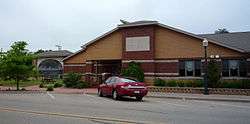
City Hall | |
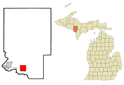 Location of Norway, Michigan | |
| Coordinates: 45°47′21″N 87°54′16″W / 45.78917°N 87.90444°W | |
| Country | United States |
| State | Michigan |
| County | Dickinson |
| Area[1] | |
| • Total | 8.80 sq mi (22.79 km2) |
| • Land | 8.72 sq mi (22.58 km2) |
| • Water | 0.08 sq mi (0.21 km2) |
| Elevation | 951 ft (290 m) |
| Population (2010)[2] | |
| • Total | 2,845 |
| • Estimate (2012[3]) | 2,850 |
| • Density | 326.3/sq mi (126.0/km2) |
| Time zone | Central (CST) (UTC-6) |
| • Summer (DST) | CDT (UTC-5) |
| ZIP code | 49870 |
| Area code(s) | 906 |
| FIPS code | 26-59220[4] |
| GNIS feature ID | 0633751[5] |
Norway is a city in Dickinson County in the U.S. state of Michigan. The population was 2,845 at the 2010 census. It is part of the Iron Mountain, MI–WI Micropolitan Statistical Area.
The city is in the southwest of Norway Township, but is politically independent. It is on U.S. Highway 2 (US 2), which connects with M-95 about six miles (9.7 km) west in Iron Mountain and with US 41 about 21 miles (34 km) to the east. US 141 north merges with US 2 about four miles (6.4 km) west of the city. US 8 has its eastern terminus in the city and crosses the Menominee River to continue west in Wisconsin.
History
A post office called Norway was established in 1891.[6] The city was named from a forest of Norway pines near the original town site.[7]
Geography
According to the United States Census Bureau, the city has a total area of 8.80 square miles (22.79 km2), of which, 8.72 square miles (22.58 km2) is land and 0.08 square miles (0.21 km2) is water.[1]
Transportation
Major Highways
 US 2
US 2 US 8
US 8- Indian Trails provides daily intercity bus service between St. Ignace and Ironwood, Michigan.[8]
Airport
Ford Airport (Iron Mountain) (KIMT) serves Norway, the county and surrounding communities with both scheduled commercial jet service and general aviation services.
Demographics
| Historical population | |||
|---|---|---|---|
| Census | Pop. | %± | |
| 1900 | 4,170 | — | |
| 1910 | 4,974 | 19.3% | |
| 1920 | 4,533 | −8.9% | |
| 1930 | 4,016 | −11.4% | |
| 1940 | 3,728 | −7.2% | |
| 1950 | 3,258 | −12.6% | |
| 1960 | 3,171 | −2.7% | |
| 1970 | 3,033 | −4.4% | |
| 1980 | 2,919 | −3.8% | |
| 1990 | 2,910 | −0.3% | |
| 2000 | 2,959 | 1.7% | |
| 2010 | 2,845 | −3.9% | |
| Est. 2015 | 2,798 | [9] | −1.7% |
2010 census
As of the census[2] of 2010, there were 2,845 people, 1,256 households, and 765 families residing in the city. The population density was 326.3 inhabitants per square mile (126.0/km2). There were 1,402 housing units at an average density of 160.8 per square mile (62.1/km2). The racial makeup of the city was 97.4% White, 0.8% Native American, 0.2% Asian, 0.2% from other races, and 1.4% from two or more races. Hispanic or Latino of any race were 1.4% of the population.
There were 1,256 households of which 29.3% had children under the age of 18 living with them, 44.3% were married couples living together, 11.9% had a female householder with no husband present, 4.7% had a male householder with no wife present, and 39.1% were non-families. 34.2% of all households were made up of individuals and 16.4% had someone living alone who was 65 years of age or older. The average household size was 2.25 and the average family size was 2.87.
The median age in the city was 41.9 years. 23.5% of residents were under the age of 18; 6.8% were between the ages of 18 and 24; 23.7% were from 25 to 44; 27.4% were from 45 to 64; and 18.5% were 65 years of age or older. The gender makeup of the city was 48.3% male and 51.7% female.
2000 census
As of the census[4] of 2000, there were 2,959 people, 1,288 households, and 812 families residing in the city. The population density was 335.6 per square mile (129.5/km²). There were 1,392 housing units at an average density of 157.9 per square mile (60.9/km²). The racial makeup of the city was 97.53% White, 0.95% Native American, 0.07% Asian, 0.14% Pacific Islander, 0.24% from other races, and 1.08% from two or more races. Hispanic or Latino of any race were 0.78% of the population. 18.7% were of Italian, 14.7% German, 10.0% French, 9.3% Polish, 7.5% Swedish, 7.1% English and 5.6% Irish ancestry according to Census 2000.
There were 1,288 households out of which 30.0% had children under the age of 18 living with them, 49.1% were married couples living together, 10.2% had a female householder with no husband present, and 36.9% were non-families. 33.0% of all households were made up of individuals and 17.9% had someone living alone who was 65 years of age or older. The average household size was 2.30 and the average family size was 2.91.
In the city the population was spread out with 25.3% under the age of 18, 6.5% from 18 to 24, 28.4% from 25 to 44, 20.6% from 45 to 64, and 19.2% who were 65 years of age or older. The median age was 39 years. For every 100 females there were 90.7 males. For every 100 females age 18 and over, there were 86.9 males.
The median income for a household in the city was $31,059, and the median income for a family was $37,533. Males had a median income of $31,595 versus $21,350 for females. The per capita income for the city was $17,681. About 7.5% of families and 10.8% of the population were below the poverty line, including 14.2% of those under age 18 and 10.1% of those age 65 or over.
Notable people
- Richard C. Flannigan, Michigan Supreme Court chief justice
- John Ralston, NFL and NCAA football coach
- Rudy Rosatti, NFL lineman (Packers and Giants)
- Art Van Damme, jazz musician
Points of interest
- Norway Speedway is a 1/3-mile paved ASA member track.
Images
 Downtown Norway
 Police station
 Post office
 Looking east on US 2
 Welcome sign on US 8
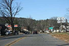 US 8 eastern terminus in Norway
References
- 1 2 "US Gazetteer files 2010". United States Census Bureau. Retrieved 2012-11-25.
- 1 2 "American FactFinder". United States Census Bureau. Retrieved 2012-11-25.
- ↑ "Population Estimates". United States Census Bureau. Retrieved 2013-06-03.
- 1 2 "American FactFinder". United States Census Bureau. Retrieved 2008-01-31.
- ↑ "US Board on Geographic Names". United States Geological Survey. 2007-10-25. Retrieved 2008-01-31.
- ↑ "Dickinson County". Jim Forte Postal History. Retrieved 1 March 2015.
- ↑ Chicago and North Western Railway Company (1908). A History of the Origin of the Place Names Connected with the Chicago & North Western and Chicago, St. Paul, Minneapolis & Omaha Railways. p. 108.
- ↑ "ST. IGNACE-SAULT STE. MARIE-IRONWOOD" (PDF). Indian Trails. January 15, 2013. Retrieved 2013-02-28.
- ↑ "Annual Estimates of the Resident Population for Incorporated Places: April 1, 2010 to July 1, 2015". Retrieved July 2, 2016.
- ↑ "Census of Population and Housing". Census.gov. Retrieved June 4, 2015.
External links
| Wikimedia Commons has media related to Norway, Michigan. |
- City of Norway
 Reynolds, Francis J., ed. (1921). "Norway, a city of Michigan". Collier's New Encyclopedia. New York: P.F. Collier & Son Company.
Municipalities and communities of Dickinson County, Michigan, United States | ||
|---|---|---|
| Cities | 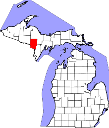 | |
| Charter township | ||
| Civil townships | ||
| CDP | ||
| Other unincorporated communities | ||
Coordinates: 45°47′13″N 87°54′13″W / 45.78694°N 87.90361°W