North Haverhill, New Hampshire
| North Haverhill, New Hampshire | |
|---|---|
| Census-designated place | |
|
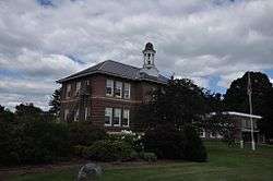
Haverhill Town Hall | |
 North Haverhill  North Haverhill | |
| Coordinates: 44°05′23″N 72°01′36″W / 44.08972°N 72.02667°WCoordinates: 44°05′23″N 72°01′36″W / 44.08972°N 72.02667°W | |
| Country | United States |
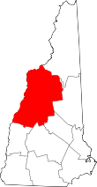
| State | New Hampshire |
| County | Grafton |
| Town | Haverhill |
| Area | |
| • Total | 3.4 sq mi (8.7 km2) |
| • Land | 3.1 sq mi (7.9 km2) |
| • Water | 0.3 sq mi (0.8 km2) |
| Elevation | 489 ft (149 m) |
| Time zone | Eastern (EST) (UTC-5) |
| • Summer (DST) | EDT (UTC-4) |
| ZIP code | 03774 |
| Area code(s) | 603 |
| FIPS code | 33-54740 |
| GNIS feature ID | 868786[1] |
North Haverhill is an unincorporated community and census-designated place (CDP) in the town of Haverhill in Grafton County, New Hampshire, United States. It is one of several villages in the town of Haverhill, which is the county seat of Grafton County.[2]
North Haverhill is centered on the junction of New Hampshire Routes 10 and 116, on a bluff overlooking the Connecticut River, the western boundary of New Hampshire. It is situated in the middle of a fertile agricultural area at the western base of the White Mountains. Route 10, following the Connecticut River, connects the village of Woodsville to the north with the towns of Piermont, Orford, Lyme, and Hanover to the south. Route 116 heads east into the White Mountains, leading to the towns of Benton, Easton, and Franconia.
North Haverhill became the county seat of Grafton County when the county courthouse and related offices moved in 1972 from Woodsville into a new office complex on Route 10 just north of the North Haverhill village center. North Haverhill has a separate ZIP code (03774) from other areas in the town of Haverhill.
Notable residents
- Mike Olsen, NASCAR driver
References
- ↑ "North Haverhill". Geographic Names Information System. United States Geological Survey.
- ↑ "Grafton County, New Hampshire; Office of the Commissioners". Grafton County, NH. Retrieved December 5, 2011.