North End Historic District (Westerly, Rhode Island)
|
North End Historic District | |
|
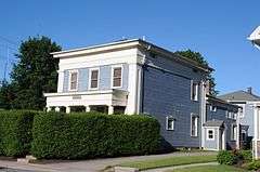
Nathan P. Dixon House | |
  | |
| Location | Westerly, Rhode Island |
|---|---|
| Coordinates | 41°23′16″N 71°49′38″W / 41.38778°N 71.82722°WCoordinates: 41°23′16″N 71°49′38″W / 41.38778°N 71.82722°W |
| Area | 150 acres (0.61 km2) |
| Architect | Multiple |
| MPS | Westerly MRA |
| NRHP Reference # | 06000298 [1] |
| Added to NRHP | April 20, 2006 |
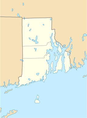
The North End Historic District is a predominantly residential historic district in northwestern Westerly, Rhode Island. The area traces the industrial development of Westerly, with proximity to both its central business district as well as water-based textile mills, and stone quarries further inland. Most of the district's architecture was built between 1832 and 1955. The district is bounded on the east by High Street; on the south by properties on Friendship, West, Pleasant Streets, Marriott Avenue and Industrial Drive; on the west by properties on Pleasant, Canal, Pierce and Pond Streets; and on the north by properties on Pond, Pierce, Pearl, and High Streets, and Turano Avenue.[2]
The district was added to the National Register of Historic Places on April 20, 2006.[1]
See also
References
- 1 2 National Park Service (2007-01-23). "National Register Information System". National Register of Historic Places. National Park Service.
- ↑ "NRHP nomination for North End Historic District" (PDF). Rhode Island Preservation. Retrieved 2014-08-13.
| Topics | |
|---|---|
| Lists by states |
|
| Lists by insular areas | |
| Lists by associated states | |
| Other areas | |
| |