Nikaho, Akita
| Nikaho にかほ市 | |||
|---|---|---|---|
| City | |||
|
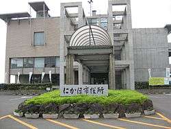
Nikaho City Hall | |||
| |||
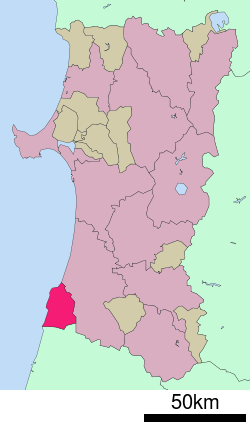 Location of Nikaho in Akita Prefecture | |||
 Nikaho
| |||
| Coordinates: 39°12′10.8″N 139°54′27.9″E / 39.203000°N 139.907750°ECoordinates: 39°12′10.8″N 139°54′27.9″E / 39.203000°N 139.907750°E | |||
| Country | Japan | ||
| Region | Tōhoku | ||
| Prefecture | Akita Prefecture | ||
| Area | |||
| • Total | 241.13 km2 (93.10 sq mi) | ||
| Population (May 2015) | |||
| • Total | 25,530 | ||
| • Density | 106/km2 (270/sq mi) | ||
| Time zone | Japan Standard Time (UTC+9) | ||
| - Tree | Sugi | ||
| - Flower | silk tree | ||
| - Bird | sea cormorant | ||
| -Fish | Gadidae | ||
| Phone number | 0184-43-3200 | ||
| Address | 1 Aza-Hamanota, Kisakatamachi, Nikaho-shi 018-0113 | ||
| Website | Official website | ||


Nikaho (にかほ市 Nikaho-shi) is a city located in Akita Prefecture, in the northern Tohoku region of Japan.
As of May 2015, the city had an estimated population of 25,530 and a population density of 106 persons per km². The total area was 241.13 square kilometres (93.10 sq mi).
Geography
Nikaho is located at the far southwest corner of Akita Prefecture, bordered by the Sea of Japan to the west, and by Yamagata Prefecture to the south. Part of the city is within the borders of the Chōkai Quasi-National Park.[1]
Neighboring municipalities
- Akita Prefecture
- Yamagata Prefecture
Climate
Nikaho has a Humid continental climate (Köppen climate classification Cfa) with large seasonal temperature differences, with warm to hot (and often humid) summers and cold (sometimes severely cold) winters. Precipitation significant throughout the year, but is heaviest from August to October.
History
The area of present-day Nikaho was part of ancient Ugo Province, dominated by the Satake clan during the Edo period, who ruled Kubota Domain under the Tokugawa shogunate. After the start of the Meiji period, it became part of Yuri District, Akita Prefecture in 1878.
The modern city of Nikaho was established on October 1, 2005, from the merger of the former towns of Nikaho, absorbing the towns of Kisakata and Konoura (all from Yuri District).
Economy
The economy of Nikaho is based on commercial fishing and agriculture. Industry includes a large factory by the electronics firm TDK.
Education
Nikaho has six elementary schools, three middle schools and one high school.
Transportation
Railway
Highway
Local attractions
- Kanman-ji Temple (蚶満寺 Kanman-ji)
- a thousand-year old temple in the south of Nikaho which was made famous by the haiku poet Matsuo Bashō's visit to the area in 1689. He wrote of the temple in his Oku no Hosomichi.
- Kujūkushima (旧跡九十九島 Kyūseki Kujūkushima)
- a collection of clumps of land which used to be small islands until a major earthquake in 1804 submerged the sea around them. They were often compared to the similar small islands on the Pacific coast of Matsushima.
- Kosagawa Beach (小砂川海水浴場)
- a long stretch of sandy beach in the south of Nikaho.
- Kisakata Hot Spring (象潟温泉)
- An onsen (hot spring) located in the Nemunooka Roadside Station. The hot spring offers views of the Japan Sea coast.
- Ferrite Children's Science Museum (フェライト子ども科学館)
- a children's museum in the north of Nikaho with many interactive exhibits which explores the different uses of ferrite.
- Shirase Antarctic Memorial Museum (白瀬南極探検隊記念館)
- a memorial museum which focuses on the Antarctic Expedition by local explorer Shirase Nobu and includes a replica of Shirase's ship.
- TDK Museum (TDK歴史館)
- a museum full of information and exhibits about the company TDK. TDK was founded by a local man Kenzō Saitō and there are many TDK factories and suppliers in the area.
Parks in Nikaho
- Seishi Park (勢至公園 Seishi Kōen)
- a park surrounding a lake and ringed with cherry trees. It is especially attractive in late April and early May when the cherry trees start to bloom.
- Kuriyamaike Park (栗山池公園)
- a park in the foothills of Mount Chokai with a small lake, cherry trees and hydrangeas.
- Misaki Park (三崎公園)
- a park which snakes along the coast on the border of Yamagata and Akita Prefectures.
- Nikaho Heights (仁賀保高原 Nikaho Kōgen)
- a plateau in the foothills of Mount Chokai with splendid views of the area.
Local events
- Fireworks
- A fireworks festival is held each year over three nights in each of the former towns of Nikaho City.
- Cod Festival (掛魚まつり Kakeyo Matsuri)
- This religious event takes place in February in which cod are carried from the Konoura fishing port to a local Shinto shrine.
- Akita Triathlon Bashō's Race in Kisakata (秋田トライアスロン芭蕉レ―ス象潟大会)
- one of the top triathlon events in the Japanese calendar.
- Mount Chōkai MTB Race (鳥海山グルッと一周MTBサイクリング)
- a mountain bike race around the base of Mount Chōkai.
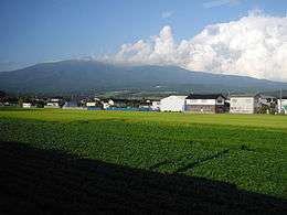
Mount Chōkai
Mount Chōkai is an inactive volcano which stands alone on the border between Akita Prefecture and Yamagata Prefecture. It is 2236 metres high and is the second highest mountain in the Tōhoku area. It is popular with skiers, hikers and climbers.
There are two main trails for climbing Mount Chōkai from the Akita side. One trailhead is in Yurihonjō, Akita, north of Nikaho. The other, in Nikaho, starts at the Nakajima parking area. A one-way hike from the Nakajima commonly takes 4 hours and offers outstanding views of the Japan Sea coast and the lush greenery of the Nikaho area.
The mountain has its own unique Alpine plants and vegetation such as Chōkai Thistle (チョウカイアザミ) or Chōkai Fusuma (チョウカイフスマ).
Local crafts, arts, and food
- Sake (Rice wine)
- There is one independent sake brewery in Nikaho: Hiraizumi (平泉)
- Hatahata Zushi (はたはたずし)
- Oysters & abalone
- Karintō
- a local brown sugar-coated candy.
- Chōjin Neiger (超人ネイガー)
- a superhero character which was born in Nikaho.
Sister city relations
 Shawnee, Oklahoma, USA [2]
- Anacortes, Washington, USA[2]
 Zhuji, Zhejiang, China [3] friendship city since October 23, 2008
Noted people from Nikaho
- Shirase Nobu (白瀬矗), Antarctic explorer who led an expedition to the South Pole in 1910.
- Kenzō Saitō (齋藤憲三), founder of TDK.
Notes
- ↑ "Natural Parks of Akita Prefecture" (PDF) (in Japanese). Akita Prefecture. Retrieved 29 February 2012.
- 1 2 "US-Japan Sister Cities by State". Asia Matters for America. Honolulu, HI: East-West Center. Retrieved 20 November 2015.
- ↑ "International Exchange". List of Affiliation Partners within Prefectures. Council of Local Authorities for International Relations (CLAIR). Retrieved 21 November 2015.
External links
| Wikivoyage has a travel guide for Nikaho. |
| Wikimedia Commons has media related to Nikaho, Akita. |
- Nikaho City official website (Japanese)
| Core city | ||
|---|---|---|
| Cities | ||
| Kazuno District | ||
| Kitaakita District | ||
| Minamiakita District | ||
| Ogachi District | ||
| Semboku District | ||
| Yamamoto District | ||