Newington, Thanet
| Newington | |
 Newington |
|
| Population | 5,044 (2011.Ward)[1] |
|---|---|
| OS grid reference | TR365665 |
| District | Thanet |
| Shire county | Kent |
| Region | South East |
| Country | England |
| Sovereign state | United Kingdom |
| Post town | Ramsgate |
| Postcode district | CT12 |
| Dialling code | 01843 |
| Police | Kent |
| Fire | Kent |
| Ambulance | South East Coast |
| EU Parliament | South East England |
| UK Parliament | South Thanet |
Coordinates: 51°20′46″N 1°23′30″E / 51.3460°N 1.3917°E
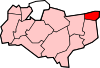
Newington is a suburb in the west of the town of Ramsgate, on the eastern tip of Kent, England.
Demography
| Newington compared | |||
|---|---|---|---|
| 2001 UK Census | Newington ward | Thanet borough | England |
| Population | 5,009 | 126,702 | 49,138,831 |
| Foreign born | 2.6% | 5.1% | 9.2% |
| White | 98.8% | 97.7% | 90.9% |
| Asian | 0.1% | 0.9% | 4.6% |
| Black | 0.2% | 0.3% | 2.3% |
| Christian | 67.8% | 73.6% | 71.7% |
| Muslim | 0.3% | 0.5% | 3.1% |
| Hindu | 0% | 0.2% | 1.1% |
| No religion | 21.7% | 15.9% | 14.6% |
| Unemployed | 6.5% | 4.4% | 3.3% |
| Retired | 13.2% | 17.5% | 13.5% |
At the 2001 UK census, the Newington electoral ward had a population of 5,009. The ethnicity was 98.8% white, 0.8% mixed race, 0.1% Asian, 0.2% black and 0.1% other. The place of birth of residents was 97.4% United Kingdom, 0.3% Republic of Ireland, 0.8% other Western European countries, and 1.5% elsewhere. Religion was recorded as 67.8% Christian, 0.1% Buddhist, 0% Hindu, 0.1% Sikh, 0.1% Jewish, and 0.3% Muslim. 21.7% were recorded as having no religion, 0.2% had an alternative religion and 9.8% did not state their religion.[2]
The economic activity of residents aged 16–74 was 32.4% in full-time employment, 13.2% in part-time employment, 4% self-employed, 6.5% unemployed, 2.5% students with jobs, 3.2% students without jobs, 13.2% retired, 12.3% looking after home or family, 8.9% permanently sick or disabled and 3.9% economically inactive for other reasons. The industry of employment of residents was 20.4% retail, 17.7% manufacturing, 10% construction, 8.7% real estate, 11.9% health and social work, 6.8% education, 8.8% transport and communications, 3.2% public administration, 5.2% hotels and restaurants, 1.1% finance, 1.5% agriculture and 4.7% other. Compared with national figures, the ward had a relatively high proportion of workers in retail, construction, transport and communications. There were a relatively low proportion in finance, public administration and real estate. Of the ward's residents aged 16–74, 4.8% had a higher education qualification or the equivalent, compared with 19.9% nationwide.[2]
References
- ↑ "Ramsgate Ward population 2011.accessdate=2 October 2015".
- 1 2 "Neighbourhood Statistics". Statistics.gov.uk. Retrieved 2008-02-26.
 | Unparished areas | |
|---|---|---|
| Civil parishes | ||
| Other settlements | ||