Newburg, Cumberland County, Pennsylvania
| Newburg, Cumberland County, Pennsylvania | |
|---|---|
| Borough | |
|
Borough office | |
 Newburg | |
| Coordinates: 40°08′15″N 77°33′21″W / 40.13750°N 77.55583°WCoordinates: 40°08′15″N 77°33′21″W / 40.13750°N 77.55583°W | |
| Country | United States |
| State | Pennsylvania |
| County | Cumberland |
| Government | |
| • Type | Borough Council |
| Area | |
| • Total | 0.19 sq mi (0.48 km2) |
| • Land | 0.19 sq mi (0.48 km2) |
| • Water | 0.0 sq mi (0.0 km2) |
| Elevation | 594 ft (181 m) |
| Population (2010) | |
| • Total | 336 |
| • Density | 1,820/sq mi (702.7/km2) |
| Time zone | Eastern (EST) (UTC-5) |
| • Summer (DST) | EDT (UTC-4) |
| ZIP code | 17240 |
| Area code(s) | 717 |
| Website |
www |

Newburg is a borough in Cumberland County, Pennsylvania, United States. The population was 336 at the 2010 census.[1] It is part of the Harrisburg–Carlisle Metropolitan Statistical Area.
Geography
Newburg is located in western Cumberland County at 40°8′15″N 77°33′21″W / 40.13750°N 77.55583°W (40.137528, -77.555696).[2] It is surrounded by Hopewell Township, a separate municipality. Pennsylvania Route 641 passes through the borough, leading east 9 miles (14 km) to Newville and west 6 miles (10 km) to Roxbury. Pennsylvania Route 696 crosses PA 641 on the west side of town and leads south 6 miles (10 km) to Shippensburg. To the northwest, via PA 696 and then Pennsylvania Route 997, it is 4 miles (6 km) to Exit 201 on the Pennsylvania Turnpike (Interstate 76).
According to the United States Census Bureau, the borough has a total area of 0.19 square miles (0.48 km2), all land.[1]
Demographics
| Historical population | |||
|---|---|---|---|
| Census | Pop. | %± | |
| 1870 | 392 | — | |
| 1880 | 433 | 10.5% | |
| 1890 | 376 | −13.2% | |
| 1900 | 340 | −9.6% | |
| 1910 | 264 | −22.4% | |
| 1920 | 180 | −31.8% | |
| 1930 | 222 | 23.3% | |
| 1940 | 278 | 25.2% | |
| 1950 | 289 | 4.0% | |
| 1960 | 283 | −2.1% | |
| 1970 | 320 | 13.1% | |
| 1980 | 303 | −5.3% | |
| 1990 | 312 | 3.0% | |
| 2000 | 372 | 19.2% | |
| 2010 | 336 | −9.7% | |
| Est. 2015 | 340 | [3] | 1.2% |
| Sources:[4][5][6] | |||
As of the census[5] of 2000, there were 372 people, 142 households, and 112 families residing in the borough. The population density was 1,458.1 people per square mile (552.4/km²). There were 148 housing units at an average density of 580.1/sq mi (219.8/km²). The racial makeup of the borough was 97.04% White, 2.69% Native American, and 0.27% from two or more races.
There were 142 households, out of which 40.8% had children under the age of 18 living with them, 70.4% were married couples living together, 7.7% had a female householder with no husband present, and 21.1% were non-families. 18.3% of all households were made up of individuals, and 7.7% had someone living alone who was 65 years of age or older. The average household size was 2.62 and the average family size was 3.00.
In the borough the population was spread out, with 27.2% under the age of 18, 5.6% from 18 to 24, 29.8% from 25 to 44, 22.8% from 45 to 64, and 14.5% who were 65 years of age or older. The median age was 37 years. For every 100 females there were 88.8 males. For every 100 females age 18 and over, there were 85.6 males.
The median income for a household in the borough was $38,000, and the median income for a family was $44,250. Males had a median income of $34,722 versus $23,333 for females. The per capita income for the borough was $19,950. About 4.9% of families and 5.6% of the population were below the poverty line, including 4.5% of those under age 18 and 12.9% of those age 65 or over.
References
- 1 2 "Geographic Identifiers: 2010 Census Summary File 1 (G001): Newburg borough (Cumberland County), Pennsylvania". U.S. Census Bureau, American Factfinder. Retrieved June 18, 2015.
- ↑ "US Gazetteer files: 2010, 2000, and 1990". United States Census Bureau. 2011-02-12. Retrieved 2011-04-23.
- ↑ "Annual Estimates of the Resident Population for Incorporated Places: April 1, 2010 to July 1, 2015". Retrieved July 2, 2016.
- ↑ "Census of Population and Housing". U.S. Census Bureau. Retrieved 11 December 2013.
- 1 2 "American FactFinder". United States Census Bureau. Retrieved 2008-01-31.
- ↑ "Incorporated Places and Minor Civil Divisions Datasets: Subcounty Resident Population Estimates: April 1, 2010 to July 1, 2012". Population Estimates. U.S. Census Bureau. Retrieved 11 December 2013.
External links
Municipalities and communities of Cumberland County, Pennsylvania, United States | ||
|---|---|---|
| Boroughs | 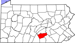 | |
| Townships | ||
| CDPs | ||
| Unincorporated communities | ||
| Footnotes | ‡This populated place also has portions in an adjacent county or counties | |