Wormleysburg, Pennsylvania
| Wormleysburg, Pennsylvania | ||
|---|---|---|
| Borough | ||
| ||
| Motto: A Better View | ||
 Wormleysburg | ||
| Coordinates: 40°15′31″N 76°54′21″W / 40.25861°N 76.90583°WCoordinates: 40°15′31″N 76°54′21″W / 40.25861°N 76.90583°W | ||
| Country | United States | |
| State | Pennsylvania | |
| County | Cumberland | |
| Settled | 1772 | |
| Incorporated | 1916 | |
| Government | ||
| • Type | Borough Council | |
| • Mayor | George O. Preble | |
| Area | ||
| • Total | 0.81 sq mi (2.09 km2) | |
| • Land | 0.80 sq mi (2.06 km2) | |
| • Water | 0.01 sq mi (0.03 km2) | |
| Elevation | 338 ft (103 m) | |
| Population (2010) | ||
| • Total | 3,070 | |
| • Density | 3,862/sq mi (1,491.1/km2) | |
| Time zone | Eastern (EST) (UTC-5) | |
| • Summer (DST) | EDT (UTC-4) | |
| ZIP codes | 17043, 17011 | |
| Area code(s) | 717 | |
| Website |
www | |

Wormleysburg is a borough in Cumberland County, Pennsylvania, United States. The population was 3,070 at the 2010 census.[1] It is part of the Harrisburg–Carlisle Metropolitan Statistical Area.
Wormleysburg is served by West Shore School District. The borough is home to Harsco Corporation.
History

The John Wormley House was added to the National Register of Historic Places in 1976.[2]
Geography
Wormleysburg is located on the eastern border of Cumberland County at 40°15′31″N 76°54′21″W / 40.25861°N 76.90583°W (40.258689, -76.905954).[3] It is situated on the west bank of the Susquehanna River across from Harrisburg, the state capital. It is bordered to the north and west by East Pennsboro Township and to the south by the borough of Lemoyne. U.S. Routes 11 and 15 pass through the borough together, leading north 4.5 miles (7.2 km) to Exit 65 on Interstate 81 and southwest 3 miles (5 km) through Camp Hill to the Capital Beltway (Pennsylvania Route 581). The M. Harvey Taylor Memorial Bridge crosses the Susquehanna from Wormleysburg into Harrisburg.
According to the United States Census Bureau, Wormleysburg has a total area of 0.81 square miles (2.1 km2), of which 0.01 square miles (0.03 km2), or 1.33%, is water.[1]
Demographics
| Historical population | |||
|---|---|---|---|
| Census | Pop. | %± | |
| 1880 | 297 | — | |
| 1890 | 555 | 86.9% | |
| 1910 | 809 | — | |
| 1920 | 866 | 7.0% | |
| 1930 | 1,404 | 62.1% | |
| 1940 | 1,454 | 3.6% | |
| 1950 | 1,511 | 3.9% | |
| 1960 | 1,794 | 18.7% | |
| 1970 | 3,192 | 77.9% | |
| 1980 | 2,796 | −12.4% | |
| 1990 | 2,847 | 1.8% | |
| 2000 | 2,607 | −8.4% | |
| 2010 | 3,070 | 17.8% | |
| Est. 2015 | 3,079 | [4] | 0.3% |
| Sources:[5][6][7] | |||
As of the census[6] of 2000, there were 2,607 people, 1,295 households, and 663 families residing in the borough. The population density was 2,794.1 people per square mile (1,082.3/km²). There were 1,399 housing units at an average density of 1,499.4 per square mile (580.8/km²). The racial makeup of the borough was 92.14% White, 1.30% African American, 0.15% Native American, 4.22% Asian, 0.04% Pacific Islander, 0.31% from other races, and 1.84% from two or more races. Hispanic or Latino of any race were 1.34% of the population.
There were 1,295 households, out of which 19.4% had children under the age of 18 living with them, 40.2% were married couples living together, 8.7% had a female householder with no husband present, and 48.8% were non-families. 39.9% of all households were made up of individuals, and 10.4% had someone living alone who was 65 years of age or older. The average household size was 2.01 and the average family size was 2.71.
In the borough the population was spread out, with 17.7% under the age of 18, 8.7% from 18 to 24, 32.6% from 25 to 44, 25.1% from 45 to 64, and 16.0% who were 65 years of age or older. The median age was 38 years. For every 100 females there were 96.5 males. For every 100 females age 18 and over, there were 95.1 males.
The median income for a household in the borough was $40,536, and the median income for a family was $49,342. Males had a median income of $36,250 versus $27,902 for females. The per capita income for the borough was $28,504. About 3.6% of families and 5.2% of the population were below the poverty line, including 8.2% of those under age 18 and 1.5% of those age 65 or over.
History
The community was named for founder John Wormley and was incorporated as a borough in May 1916 from East Pennsboro Township.
References
| Wikimedia Commons has media related to Wormleysburg, Pennsylvania. |
- 1 2 "Geographic Identifiers: 2010 Census Summary File 1 (G001): Wormleysburg borough, Pennsylvania". U.S. Census Bureau, American Factfinder. Retrieved June 18, 2015.
- ↑ National Park Service (2010-07-09). "National Register Information System". National Register of Historic Places. National Park Service.
- ↑ "US Gazetteer files: 2010, 2000, and 1990". United States Census Bureau. 2011-02-12. Retrieved 2011-04-23.
- ↑ "Annual Estimates of the Resident Population for Incorporated Places: April 1, 2010 to July 1, 2015". Retrieved July 2, 2016.
- ↑ "Census of Population and Housing". U.S. Census Bureau. Archived from the original on May 11, 2015. Retrieved 11 December 2013.
- 1 2 "American FactFinder". United States Census Bureau. Retrieved 2008-01-31.
- ↑ "Incorporated Places and Minor Civil Divisions Datasets: Subcounty Resident Population Estimates: April 1, 2010 to July 1, 2012". Population Estimates. U.S. Census Bureau. Archived from the original on June 17, 2013. Retrieved 11 December 2013.
External links
Municipalities and communities of Cumberland County, Pennsylvania, United States | ||
|---|---|---|
| Boroughs | 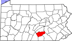 | |
| Townships | ||
| CDPs | ||
| Unincorporated communities | ||
| Footnotes | ‡This populated place also has portions in an adjacent county or counties | |