New Zealand State Highway 83
| ||||
|---|---|---|---|---|
 | ||||
| Route information | ||||
| Maintained by New Zealand Transport Agency | ||||
| Length: | 109.4 km (68.0 mi) | |||
| Major junctions | ||||
| From: |
Omarama Avenue | |||
| To: |
Hilderthorpe Pukeuri Road/Pukeuri Oamaru Road | |||
| Location | ||||
| Primary destinations: | Otematata, Kurow, Duntroon. | |||
| Highway system | ||||
| ||||

State Highway 83 is a South Island State Highway in New Zealand running up the Waitaki Valley between the settlements of Pukeuri and Omarama. It forms part of the southernmost of the east-west roads crossing the South Island (via Haast Pass).
Route
Since designation, this is the route SH 83 takes.
As Chain Hills Highway, it begins in Omarama and passes through most of the settlement in an easterly direction. Leaving Omarama, the road changes name to Omarama Otematata Road. The road then runs along the banks of the Ahuriri Arm of Lake Benmore and descends into the township of Otematata (turnoff for the Benmore Dam). After Otematata, the road then passes along the southern banks of Lakes Aviemore and Waitaki as well as their respective dams.
The road emerges on the upper Waitaki River floodplain and enters the township of Kurow. Beyond Kurow, the road is all but flat and runs along the southern flanks of the floodplains as well as through Duntroon and Georgetown before crossing a low saddle to descend into Pukeuri.
Images
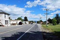 SH 83 through Duntroon
 SH 83 through Kurow (facing the coast)
 SH 83 through Kurow (facing the alps)
 SH 83 passing the Waitaki Dam
 SH 83 passing through Otematata
 SH 83 near its terminus in Omarama
See also
References
External links
| National | ||
|---|---|---|
| North Island |
| |
| South Island | ||
| Former state highways | ||
| Touring routes |
| |