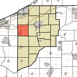
New Durham Township, LaPorte County, Indiana
| New Durham Township | |
|---|---|
| Township | |
 | |
| Coordinates: 41°33′59″N 86°52′21″W / 41.56639°N 86.87250°WCoordinates: 41°33′59″N 86°52′21″W / 41.56639°N 86.87250°W | |
| Country | United States |
| State | Indiana |
| County | LaPorte |
| Government | |
| • Type | Indiana township |
| Area | |
| • Total | 36.06 sq mi (93.4 km2) |
| • Land | 35.96 sq mi (93.1 km2) |
| • Water | 0.1 sq mi (0.3 km2) |
| Elevation[1] | 830 ft (253 m) |
| Population (2010) | |
| • Total | 8,664 |
| • Density | 240.9/sq mi (93.0/km2) |
| FIPS code | 18-52830[2] |
| GNIS feature ID | 453663 |
New Durham Township is one of twenty-one townships in LaPorte County, Indiana. As of the 2010 census, its population was 8,664 and it contained 2,396 housing units.[3]
History
An early settler being a native of Durham, New York, caused the name to be selected.[4]
The Pinhook Methodist Church and Cemetery was listed in the National Register of Historic Places in 2009.[5]
Geography
According to the 2010 census, the township has a total area of 36.06 square miles (93.4 km2), of which 35.96 square miles (93.1 km2) (or 99.72%) is land and 0.1 square miles (0.26 km2) (or 0.28%) is water.[3]
References
- ↑ "US Board on Geographic Names". United States Geological Survey. 2007-10-25. Retrieved 2008-01-31.
- ↑ "American FactFinder". United States Census Bureau. Retrieved 2008-01-31.
- 1 2 "Population, Housing Units, Area, and Density: 2010 - County -- County Subdivision and Place -- 2010 Census Summary File 1". United States Census. Retrieved 2013-05-10.
- ↑ History of La Porte County, Indiana: Together with Sketches of Its Cities, Villages, and Townships. C. C. Chapman & Co. 1880. p. 775.
- ↑ National Park Service (2010-07-09). "National Register Information System". National Register of Historic Places. National Park Service.
External links
Municipalities and communities of LaPorte County, Indiana, United States | ||
|---|---|---|
| Cities | ||
| Towns | ||
| Townships | ||
| CDPs | ||
| Other unincorporated communities |
| |
| Footnotes | ‡This populated place also has portions in an adjacent county or counties | |
This article is issued from Wikipedia - version of the 10/12/2016. The text is available under the Creative Commons Attribution/Share Alike but additional terms may apply for the media files.