National Register of Historic Places listings in Silver Bow County, Montana
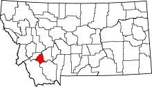
Location of Silver Bow County in Montana
This is a list of the National Register of Historic Places listings in Silver Bow County, Montana. It is intended to be a complete list of the properties and districts on the National Register of Historic Places in Silver Bow County, Montana, United States. The locations of National Register properties and districts for which the latitude and longitude coordinates are included below, may be seen in a map.[1]
There are 17 properties and districts listed on the National Register in the county, including 2 National Historic Landmarks.
- This National Park Service list is complete through NPS recent listings posted December 16, 2016.[2]
Listings county-wide
| [3] | Name on the Register | Image | Date listed[4] | Location | City or town | Description |
|---|---|---|---|---|---|---|
| 1 | Big Hole Pumpstation | 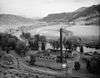 |
(#80002432) |
Montana Highway 43 45°45′50″N 112°47′14″W / 45.763889°N 112.787222°W |
Butte | |
| 2 | Butte, Anaconda and Pacific Railway Historic District | Upload image | (#88001111) |
Right-of-way begins in Butte and travels to Anaconda, generally along the course of Silver Bow Creek; also the confluence of German Gulch and Silver Bow Creeks at the eastern end of Silver Bow Canyon 46°02′37″N 112°44′25″W / 46.043611°N 112.740278°W |
Butte | Extends into Deer Lodge County. Location at the confluence represents a boundary increase, added on January 13, 1989 |
| 3 | Butte-Anaconda Historic District | 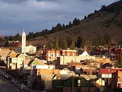 |
(#66000438) |
Most of the developed areas of Anaconda, Butte, and Walkerville 46°00′55″N 112°32′10″W / 46.015278°N 112.536111°W |
Butte and Walkerville | Extends into Deer Lodge County |
| 4 | Charles W. Clark Mansion | _-_Silver_Bow_County%2C_Montana.png) |
(#76001128) |
108 N. Washington St. 46°00′49″N 112°32′28″W / 46.013611°N 112.541111°W |
Butte | |
| 5 | W. A. Clark Mansion | _2002-05.jpg) |
(#70000366) |
219 W. Granite 46°00′52″N 112°32′21″W / 46.014444°N 112.539167°W |
Butte | |
| 6 | Hawthorne Grade School |  |
(#87002304) |
3500 White Way 45°58′28″N 112°29′16″W / 45.974444°N 112.487778°W |
Butte | |
| 7 | Longfellow Grade School | Upload image | (#87002305) |
1629 Roosevelt Ave. 45°58′47″N 112°30′54″W / 45.979722°N 112.515°W |
Butte | Demolished in 2007 |
| 8 | Madison Grade School | _-_Silver_Bow_County%2C_Montana.png) |
(#87002306) |
45 E. Greenwood 45°59′24″N 112°32′06″W / 45.99°N 112.535°W |
Butte | |
| 9 | Matt's Place Drive-In | _-_Silver_Bow_County%2C_Montana.png) |
(#01000308) |
2339 Placer St. 45°59′30″N 112°32′18″W / 45.991667°N 112.538333°W |
Butte | |
| 10 | Parrot Mine Shops Complex | _-_Silver_Bow_County%2C_Montana.png) |
(#06001228) |
244 Anaconda Rd. 46°01′01″N 112°31′41″W / 46.016944°N 112.528056°W |
Butte | |
| 11 | Ramsay Historic District | Upload image | (#87002227) |
6.5 miles west of Butte on Interstate 90 46°00′20″N 112°41′09″W / 46.005556°N 112.685833°W |
Butte | |
| 12 | Silver Bow Brewery Malt House | Upload image | (#83001076) |
West of Butte off U.S. Route 91 46°00′22″N 112°38′35″W / 46.006111°N 112.643056°W |
Butte | |
| 13 | Silver Bow County Poor Farm Hospital |  |
(#81000366) |
3040 Continental Dr. 45°59′04″N 112°29′09″W / 45.984444°N 112.485833°W |
Butte | |
| 14 | Socialist Hall |  |
(#95000661) |
1957 Harrison Ave. 45°59′39″N 112°30′45″W / 45.994167°N 112.5125°W |
Butte | |
| 15 | U.S. Post Office |  |
(#79001426) |
400 N. Main St 46°00′52″N 112°32′19″W / 46.014444°N 112.538611°W |
Butte | |
| 16 | Burton K. Wheeler House | _-_Silver_Bow_County%2C_Montana.png) |
(#76001129) |
1232 E. 2nd St. 46°00′20″N 112°31′13″W / 46.005556°N 112.520278°W |
Butte | |
| 17 | Wold Barn | Upload image | (#08001287) |
Southwestern corner of the junction of Hecla and 3rd Sts. Coordinates missing |
Melrose |
See also
| Wikimedia Commons has media related to National Register of Historic Places in Silver Bow County, Montana. |
- List of National Historic Landmarks in Montana
- National Register of Historic Places listings in Montana
References
- ↑ The latitude and longitude information provided in this table was derived originally from the National Register Information System, which has been found to be fairly accurate for about 99% of listings. For about 1% of NRIS original coordinates, experience has shown that one or both coordinates are typos or otherwise extremely far off; some corrections may have been made. A more subtle problem causes many locations to be off by up to 150 yards, depending on location in the country: most NRIS coordinates were derived from tracing out latitude and longitudes off of USGS topographical quadrant maps created under the North American Datum of 1927, which differs from the current, highly accurate WGS84 GPS system used by most on-line maps. Chicago is about right, but NRIS longitudes in Washington are higher by about 4.5 seconds, and are lower by about 2.0 seconds in Maine. Latitudes differ by about 1.0 second in Florida. Some locations in this table may have been corrected to current GPS standards.
- ↑ "National Register of Historic Places: Weekly List Actions". National Park Service, United States Department of the Interior. Retrieved on December 16, 2016.
- ↑ Numbers represent an ordering by significant words. Various colorings, defined here, differentiate National Historic Landmarks and historic districts from other NRHP buildings, structures, sites or objects.
- ↑ The eight-digit number below each date is the number assigned to each location in the National Register Information System database, which can be viewed by clicking the number.
| Topics | |
|---|---|
| Lists by states |
|
| Lists by insular areas | |
| Lists by associated states | |
| Other areas | |
| |
Municipalities and communities of Silver Bow County, Montana, United States | ||
|---|---|---|
| City | | |
| Town | ||
| Unincorporated Communities | ||
This article is issued from Wikipedia - version of the 10/4/2016. The text is available under the Creative Commons Attribution/Share Alike but additional terms may apply for the media files.