National Register of Historic Places listings in Jasper County, Missouri
Location of Jasper County in Missouri
This is a list of the National Register of Historic Places listings in Jasper County, Missouri.
This is intended to be a complete list of the properties and districts on the National Register of Historic Places in Jasper County, Missouri, United States. Latitude and longitude coordinates are provided for many National Register properties and districts; these locations may be seen together in a map.[1]
There are 34 properties and districts listed on the National Register in the county.
- This National Park Service list is complete through NPS recent listings posted December 16, 2016.[2]
Current listings
| [3] | Name on the Register | Image | Date listed[4] | Location | City or town | Description |
|---|---|---|---|---|---|---|
| 1 | 66 Drive-In | 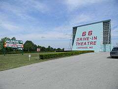 |
(#03000182) |
17231 Old 66 Boulevard 37°10′24″N 94°22′06″W / 37.173333°N 94.368333°W |
Carthage | |
| 2 | Lucius P. Buchanan House | Upload image | (#16000546) |
3708 E. University Pkwy. 37°05′49″N 94°27′52″W / 37.097040°N 94.464357°W |
Joplin | Now the Ralph L. Gray Alumni Center of Missouri Southern State University |
| 3 | Carthage Courthouse Square Historic District | Upload image | (#80002370) |
Roughly bounded by E. Central Ave., S. Maple, Lincoln, and W. 5th Sts. 37°10′36″N 94°18′37″W / 37.176667°N 94.310278°W |
Carthage | |
| 4 | Carthage South Historic District |  |
(#82004915) |
City limits of Carthage 37°10′08″N 94°18′38″W / 37.168889°N 94.310556°W |
Carthage | |
| 5 | Cassill Place Historic District | |
(#86000005) |
Roughly the first half-block of W. Central east of Blanche St. 37°10′44″N 94°19′13″W / 37.178889°N 94.320278°W |
Carthage | |
| 6 | Cave Spring School and Cave Spring Cemetery | Upload image | (#12000416) |
4323 Cty. Rd. 4 37°06′43″N 94°03′45″W / 37.111812°N 94.062518°W |
Sarcoxie | |
| 7 | Colonial Apartments | |
(#01000835) |
406 Walnut St. 37°10′29″N 94°18′51″W / 37.174722°N 94.314167°W |
Carthage | |
| 8 | Downtown Webb City Historic District | Upload image | (#14000427) |
Roughly N. and S. Main, E. and W. Broadway, Daugherty, E. Church, N. Tom, N. Liberty, and N. and S. Webb 37°08′48″N 94°27′50″W / 37.1466°N 94.4638°W |
Webb City | |
| 9 | Elks Club Lodge No. 501 | 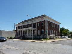 |
(#85001188) |
318-320 W. 4th St. 37°05′15″N 94°30′58″W / 37.0875°N 94.516111°W |
Joplin | |
| 10 | Fifth and Main Historic District | |
(#06000541) |
501-513 S. Main St., 502-508 Virginia St. 37°05′19″N 94°30′48″W / 37.088611°N 94.513333°W |
Joplin | |
| 11 | Fox Theater | 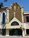 |
(#90001100) |
415 S. Main St. 37°05′18″N 94°30′51″W / 37.088333°N 94.514167°W |
Joplin | |
| 12 | Gentry Apartments | 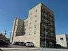 |
(#06000683) |
318 S. Wall St. 37°05′23″N 94°30′57″W / 37.089722°N 94.515833°W |
Joplin | |
| 13 | Inter-State Grocer Company Building | 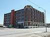 |
(#08001024) |
1027-1035 S. Main St. 37°04′45″N 94°30′48″W / 37.079167°N 94.513333°W |
Joplin | |
| 14 | Jasper County Courthouse | 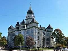 |
(#73001041) |
Courthouse Sq. 37°10′45″N 94°18′37″W / 37.179167°N 94.310278°W |
Carthage | |
| 15 | Joplin and Wall Avenues Historic District | Upload image | (#10000819) |
Portions of S. Joplin and Wall Aves., W. First, Second, Third Sts. 37°05′23″N 94°30′53″W / 37.089722°N 94.514722°W |
Joplin | |
| 16 | Joplin Carnegie Library | 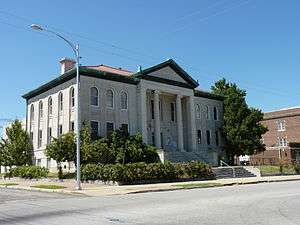 |
(#79001377) |
9th and Wall Sts. 37°04′55″N 94°30′57″W / 37.081944°N 94.515833°W |
Joplin | |
| 17 | Joplin Connor Hotel | 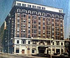 |
(#73001042) |
324 Main St. 37°05′17″N 94°30′49″W / 37.088056°N 94.513611°W |
Joplin | Demolished.[5] |
| 18 | Joplin Downtown Historic District | 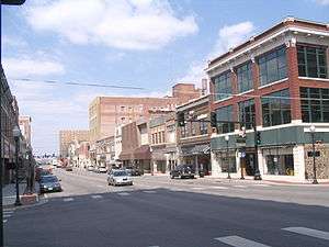 |
(#08000661) |
S. Main St., roughly between E. 4th and E. 6th Sts. 37°05′12″N 94°30′48″W / 37.086667°N 94.513333°W |
Joplin | |
| 19 | Joplin Furniture Company Building | Upload image | (#12000473) |
702-708 Main St. 37°05′02″N 94°30′49″W / 37.083812°N 94.513655°W |
Joplin | |
| 20 | Joplin Supply Company | 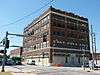 |
(#07000652) |
228 S. Joplin Ave. 37°05′20″N 94°30′52″W / 37.088889°N 94.514444°W |
Joplin | |
| 21 | Joplin Union Depot | |
(#73001043) |
Broadway and Main St. 37°05′30″N 94°30′42″W / 37.091667°N 94.511667°W |
Joplin | |
| 22 | Main and Eighth Streets Historic District | 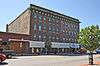 |
(#11000185) |
Portions of the 800 and 900 block of S. Main St. 37°04′53″N 94°30′49″W / 37.081389°N 94.513611°W |
Joplin | |
| 23 | Middle West Hotel |  |
(#82003149) |
1 S. Main St. 37°08′46″N 94°27′45″W / 37.146111°N 94.4625°W |
Webb City | |
| 24 | Murphysburg Historic District | Upload image | (#15000228) |
Roughly bounded by S. Sergeant, S. Pearl & S. Byers Aves., W. 1st, W. 4th & W. 7th Sts. 37°05′08″N 94°31′05″W / 37.0856°N 94.5180°W |
Joplin | |
| 25 | Newman Brothers Building | 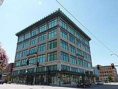 |
(#90001101) |
602-608 S. Main St. 37°05′07″N 94°30′45″W / 37.085278°N 94.5125°W |
Joplin | |
| 26 | Olivia Apartments | 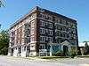 |
(#08000536) |
320 Moffet Ave. 37°05′19″N 94°31′08″W / 37.088611°N 94.518889°W |
Joplin | |
| 27 | Phelps Country Estate | 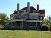 |
(#83001023) |
RR 1, Newcastle Rd. just west of CR100 37°15′00″N 94°14′10″W / 37.25°N 94.236111°W |
Carthage | |
| 28 | Rains Brothers Building | 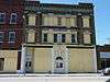 |
(#90001102) |
906-908 S. Main St. 37°04′52″N 94°30′44″W / 37.081111°N 94.512222°W |
Joplin | Destroyed by fire March 1, 2012[6] |
| 29 | Ridgway Apartments | 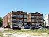 |
(#06000682) |
402 S. Byers Ave. and 404 S. Byers Ave. 37°05′22″N 94°31′05″W / 37.089444°N 94.518056°W |
Joplin | |
| 30 | St. Louis and San Francisco Railroad Building | 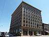 |
(#02001193) |
605 Main St. 37°05′09″N 94°30′47″W / 37.085833°N 94.513056°W |
Joplin | |
| 31 | St. Peter the Apostle Catholic Church and Rectory | 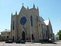 |
(#91000851) |
812 Pearl St. 37°04′58″N 94°31′01″W / 37.082778°N 94.516944°W |
Joplin | |
| 32 | Sarcoxie Public Square Historic District | Upload image | (#14000872) |
Along 5th, 6th, Center & Cross Sts. 37°04′09″N 94°07′00″W / 37.0693°N 94.1167°W |
Sarcoxie | |
| 33 | Scottish Rite Cathedral | 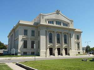 |
(#90000989) |
505 Byers Ave. 37°05′11″N 94°31′02″W / 37.086389°N 94.517222°W |
Joplin | |
| 34 | South Main Street Historic District |  |
(#10000818) |
Western side of S. Main St., between W. First and W. Second Sts. 37°05′24″N 94°30′48″W / 37.09°N 94.513333°W |
Joplin |
See also
- List of National Historic Landmarks in Missouri
- National Register of Historic Places listings in Missouri
References
| Wikimedia Commons has media related to National Register of Historic Places in Jasper County, Missouri. |
- ↑ The latitude and longitude information provided in this table was derived originally from the National Register Information System, which has been found to be fairly accurate for about 99% of listings. For about 1% of NRIS original coordinates, experience has shown that one or both coordinates are typos or otherwise extremely far off; some corrections may have been made. A more subtle problem causes many locations to be off by up to 150 yards, depending on location in the country: most NRIS coordinates were derived from tracing out latitude and longitudes off of USGS topographical quadrant maps created under the North American Datum of 1927, which differs from the current, highly accurate WGS84 GPS system used by most on-line maps. Chicago is about right, but NRIS longitudes in Washington are higher by about 4.5 seconds, and are lower by about 2.0 seconds in Maine. Latitudes differ by about 1.0 second in Florida. Some locations in this table may have been corrected to current GPS standards.
- ↑ "National Register of Historic Places: Weekly List Actions". National Park Service, United States Department of the Interior. Retrieved on December 16, 2016.
- ↑ Numbers represent an ordering by significant words. Various colorings, defined here, differentiate National Historic Landmarks and historic districts from other NRHP buildings, structures, sites or objects.
- ↑ The eight-digit number below each date is the number assigned to each location in the National Register Information System database, which can be viewed by clicking the number.
- ↑ http://www.dnr.mo.gov/shpo/Jasper.htm
- ↑ "Fire destroys historic downtown Joplin building". The Joplin Globe. Joplin, Missouri. March 1, 2012. Retrieved August 26, 2012.
| Topics | |
|---|---|
| Lists by states |
|
| Lists by insular areas | |
| Lists by associated states | |
| Other areas | |
| |
Municipalities and communities of Jasper County, Missouri, United States | ||
|---|---|---|
| Cities | | |
| Villages | ||
| Townships | ||
| Unincorporated communities | ||
| Ghost town | ||
| Footnotes | ‡This populated place also has portions in an adjacent county or counties | |
This article is issued from Wikipedia - version of the 9/10/2016. The text is available under the Creative Commons Attribution/Share Alike but additional terms may apply for the media files.