National Register of Historic Places listings in Jackson County, Missouri: Downtown Kansas City

This is a list of the National Register of Historic Places listings in downtown Kansas City, Missouri.
This is intended to be a complete list of the properties and districts on the National Register of Historic Places in downtown Kansas City, Missouri, United States. Downtown Kansas City is defined as being roughly bounded by the Missouri River to the north, 31st Street to the south, Troost Avenue to the east, and State Line Road to the west. The locations of National Register properties and districts may be seen in an online map.[1]
There are 298 properties and districts listed on the National Register in Kansas City. Downtown Kansas City includes 144 of these properties and districts; the city's remaining properties and districts are listed elsewhere. One historic district overlaps the downtown and non-downtown areas of Jackson County.
- This National Park Service list is complete through NPS recent listings posted December 16, 2016.[2]
Current listings
| [3] | Name on the Register | Image | Date listed[4] | Location | Neighborhood | Description |
|---|---|---|---|---|---|---|
| 1 | 1524 Grand Avenue Building | 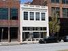 |
(#04000389) |
1524 Grand Boulevard 39°05′42″N 94°34′53″W / 39.094908°N 94.581342°W |
Crossroads | |
| 2 | 1901 McGee Street Automotive Service Building | 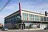 |
(#08001359) |
1901-1907 McGee St. 39°05′25″N 94°34′48″W / 39.090142°N 94.580041°W |
Crossroads | |
| 3 | Acme Brass and Machine Works Building |  |
(#04000694) |
609-611 E. 17th St. 39°05′35″N 94°34′34″W / 39.093095°N 94.576050°W |
Hospital Hill | |
| 4 | Alana Apartment Hotel | 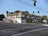 |
(#06000543) |
2700-2706 Troost Ave. and 1015 E. 27th St. 39°04′39″N 94°34′16″W / 39.077562°N 94.571178°W |
Longfellow/Dutch Hill | |
| 5 | Argyle Building | 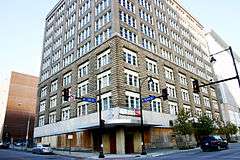 |
(#05000891) |
306 E. 12th St. 39°05′59″N 94°34′45″W / 39.099828°N 94.579295°W |
Downtown | |
| 6 | Auto Coach Building | 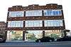 |
(#07000328) |
1730-34 Oak St. 39°05′32″N 94°34′45″W / 39.092154°N 94.579125°W |
Crossroads | |
| 7 | Baker-Vawter Building |  |
(#00000432) |
915-917 Wyandotte 39°06′11″N 94°35′07″W / 39.103087°N 94.585286°W |
Downtown | |
| 8 | Blackstone Hotel | .jpg) |
(#03001057) |
817 Cherry St. 39°06′13″N 94°34′33″W / 39.103543°N 94.575910°W |
Downtown | |
| 9 | BMA Tower | 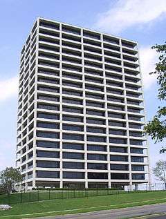 |
(#02000886) |
700 West Karnes (Should be 700 West 31st Street.) 39°04′20″N 94°35′37″W / 39.072111°N 94.593619°W |
West Side | |
| 10 | Boley Building | 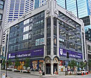 |
(#71000467) |
1130 Walnut St. 39°06′00″N 94°34′56″W / 39.1°N 94.582222°W |
Downtown | |
| 11 | Bonfils Building | 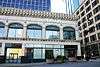 |
(#84002568) |
1200 Grand Ave. 39°05′59″N 94°34′52″W / 39.099708°N 94.581144°W |
Downtown | |
| 12 | Bryant Building | 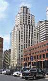 |
(#89000312) |
1102 Grand Ave. 39°06′03″N 94°34′52″W / 39.100808°N 94.581048°W |
Downtown | |
| 13 | Buick Automobile Company Building | 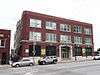 |
(#04000386) |
216 Admiral Boulevard 39°06′20″N 94°34′48″W / 39.105514°N 94.579900°W |
Downtown | |
| 14 | Bunker Building | 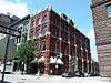 |
(#75001067) |
820 Baltimore Ave. 39°06′14″N 94°35′04″W / 39.103829°N 94.584519°W |
Downtown | |
| 15 | Chambers Building | .jpg) |
(#01001379) |
25 E. 12th St. 39°05′59″N 94°34′57″W / 39.099771°N 94.582366°W |
Downtown | |
| 16 | Cherry Street Colonnades Historic District | Upload image | (#05001050) |
2523, 2527, 2531, 2535, 2539, 2543, 2547, 2542, and 2544 Cherry St. 39°04′48″N 94°34′38″W / 39.080129°N 94.577177°W |
Longfellow/Dutch Hill | |
| 17 | Christian Church Hospital | 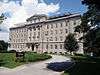 |
(#04001161) |
2697 West Paseo Boulevard (NRHP application incorrectly gives 2524 W. Paseo Boulevard.) 39°04′42″N 94°33′59″W / 39.078455°N 94.566320°W |
Beacon Hill-McFeders | |
| 18 | City Bank Building | 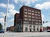 |
(#83000996) |
1801 Grand Ave. 39°05′30″N 94°34′51″W / 39.091667°N 94.580833°W |
Crossroads | |
| 19 | Coates House Hotel | 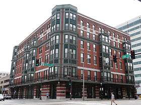 |
(#72000715) |
1005 Broadway 39°06′08″N 94°35′17″W / 39.102222°N 94.588056°W |
Downtown | |
| 20 | Coca-Cola Building | 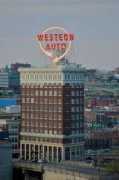 |
(#88001300) |
2101-2111 Grand Ave. 39°05′15″N 94°34′53″W / 39.087434°N 94.581268°W |
Crown Center | Also known as the Western Auto Building |
| 21 | Columbia Building | 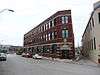 |
(#00000433) |
2006-2012 Wyandotte St. 39°05′20″N 94°35′11″W / 39.088901°N 94.586317°W |
Crossroads | |
| 22 | Commerce Tower | 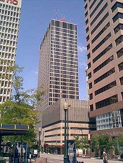 |
(#14000141) |
911 Main St. 39°06′12″N 94°34′58″W / 39.103307°N 94.582868°W |
Downtown | |
| 23 | Commerce Trust Company Historic District | 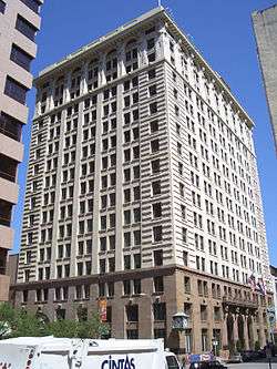 |
(#15000772) |
Bounded by E. 9th, Walnut, E. 10th & Main Sts. 39°06′10″N 94°34′57″W / 39.1028°N 94.5826°W |
Downtown | |
| 24 | Continental Hotel | 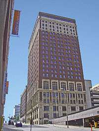 |
(#83000997) |
106 W. 11th St. 39°06′03″N 94°35′04″W / 39.100966°N 94.584417°W |
Downtown | Also known as Mark Twain Tower |
| 25 | Thos. Corrigan Building | 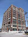 |
(#82003143) |
1828 Walnut St. 39°05′26″N 94°34′58″W / 39.090556°N 94.582778°W |
Crossroads | |
| 26 | Creamery Package Manufacturing Company Building | Upload image | (#16000764) |
1408-1410 W. 12th St. 39°06′03″N 94°36′06″W / 39.100875°N 94.601792°W |
||
| 27 | Crossroads Historic Freight District | Upload image | (#00001565) |
Roughly bounded by Southwest Boulevard, W. 20th St., Baltimore Ave., W. 22nd St., and Broadway 39°05′17″N 94°35′13″W / 39.088187°N 94.586888°W |
Crossroads | |
| 28 | Louis Curtiss Studio Building | 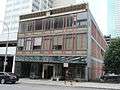 |
(#72000716) |
1116-1120 McGee St. 39°06′01″N 94°34′48″W / 39.100335°N 94.579924°W |
Downtown | |
| 29 | Dierks Building | 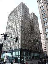 |
(#08001387) |
1000-1006 Grand Boulevard 39°06′08″N 94°34′51″W / 39.102264°N 94.580758°W |
Downtown | |
| 30 | District I | Upload image | (#83001000) |
Roughly bounded by Baltimore Ave. and W. 12th, W. 13th, and Wyandotte Sts. 39°05′59″N 94°35′04″W / 39.099722°N 94.584444°W |
Downtown | |
| 31 | East 27th Street Colonnades Historic District | Upload image | (#06000538) |
1300-02, 1312-14, and 1320-22 E. 27th St. 39°04′40″N 94°34′04″W / 39.077743°N 94.567733°W |
Beacon Hill-McFeders | |
| 32 | Exchange Building | Upload image | (#03000524) |
1201-1207 Grand Boulevard 39°06′06″N 94°34′49″W / 39.101667°N 94.580278°W |
Downtown | Demolished. |
| 33 | The Fairfax Building | 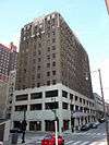 |
(#15000471) |
101 W. 11th St. 39°06′03″N 94°35′04″W / 39.1009°N 94.5845°W |
Downtown | |
| 34 | Faultless Starch Company Building | .JPG) |
(#02000470) |
1025 W. 8th St. 39°06′19″N 94°35′45″W / 39.105388°N 94.595821°W |
West Bottoms | |
| 35 | Federal Reserve Bank of Kansas City | 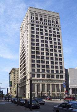 |
(#07000327) |
925 Grand Boulevard 39°06′14″N 94°34′49″W / 39.103863°N 94.580248°W |
Downtown | |
| 36 | The Fidelity National Bank and Trust Company Building | 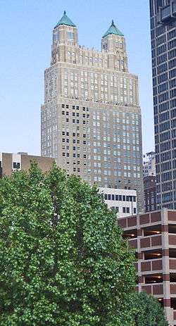 |
(#97000908) |
911 Walnut St. 39°06′11″N 94°34′54″W / 39.103095°N 94.581596°W |
Downtown | |
| 37 | Fire Department Headquarters; Fire station No. 2 | 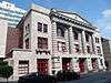 |
(#82003144) |
1020 Central Ave. 39°06′05″N 94°35′14″W / 39.101493°N 94.587131°W |
Downtown | |
| 38 | Firestone Building | 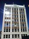 |
(#86000004) |
2001 Grand Ave. 39°05′20″N 94°34′51″W / 39.088889°N 94.580833°W |
Crown Center | |
| 39 | Gate City National Bank | 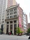 |
(#82003145) |
1111 Grand Ave. 39°06′02″N 94°34′50″W / 39.100616°N 94.580689°W |
Downtown | |
| 40 | Globe Storage and Transfer Company Building | 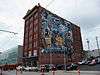 |
(#07000326) |
1712 Main St. 39°05′35″N 94°35′01″W / 39.092919°N 94.583659°W |
Crossroads | |
| 41 | Gloyd Building | Upload image | (#85001610) |
921 Walnut St. 39°06′10″N 94°34′53″W / 39.102778°N 94.581389°W |
Downtown | Demolished in 2001. |
| 42 | Grand Avenue Garage | 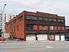 |
(#14001238) |
718 Grand Ave. 39°06′18″N 94°34′52″W / 39.104862°N 94.580976°W |
Downtown | |
| 43 | Grand Avenue Temple and Grand Avenue Temple Building | 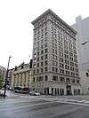 |
(#85001006) |
205 E. 9th St. and 903 Grand Ave. 39°06′12″N 94°34′50″W / 39.103333°N 94.580556°W |
Downtown | |
| 44 | Graphic Arts Building | 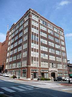 |
(#05000810) |
934 Wyandotte St. 39°06′09″N 94°35′08″W / 39.102424°N 94.585674°W |
Downtown | |
| 45 | Greenlease Cadillac Building | 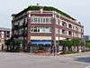 |
(#03000523) |
2900 Gillham Rd. 39°04′25″N 94°34′44″W / 39.073744°N 94.579018°W |
Union Hill | |
| 46 | Guadalupe Center | 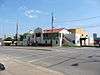 |
(#03000866) |
1015 Avenida de Cesar Chavez 39°05′09″N 94°35′49″W / 39.085783°N 94.596945°W |
West Side | |
| 47 | Gumbel Building | Upload image | (#79001367) |
801 Walnut St. 39°06′15″N 94°34′54″W / 39.104302°N 94.581592°W |
Downtown | |
| 48 | Helping Hand Institute Building | 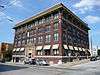 |
(#00000434) |
523 Grand Boulevard 39°06′29″N 94°34′48″W / 39.108062°N 94.580069°W |
River Market | |
| 49 | Hesse Carriage Company Building | 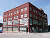 |
(#07000169) |
1700 Oak St. 39°05′35″N 94°34′45″W / 39.093152°N 94.579116°W |
Crossroads | |
| 50 | Holy Rosary Historic District |  |
(#07000007) |
Roughly bounded by 5th and Campbell, 5th and Harrison, and 9th and E. Missouri Ave. (More precisely, 5th to Missouri, and Campbell to Harrison.) 39°06′34″N 94°34′21″W / 39.1094°N 94.572481°W |
Columbus Park | |
| 51 | Hotel Phillips |  |
(#79001369) |
106 W. 12th St. 39°06′00″N 94°35′05″W / 39.100030°N 94.584605°W |
Downtown | |
| 52 | Frank M. Howe Residence |  |
(#85000854) |
1707 Jefferson St. 39°05′33″N 94°35′31″W / 39.092390°N 94.592020°W |
West Side | |
| 53 | Imperial Brewing Company Brewery |  |
(#11000011) |
2825 Southwest Boulevard 39°04′37″N 94°36′11″W / 39.076810°N 94.603073°W |
West Side | |
| 54 | Insurance Building-Consumers Cooperative Association Building | 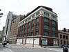 |
(#05001327) |
318-320 E. 10th St. 39°06′09″N 94°34′45″W / 39.102392°N 94.579256°W |
Downtown | |
| 55 | Inter-State Building | 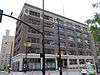 |
(#08000534) |
417 E. 13th St./1300 Locust St. 39°05′54″N 94°34′40″W / 39.098273°N 94.577794°W |
Downtown | |
| 56 | Jenkins Music Company Building | 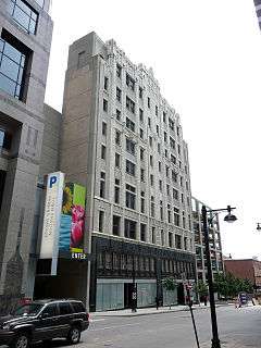 |
(#79001370) |
1217-1223 Walnut St. 39°05′57″N 94°34′55″W / 39.099148°N 94.581968°W |
Downtown | |
| 57 | Jensen-Salsbery Laboratories |  |
(#85001574) |
520 W. Pennway St. 39°05′16″N 94°35′27″W / 39.087778°N 94.590833°W |
West Side | |
| 58 | Kansas City Club Building | 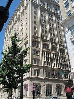 |
(#02001401) |
1228 Baltimore Ave. 39°05′56″N 94°35′05″W / 39.098781°N 94.584734°W |
Downtown | |
| 59 | Kansas City Cold Storage Company Building | 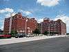 |
(#05000510) |
500 E. 3rd St. 39°06′40″N 94°34′43″W / 39.111183°N 94.578607°W |
River Market | |
| 60 | Kansas City Live Stock Exchange | 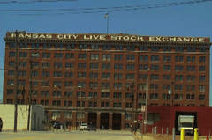 |
(#84002571) |
1600 Genessee St. 39°05′40″N 94°36′19″W / 39.094444°N 94.605278°W |
West Side | |
| 61 | Kansas City Parks and Boulevards Historic District | Upload image | (#14000931) |
Roughly bounded by Missouri R., Hardesty Ave., Armour Blvd. & State Line. 39°04′57″N 94°33′18″W / 39.082598°N 94.555041°W |
||
| 62 | Kansas City Police Station Number 4 | 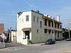 |
(#05001184) |
103 W. 19th St. 39°05′27″N 94°35′07″W / 39.090781°N 94.585284°W |
Crossroads | |
| 63 | Kansas City Power and Light Company Building | 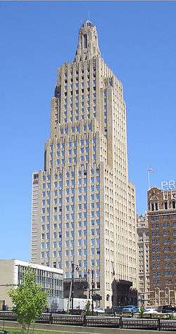 |
(#88001852) |
1330 Baltimore Ave. 39°05′51″N 94°35′05″W / 39.097554°N 94.584720°W |
Downtown | |
| 64 | Kansas City Public Library | 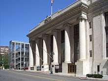 |
(#77000807) |
500 E. 9th St. 39°06′13″N 94°34′37″W / 39.103489°N 94.577015°W |
Downtown | |
| 65 | Kansas City Southern Railway Building | .jpg) |
(#04000392) |
114 W. 11th St. 39°06′04″N 94°35′07″W / 39.101076°N 94.585187°W |
Downtown | |
| 66 | Kansas City Terminal Railway Company Roundhouse Historic District | 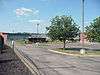 |
(#00001682) |
Junction of 27th St. and Southwest Boulevard 39°04′46″N 94°36′04″W / 39.079402°N 94.600990°W |
West Side | |
| 67 | Kansas City Title and Trust Building | 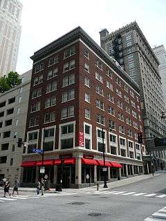 |
(#05000624) |
927 Walnut St. 39°06′09″N 94°34′54″W / 39.102424°N 94.581786°W |
Downtown | |
| 68 | Kansas City Water Department Building | 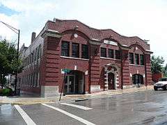 |
(#94000290) |
201 Main St. 39°06′38″N 94°35′00″W / 39.110678°N 94.583456°W |
River Market | |
| 69 | Kansas City, Missouri Western Union Telegraph Building |  |
(#03000010) |
100-114 E. 7th St. 39°06′20″N 94°34′53″W / 39.105641°N 94.581391°W |
Downtown | |
| 70 | Kelley-Reppert Motor Company Building | 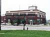 |
(#04001223) |
422 Admiral Boulevard 39°06′20″N 94°34′40″W / 39.105521°N 94.577676°W |
Downtown | |
| 71 | Kemper Arena | 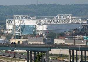 |
(#14000160) |
1800 Genessee Street 39°05′31″N 94°36′21″W / 39.09194°N 94.60583°W |
Downtown | Revolutionary 1974 Helmut Jahn design has hosted political conventions as well as NBA and NHL games |
| 72 | Kirkwood Building | 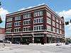 |
(#01000767) |
1737-41 McGee St. 39°05′30″N 94°34′43″W / 39.091758°N 94.578730°W |
Crossroads | |
| 73 | Land Bank Building | 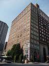 |
(#85000101) |
15 W. 10th St. 39°06′08″N 94°35′01″W / 39.102093°N 94.583686°W |
Downtown | |
| 74 | Liberty Memorial | 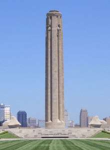 |
(#00001148) |
100 W. 26th St. 39°04′52″N 94°35′09″W / 39.081054°N 94.585957°W |
Crown Center | |
| 75 | Liquid Carbonic Company Building |  |
(#94000365) |
2000 Baltimore St. 39°05′20″N 94°35′06″W / 39.088910°N 94.585057°W |
Crossroads | |
| 76 | Loew's Midland Theater-Midland Building | 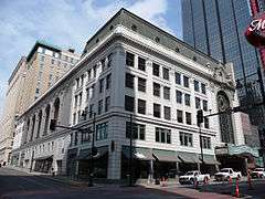 |
(#77000808) |
1232-1234 Main St. and 1221-1233 Baltimore Ave. 39°05′56″N 94°35′01″W / 39.098829°N 94.583483°W |
Downtown | |
| 77 | R.A. Long Building |  |
(#02001683) |
928 Grand Boulevard 39°06′09″N 94°34′52″W / 39.102372°N 94.581088°W |
Downtown | |
| 78 | Lowe and Campbell Sporting Goods Building | 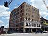 |
(#11001018) |
1509-13 Baltimore Ave. 39°05′44″N 94°35′04″W / 39.095578°N 94.584525°W |
Crossroads | |
| 79 | Mainstreet Theatre | 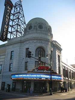 |
(#07000043) |
1400 Main St. 39°05′49″N 94°35′01″W / 39.097016°N 94.583619°W |
Downtown | |
| 80 | Marks and Garvey Historic District | 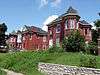 |
(#06000542) |
2429, 2433, and 2437 Tracy Ave. 39°04′57″N 94°34′04″W / 39.082374°N 94.567853°W |
Beacon Hill-McFeders | |
| 81 | Albert Marty Building | 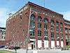 |
(#12001257) |
1412-1418 W. 12th St. 39°06′03″N 94°36′08″W / 39.100890°N 94.602232°W |
West Bottoms | |
| 82 | Mercantile Bank & Trust Building | 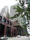 |
(#09000830) |
1101 Walnut St. 39°06′03″N 94°34′55″W / 39.100939°N 94.581836°W |
Downtown | |
| 83 | Midwest Hotel |  |
(#04000394) |
1925 Main St. 39°05′22″N 94°35′01″W / 39.089470°N 94.583543°W |
Crossroads | |
| 84 | Monroe Hotel |  |
(#04000395) |
1904-06 Main St. 39°05′24″N 94°35′02″W / 39.090013°N 94.583866°W |
Crossroads | |
| 85 | Montgomery Ward and Company General Merchandise Warehouse | 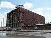 |
(#10000461) |
819 E. 19th St. 39°05′24″N 94°34′24″W / 39.089941°N 94.573397°W |
Hospital Hill | |
| 86 | C.A. Murdock Manufacturing Company Building | Upload image | (#16000234) |
1225-1227 Union Avenue 39°06′09″N 94°35′57″W / 39.102455°N 94.599230°W |
||
| 87 | National Bank of Commerce Building | |
(#99000530) |
922-924 Walnut St. 39°06′09″N 94°34′55″W / 39.102571°N 94.582041°W |
Downtown | |
| 88 | National Garage | Upload image | (#00000436) |
1100-1110 McGee St. 39°06′12″N 94°34′47″W / 39.103333°N 94.579722°W |
Downtown | Demolished in 2004. |
| 89 | New York Life Building | 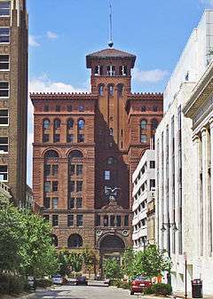 |
(#70000336) |
20 W. 9th St. 39°06′13″N 94°35′03″W / 39.103708°N 94.584072°W |
Downtown | |
| 90 | Old New England Building | 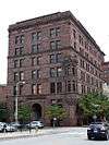 |
(#73001040) |
112 W. 9th St. 39°06′14″N 94°35′07″W / 39.103797°N 94.585206°W |
Downtown | |
| 91 | Old Town Historic District | Upload image | (#78001656) |
Roughly bounded by Independence Ave., 2nd, Delaware and Walnut Sts.; also 119, 207, and 213 Walnut St.; also 136 Main St.; also 140 Walnut St.; also roughly bounded by E. 2nd, Locust, and Walnut Sts., and E. Missouri Ave. 39°06′32″N 94°34′59″W / 39.108889°N 94.583056°W |
River Market | Second through fifth sets of boundaries represent boundary increases of July 1, 2005, October 5, 2005, February 14, 2006, and January 17, 2012 |
| 92 | Palace Clothing Company Building | 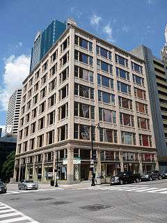 |
(#85000102) |
1126-1128 Grand Ave. 39°06′00″N 94°34′52″W / 39.100050°N 94.581224°W |
Downtown | |
| 93 | George B. Peck Dry Goods Company Building | 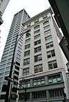 |
(#80002368) |
1044 Main St. 39°06′04″N 94°35′01″W / 39.101111°N 94.583611°W |
Downtown | |
| 94 | Thomas J. Pendergast Headquarters | |
(#11000764) |
1908 Main St. 39°05′24″N 94°35′02″W / 39.089922°N 94.583891°W |
Crossroads | |
| 95 | Pennbroke Apartments |  |
(#09000206) |
604 W. 10th St. 39°06′09″N 94°35′29″W / 39.102630°N 94.591416°W |
Quality Hill | |
| 96 | Joseph Grear Peppard House |  |
(#85000649) |
1704 Jefferson St. 39°05′34″N 94°35′33″W / 39.092778°N 94.5925°W |
West Side | |
| 97 | Perfection Stove Company Building |  |
(#14000376) |
1200 Union Ave. 39°06′09″N 94°35′54″W / 39.102544°N 94.598438°W |
West Bottoms | |
| 98 | Nelle E. Peters Troost Avenue Historic District |  |
(#09000552) |
2719-37 and 2730 Troost Ave. 39°04′36″N 94°34′15″W / 39.076805°N 94.570745°W |
Beacon Hill-McFeders | |
| 99 | Pickwick Hotel, Office Building, Parking Garage and Bus Terminal | 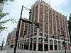 |
(#05000220) |
901-937 McGee St., 301-311 E. 9th St., 300-310 E. Tenth St., and 906-912 Oak St. 39°06′10″N 94°34′46″W / 39.102827°N 94.579311°W |
Downtown | |
| 100 | President Hotel | .jpg) |
(#83001016) |
1327-1335 Baltimore Ave. 39°05′52″N 94°35′03″W / 39.097778°N 94.584167°W |
Downtown | |
| 101 | Professional Building | 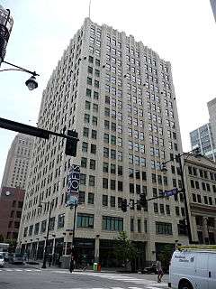 |
(#79001373) |
1101-1107 Grand Ave. 39°06′03″N 94°34′49″W / 39.100833°N 94.580278°W |
Downtown | |
| 102 | Quality Hill |  |
(#78001657) |
Roughly bounded by Broadway, 10th, 14th, and Jefferson Sts. 39°06′00″N 94°35′26″W / 39.1°N 94.590556°W |
Quality Hill | |
| 103 | Richards and Conover Hardware Company Building | 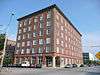 |
(#98001636) |
200 W. 5th St. 39°06′28″N 94°35′08″W / 39.107877°N 94.585585°W |
River Market | |
| 104 | Ridenour-Baker Grocery Company Building | 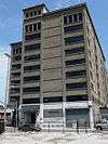 |
(#14000161) |
933 Mulberry St. 39°06′11″N 94°35′58″W / 39.103157°N 94.599432°W |
West Bottoms | |
| 105 | Rieger Hotel | .jpg) |
(#04000396) |
1922 Main St. 39°05′22″N 94°35′02″W / 39.089456°N 94.583909°W |
Crossroads | |
| 106 | Sacred Heart Church, School and Rectory | 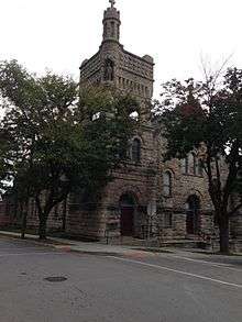 |
(#78001659) |
2540-2544 Madison Ave. and 910 W. 26th St. 39°04′50″N 94°35′44″W / 39.080556°N 94.595556°W |
West Side | |
| 107 | Safeway Stores and Office and Warehouse Building |  |
(#00000435) |
2029-2043 Wyandotte St. 39°05′17″N 94°35′10″W / 39.087924°N 94.586005°W |
Crossroads | |
| 108 | St. Mary's Episcopal Church | .jpg) |
(#78001663) |
1307 Holmes St. 39°05′53″N 94°34′28″W / 39.098056°N 94.574444°W |
Downtown | |
| 109 | Savoy Hotel and Grill |  |
(#74001073) |
219 W. 9th St. and 9th and Central Sts. 39°06′13″N 94°35′12″W / 39.103611°N 94.586667°W |
Downtown | |
| 110 | Scarritt Building and Arcade |  |
(#71000468) |
Corner of 9th and Grand Sts. and 819 Walnut St. 39°06′13″N 94°34′52″W / 39.103634°N 94.581108°W |
Downtown | |
| 111 | Sewall Paint and Glass Company Building | 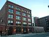 |
(#02000469) |
1009-1013 W. 8th St. 39°06′20″N 94°35′43″W / 39.105588°N 94.595254°W |
West Bottoms | |
| 112 | Smith and Sons Manufacturing Company Building | Upload image | (#07001290) |
1400-26 Guinotte Ave. 39°06′56″N 94°33′58″W / 39.115556°N 94.566111°W |
Columbus Park | Demolished about 2010. |
| 113 | E. R. Squibb and Sons Building | 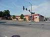 |
(#10000985) |
2500 W. Pennyway St. 39°04′55″N 94°35′32″W / 39.081944°N 94.592222°W |
West Side | |
| 114 | Standard Theatre | 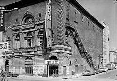 |
(#74001074) |
300 W. 12th St. 39°06′01″N 94°35′14″W / 39.100204°N 94.587237°W |
Downtown | |
| 115 | R.O. Stenzel & Company, Warehouse |  |
(#07000702) |
1811 Walnut 39°05′29″N 94°34′56″W / 39.091266°N 94.582349°W |
Crossroads | |
| 116 | Stine and McClure Undertaking Company Building | 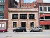 |
(#90001105) |
924-926 Oak St. 39°06′09″N 94°34′43″W / 39.102491°N 94.578588°W |
Downtown | |
| 117 | Studna Garage Building | 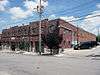 |
(#06000539) |
415 Oak St. 39°06′34″N 94°34′45″W / 39.109491°N 94.579243°W |
River Market | |
| 118 | Sweeney Automobile and Tractor School |  |
(#14000142) |
215 W. Pershing Rd. 39°05′00″N 94°35′13″W / 39.083222°N 94.586942°W |
Crown Center | |
| 119 | Switzer School Buildings | Upload image | (#09001098) |
Generally bounded by Madison Ave. and Summit St., and 18th to 20th Sts. 39°05′25″N 94°35′39″W / 39.090297°N 94.594044°W |
West Side | |
| 120 | Temple Block Building | Upload image | (#85001344) |
531 Walnut St. 39°06′27″N 94°34′49″W / 39.107516°N 94.580356°W |
River Market | Demolished. |
| 121 | Ten Main Center | 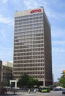 |
(#15000760) |
920 Main St. 39°06′09″N 94°35′00″W / 39.1026°N 94.5834°W |
||
| 122 | Townley Metal & Hardware Company Building | 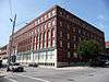 |
(#94000286) |
200-210 Walnut St. 39°06′38″N 94°34′57″W / 39.110682°N 94.582574°W |
River Market | |
| 123 | Traders National Bank Building |  |
(#16000233) |
1125 Grand Blvd. 39°06′00″N 94°34′51″W / 39.100068°N 94.580883°W |
||
| 124 | Triangle Battery and Service Company Building | Upload image | (#03001058) |
3001-03 Gillham Rd. 39°04′21″N 94°34′43″W / 39.072393°N 94.578599°W |
Longfellow/Dutch Hill | Demolished. |
| 125 | TWA Corporate Headquarters' Building | 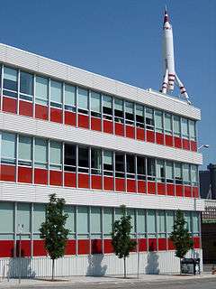 |
(#02001403) |
1735-1741 Baltimore Ave.-1740 Main St. 39°05′31″N 94°35′04″W / 39.091919°N 94.584473°W |
Crossroads | |
| 126 | Twenty-Twenty Grand Building | 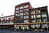 |
(#12000205) |
2008-2020 Grand Boulevard 39°05′18″N 94°34′55″W / 39.088452°N 94.58186°W |
Crossroads | |
| 127 | Twenty-Ninth Street Colonnaded Apartments Historic District | Upload image | (#07000018) |
900-906 E. 29th St. and 2843 N. Campbell, 910-912 E. 29th St., and 914 E. 29th St. 39°04′28″N 94°34′25″W / 39.074328°N 94.573520°W |
Longfellow/Dutch Hill | |
| 128 | U.S. Courthouse and Post Office-Kansas City, MO | %2C_Kansas_City_(Jackson_County%2C_Missouri).jpg) |
(#07001231) |
811 Grand Boulevard 39°06′14″N 94°34′49″W / 39.103816°N 94.580172°W |
Downtown | |
| 129 | Union Cemetery | Upload image | (#16000183) |
227 East 28th Terrace 39°04′33″N 94°34′53″W / 39.075772°N 94.581420°W |
||
| 130 | Union Station | 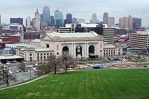 |
(#72000719) |
Pershing Rd. and Main St.; also generally bounded by the Kansas City Terminal railroad tracks at Pennway, Pershing Rd., and Union Station 39°05′05″N 94°35′08″W / 39.084722°N 94.585556°W |
Crown Center | Railroad tracks represent a boundary increase of May 6, 2004 |
| 131 | United States Post Office-Kansas City | 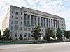 |
(#04000213) |
315 W. Pershing Rd. 39°04′58″N 94°35′17″W / 39.082862°N 94.588093°W |
Crown Center | |
| 132 | Joe Vaccaro Soda Water Manufacturing Company Building | 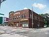 |
(#03001055) |
918-922 E. 5th St. 39°06′38″N 94°34′21″W / 39.110488°N 94.572440°W |
Columbus Park | |
| 133 | Vitagraph Film Exchange Building | 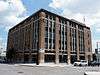 |
(#08000091) |
1703 Wyandotte St. 39°05′36″N 94°35′04″W / 39.093245°N 94.584481°W |
Crossroads | |
| 134 | Walnut Street Warehouse and Commercial Historic District | Upload image | (#99001158) |
Roughly bounded by Main St., 15th St., Grand St. and 17th St.; also 1612, 1616, 1620, and 1624 Grand Boulevard and 1705-07 and 1709 Walnut St.; also 1526, 1524, 1520, 1516-18, 1512-14, and 1508 Grand Boulevard 39°05′43″N 94°34′56″W / 39.095172°N 94.582347°W |
Crossroads | Second and third sets of boundaries represent boundary increases of June 13, 2008 and December 17, 2008 |
| 135 | Waltower Building | 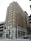 |
(#01000837) |
823 Walnut St. 39°06′13″N 94°34′54″W / 39.103613°N 94.581630°W |
Downtown | |
| 136 | Maj. William Warner House | 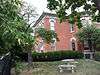 |
(#77000811) |
1021 Pennsylvania Ave. 39°06′06″N 94°35′27″W / 39.101667°N 94.590833°W |
Quality Hill | |
| 137 | Webster School | 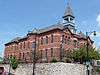 |
(#82003147) |
1644 Wyandotte St. 39°05′35″N 94°35′10″W / 39.093056°N 94.586111°W |
Crossroads | |
| 138 | West Bottoms-North Historic District | Upload image | (#16000771) |
W. 9th St., St. Louis Ave., Union Ave from Wyoming to W. of Mulberry Sts. 39°06′10″N 94°35′56″W / 39.102777°N 94.598786°W |
Downtown | |
| 139 | West Eleventh Street Historic District | Upload image | (#82003148) |
Central and W. 11th Sts. 39°06′04″N 94°35′12″W / 39.101111°N 94.586667°W |
Downtown | |
| 140 | West Ninth Street-Baltimore Avenue Historic District | Upload image | (#76001113) |
Roughly bounded by Main, 8th, 10th, and Central Sts.; also the western side of the 100 block of 10th St. and the 1000 block of Baltimore Ave.; also 807-815 Wyandotte 39°06′12″N 94°35′05″W / 39.103333°N 94.584722°W |
Downtown | Second group of boundaries and the Wyandotte address represent boundary increases of November 20, 2002 and October 12, 2010 |
| 141 | Western Newspaper Union Building |  |
(#07000170) |
304 W. 10th St. 39°06′09″N 94°35′14″W / 39.102472°N 94.587217°W |
Downtown | |
| 142 | Wholesale District | Upload image | (#79001375) |
Roughly bounded by 6th, Wyandotte, 8th, May, 11th, and Washington Sts.; also 701 Broadway & 330 W. 8th St. 39°06′14″N 94°35′15″W / 39.103889°N 94.5875°W |
Quality Hill, Downtown | Second set of boundaries represents a boundary increase on April 23, 2013 |
| 143 | WILLIAM S. MITCHELL (dredge) | Upload image | (#85003102) |
Army Corps of Engineer Harbor 39°06′51″N 94°34′56″W / 39.114167°N 94.582222°W |
River Market | Destroyed in a 1993 flood.[5] |
| 144 | The Wiltshire Apartment Hotel | Upload image | (#14000377) |
703 E. 10th St. 39°06′07″N 94°34′28″W / 39.1020°N 94.5745°W |
Downtown | Demolished 2013. |
Former listing
| [3] | Name on the Register | Image | Date listed | Date removed | Location | City or town | Summary |
|---|---|---|---|---|---|---|---|
| 1 | Emery, Bird and Thayer Building |  |
(#72001561) | 1016-1018 Grand Ave. |
Downtown | Demolished October 1973. |
See also
- List of National Historic Landmarks in Missouri
- National Register of Historic Places listings in Kansas City, Missouri
References
| Wikimedia Commons has media related to National Register of Historic Places in Kansas City, Missouri. |
- ↑ The latitude and longitude information provided in this table was derived originally from the National Register Information System, which has been found to be fairly accurate for about 99% of listings. For about 1% of NRIS original coordinates, experience has shown that one or both coordinates are typos or otherwise extremely far off; some corrections may have been made. A more subtle problem causes many locations to be off by up to 150 yards, depending on location in the country: most NRIS coordinates were derived from tracing out latitude and longitudes off of USGS topographical quadrant maps created under the North American Datum of 1927, which differs from the current, highly accurate WGS84 GPS system used by most on-line maps. Chicago is about right, but NRIS longitudes in Washington are higher by about 4.5 seconds, and are lower by about 2.0 seconds in Maine. Latitudes differ by about 1.0 second in Florida. Some locations in this table may have been corrected to current GPS standards.
- ↑ "National Register of Historic Places: Weekly List Actions". National Park Service, United States Department of the Interior. Retrieved on December 16, 2016.
- 1 2 Numbers represent an ordering by significant words. Various colorings, defined here, differentiate National Historic Landmarks and historic districts from other NRHP buildings, structures, sites or objects.
- ↑ The eight-digit number below each date is the number assigned to each location in the National Register Information System database, which can be viewed by clicking the number.
- ↑ http://www.dnr.mo.gov/shpo/Jackson.htm
| Topics | |
|---|---|
| Lists by states |
|
| Lists by insular areas | |
| Lists by associated states | |
| Other areas | |
| |