Mutasa District
| Mutasa | |
|---|---|
| District | |
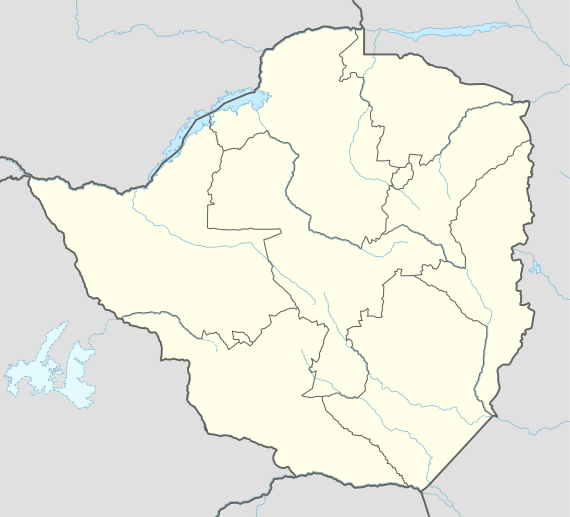 Mutasa Location in Zimbabwe | |
| Coordinates: 18°35′S 32°45′E / 18.583°S 32.750°ECoordinates: 18°35′S 32°45′E / 18.583°S 32.750°E | |
| Country | Zimbabwe |
| Province | Manicaland |
| District | Mutasa |
| Government | |
| • MP For Mutasa Central | Trevor Saruwaka |
| • MP For Mutasa North | David Anthony Chimhini |
| • MP For Mutasa South | Misheck Kagurabadza |
| Elevation | 912 m (2,992 ft) |
| Population | |
| • Total | 167,462 |
| Time zone | CET (UTC+2) |
Mutasa District is one of seven districts in the Manicaland province of Zimbabwe. Mutasa district is located 30 km from Mutare and stretches up to the Honde Valley, which is about 100 km northeast of Mutare along a tarred road that branches off the Nyanga road.[1]
Population
Population in Mutasa stands at about 169 00 as of the last census held in 2012
Location
Mutasa district is located 30 km from Mutare and stretches up to the Honde Valley, which is about 100 km northeast of Mutare along a tarred road that branches off the Nyanga road.
Economy
Mutasa District economy has agro-based. Villagers practice semi-commercial agriculture. And the district has several plantations and estates that provide employment. Villages raise cattle, goats and chicken. And they grow maize, groundnuts, sugarcane etc. and have plantations for fruit trees in the fields. Some of the villages are small holder growers of coffee, tea and banana plantations. Large scale commercial plantations produces timber, coffee and tea estates.
Infrastructure Development
Compared with other district in Manicaland Province, Mutasa District has better infrastructure.
Religion
Christianity dominates in Mutasa .Most people are Catholics (Anglicans, Methodists and Roman Catholics) African Apostolic Church AAC known as vekwa (Mwazha) large group also is a follower of the Johanne Marange Apostolic Sect .Traditional beliefs are also still dominant although people are now practising this side by side with Christianity.
Road network
The district is serviced by a network of surfaced and gravel roads. The main highways are the Mutare–Nyanga A15 highway and the Selbourne to Honde Valley road. During the rainy season some parts of the district are inaccessible by road due to the bad state of roads. The district council does not have the capacity to maintain gravel roads, hence the District Development Fund(DDF) is now maintaining most of the gravel roads. In Honde Valley some areas are only accessible only by four-wheel-drive enabled vehicles due to the terrain.
Communication Technology
Most of the district is covered by wireless or cell phone networks, although mountainous areas of the district have poor reception. Land telephone lines connect most of the business centres throughout the district. Villages and business centers with telephone services have access to the internet.
Dams and Water Infrastructure
Mutasa district is in the Highveld, receiving high rainfall, hence there are a number of small to large dams in the district, the major ones being Osborne Dam and Nyawamba Dam. Pungwe–Mutare pipeline also pass through the district and the district is still to benefit from water points along the route.It is proving expensive for local communities to access the piped water from the Pingwe along the way to Mutare interms of acquiring the right pipes for their irrigations. In Honde Valley, water supplied from by a number of small piped systems and motorised pumps serving small towns, growth points, commercial plantations, service centres and some villages, as well as direct abstractions from the rivers by riparian village communities not connected to developed installations.
Sanitation
Up to 90% of the population has Blair pit latrine and the rest have water-borne sewer system. Most of the Blair Pit latrines were constructed after independence in 1980.
Government and politics
Mutasa District is divided into three constituencies Mutasa Central, Mutasa North and Mutasa South and the PMs are, David Anthony Chimhini and Misheck Kagurabadza respectively.
Education
Mutasa has a number of schools run by the Ministry of Education[2] and tertiary institutions.
Primary Schools
- Sagambe Primary School
- Chavhanga Primary School
- Pachije St Stephen Primary
- Chikomba Primary School
- Chisukohttp Primary School
- Aberfoyle Primary School
- Eastern Highlands Primary Schools
- Katiyo Primary School
- Nyamhingura Primary School
- Muterere Primary School
- Muparutsa Primary School
- Zindi Primary School
- St James Haparari Primary School
- Vumbunu Primary School
- Sherukuru Primary School
- Pimayi Primary School
- Chitombo Primary School
- Gatsi Primary School
- Buwu Primary School
- St Columbus Primary School
- Samutete St Michaels Primary School
- Rupinda Primary School
- Muponda Primary School
- Chitombo Primary School
- Sahumani Primary School
- Makwasa Primary School
- Kwambana Primary School
- Manunure Primary School
- Honde river
- Samaringa
- Costern
- Nyamaende
- St Peters Jombe Primary School
- Holy Family School Nyatsanza Primary School
- Sagambe Secondary School
- Chavhanga Secondary School
- Chisuko Secondary School
- Muterere Secondary School
- Zindi Secondary School
- St Columbus Secondary School
- Nyamhingura Secondary
- St Mathias Tsonzo Secondary School
- St James Zongoro Secondary School
- Mwoyoweshumba Secondary School
- Nyakatsapa High School
- Gatsi Secondary School
- Sahumani
- Chitombo
- Pafiwa Mutasa
- Hartzell High School
- Samaringa Secondary School
Tertiary Institutions
The district has a tertiary institution at Bonda and Honde valley mission. Africa University is also located in the District.
Health care
Zimbabwe's public health care is delivered at four levels, which are meant to function as a referral chain. The first level is the primary level consisting of Rural Health Centres, Rural Hospitals and Urban Clinics (services do not require an attending Physician). The second level is the first referral level consisting of District Hospitals. The third level is the second referral level consisting of Provincial and General Hospitals. The fourth and final level is the third referral level to Central and Special Hospitals.
Most of the health care facilities in the district are owned and run by the government's Ministry of Health and Child Welfare although local communities are involved in the management of some clinics. The main referral hospitals are Hauna Hospital and Bonda Mission Hospital. There are several poly-clinics in the district that offer primary health care to people from the villages in the district. In recent years as the economy of Zimbabwe has declined, there has been a shortage of drugs and equipment at the hospitals although staffing levels by end of 2010 had improved. Communities also rely heavily on traditional medicines. The major diseases that affect the people in the district include diarrhea, TB and malaria.
HIV/AIDS
Like the rest of the country, the HIV/AIDS pandemic is seriously affecting the district. However, there has been a decrease of reported HIV prevalence rate in the past decade.
Hospitals
Hauna hospital, run through the Ministry of Health[3] was established in Honde valley as there was no district Hospital in the District and the only Mission Hospital at Bonda could not meet the District Health Demands. It’s now a referral Hospital for most health centres in the Valley with major cases being referred to Mutare General Hospital which happens to be the Provincial hospital
Tourist Attractions
Mutarazi Falls[4] is one tourist attraction in Honde Valley. The Valley Scenery is also a tourist attraction.Mahwemasike, meaning "planted rocks" are of great interest in the valley with a lot of tourists coming in to have a picture of the rocks.
- Pungwe River white water rafting[5]
Schools
- St James Zongoro Primary school
- Mundenda Secondary School
- Mundenda Primary School
- Old Murapa Primary School
- Hartzell Central primary School
- St Augustines High School
- Tsvingwe Secondary School
Villages & Townships
- Hauna Growth point
- Muponda Village
- Watsomba
- Chijara Village
Prominent People from Mutasa
- Ambassador John Shumba Mvundura
Oppah Muchinguri
- Dr Stanley Urayayi Sakupwanya (deceased)
- Patrick Chinamasa
- David Anthony Chimhini
- Misheck Kagurabadza
- Herbert Chitepo (deceased)
- Walter Mparutsa (deceased)
- Fortune Mparutsa (deceased)
- Gibson Maneswa
- Dr Jefter Kuziwa Sakupwanya
•Jacob Wilson Chikuhwa (Economist/Author) ∗Farai Tumbare (Zimbabwe Basketball Legend)
Dr Justin Mhaka (musician)
Notable Places
- Hauna
- Osborne Dam
- Zindi Township
- Pungwe River
- Honde Valley
- Aberfolye Lodge
Ambasodor J.S.Mvundura
References
- ↑ Central Statistical Office, Zimbabwe, Census 1992, Provincial profile.
- ↑ http://www.moesac.gov.zw
- ↑ http://www.mohcw.gov.zw/
- ↑ https://www.google.co.in/search?q=mutarazi+falls+nyanga&hl=en&rlz=1R2WQIB_enIN524&tbm=isch&tbo=u&source=univ&sa=X&ei=ysImUfKbFIzirAfysoGACg&ved=0CDYQsAQ&biw=1366&bih=618
- ↑ Pungwe Rive