Muckleford, Victoria
| Muckleford Victoria | |
|---|---|
 Muckleford | |
| Coordinates | 37°01′S 144°09′E / 37.017°S 144.150°ECoordinates: 37°01′S 144°09′E / 37.017°S 144.150°E |
| Population | 1,107 (2006 census)[1] |
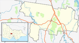
| Location |
|
| LGA(s) | Shire of Mount Alexander |
| State electorate(s) | Bendigo West |
| Federal Division(s) | Bendigo |
Muckleford is a small regional area in central Victoria, Australia named after the English hamlet of the same name in Dorset. The region features several hilly sheep farms and rural properties and has dry conditions for much of the year. There is no commercial shop center and the area consists solely of scattered farms, houses, and occasional rural commerce. In the 2006 census, it had a population of 1107.[1] The west area of Muckleford features sparse forest that was mined for gold in some areas during the 19th century.[2] The western forest contains many remnants of the mine history including several open and covered holes and one poppet head. Muckleford Post Office opened on 1 August 1857 and closed in 1966.[3]
Rilens road is a gravel road that historically carried simple raised telephone wire poles to service local farms and houses. It runs west starting from the Pyrenees highway (Highway 6180), and crosses the Muckleford Walmer road which runs north south, and then crosses over Muckleford Creek and then leads into a thin eucalypti forest. Muckleford Walmer road has several farms, a retired red brick church, and Muckleford Cemetery.[4] An 18-hole golf course Castlemaine Golf Club[5] is situated at the crossroads of Rilens road, and the Pyrenees highway which connects Castlemaine to Newstead. The Maldon to Castlemaine highway also cuts through Muckleford's regions and runs chiefly west to east. Adjacent to the Castlemaine Golf Club is the Castlemaine Steiner School & Kindergarten, which was founded in 1987.[6] Muckleford Creek starts below Walmer and flows into the Loddon River. Northern Muckleford area has a functional railway station on the Victorian Goldfields Railway line. A steam train sometimes travels through the area and is considered something of a local attraction.
In recent years the area has experienced drought conditions and some of the smaller creeks which feed into the larger tributaries often run dry for several years on end.
References
- 1 2 Australian Bureau of Statistics (25 October 2007). "Muckleford (State Suburb)". 2006 Census QuickStats. Retrieved 2007-10-25.
- ↑ http://www.vgr.com.au/history.html
- ↑ Premier Postal History, Post Office List, retrieved 2008-04-11
- ↑ http://www.australiancemeteries.com.au/vic/mt_alexander/muckleford.htm
- ↑ http://www.castlemainegolf.com
- ↑ http://www.cssk.vic.edu.au