Mount Vernon, Ohio
| Mount Vernon, Ohio | |
|---|---|
| City | |
|
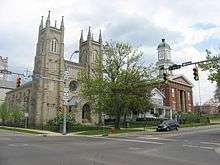
Monument in the downtown public square | |
| Motto: "One of Ohio's Most Likable Communities" | |
 Location of Mount Vernon, Ohio | |
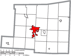 Location of Mount Vernon in Knox County | |
| Coordinates: 40°23′34″N 82°28′52″W / 40.39278°N 82.48111°WCoordinates: 40°23′34″N 82°28′52″W / 40.39278°N 82.48111°W | |
| Country | United States |
| State | Ohio |
| County | Knox |
| Government | |
| • Mayor | Richard K. Mavis |
| Area[1] | |
| • Total | 9.60 sq mi (24.86 km2) |
| • Land | 9.41 sq mi (24.37 km2) |
| • Water | 0.19 sq mi (0.49 km2) |
| Elevation[2] | 1,001 ft (305 m) |
| Population (2010)[3] | |
| • Total | 16,990 |
| • Estimate (2012[4]) | 16,812 |
| • Density | 1,805.5/sq mi (697.1/km2) |
| Time zone | Eastern (EST) (UTC-5) |
| • Summer (DST) | EDT (UTC-4) |
| ZIP code | 43050 |
| Area code(s) | 740 |
| FIPS code | 39-53102[5] |
| GNIS feature ID | 1056436[2] |
| Website | http://www.mountvernonohio.org/ |

Mount Vernon is a city in Knox County, Ohio, United States. The population was 16,990 at the 2010 census. It is the county seat of Knox County.[6]
History
The community was platted in 1805, and named after Mount Vernon, the plantation owned by George Washington.[7]
On January 1959 a severe flood caused 500 homes to be evacuated and caused $5 million in damage.[8] In August 2006, an F0 tornado touched down on the west side of town. It demolished a barn at the local 84 Lumber, and the resulting debris blew across the road to the DeCosky GM car dealership. It caused at least $150,000 of damage.[9]
Historic sites
The Woodward Opera House, the oldest opera theater of its kind in the United States, is located downtown. The theater is currently under major renovation and will, upon its completion, be transformed into a local cultural and performing-arts center.
The Knox County Historical Society, with a building and extensive exhibits, makes its headquarters on Harcourt Road in Mount Vernon. Exhibits feature information about Daniel Decatur Emmett, Paul Lynde, The Cooper Company and other subjects.
Geography

Mount Vernon is located at 40°23′34″N 82°28′52″W / 40.39278°N 82.48111°W (40.392738, −82.481151).[10]
According to the United States Census Bureau, the city has a total area of 9.60 square miles (24.86 km2), of which 9.41 square miles (24.37 km2) is land and 0.19 square miles (0.49 km2) is water.[1] The city lies in the Glaciated Allegheny Plateau and is surrounded by rolling hills and valleys.
The Kokosing River and U.S. Route 36 pass through the city.
Demographics
| Historical population | |||
|---|---|---|---|
| Census | Pop. | %± | |
| 1810 | 314 | — | |
| 1820 | 403 | 28.3% | |
| 1830 | 1,021 | 153.3% | |
| 1840 | 2,363 | 131.4% | |
| 1850 | 3,711 | 57.0% | |
| 1860 | 4,202 | 13.2% | |
| 1870 | 4,876 | 16.0% | |
| 1880 | 5,249 | 7.6% | |
| 1890 | 6,027 | 14.8% | |
| 1900 | 6,638 | 10.1% | |
| 1910 | 9,087 | 36.9% | |
| 1920 | 9,237 | 1.7% | |
| 1930 | 9,370 | 1.4% | |
| 1940 | 10,122 | 8.0% | |
| 1950 | 12,185 | 20.4% | |
| 1960 | 13,284 | 9.0% | |
| 1970 | 13,373 | 0.7% | |
| 1980 | 14,362 | 7.4% | |
| 1990 | 14,550 | 1.3% | |
| 2000 | 15,256 | 4.9% | |
| 2010 | 16,990 | 11.4% | |
| Est. 2015 | 16,742 | [11] | −1.5% |
| Sources:[5][12][13][14] | |||
2010 census
As of the census[3] of 2010, there were 16,990 people, 7,110 households, and 4,016 families residing in the city. The population density was 1,805.5 inhabitants per square mile (697.1/km2). There were 7,836 housing units at an average density of 832.7 per square mile (321.5/km2). The racial makeup of the city was 95.3% White, 1.1% African American, 0.2% Native American, 1.1% Asian, 0.7% from other races, and 1.5% from two or more races. Hispanic or Latino of any race were 1.8% of the population.
There were 7,110 households of which 28.3% had children under the age of 18 living with them, 38.4% were married couples living together, 13.6% had a female householder with no husband present, 4.4% had a male householder with no wife present, and 43.5% were non-families. 38.0% of all households were made up of individuals and 16.5% had someone living alone who was 65 years of age or older. The average household size was 2.19 and the average family size was 2.88.
The median age in the city was 37.2 years. 21.8% of residents were under the age of 18; 13.7% were between the ages of 18 and 24; 23.2% were from 25 to 44; 24% were from 45 to 64; and 17.3% were 65 years of age or older. The gender makeup of the city was 46.5% male and 53.5% female.
2000 census
As of the census[5] of 2000, there were 15,256 people, 6,187 households, and 3,730 families residing in the city. The population density was 1,710.4 people per square mile (660.7/km²). There were 6,713 housing units at an average density of 798.7 per square mile (308.6/km²). The racial makeup of the city was 96.66% White, 1.15% African American, 0.31% Native American, 0.54% Asian, 0.29% from other races, and 1.04% from two or more races. Hispanic or Latino of any race were 0.87% of the population.
There were 6,187 households out of which 28.0% had children under the age of 18 living with them, 43.8% were married couples living together, 12.7% had a female householder with no husband present, and 39.7% were non-families. 34.2% of all households were made up of individuals and 16.1% had someone living alone who was 65 years of age or older. The average household size was 2.25 and the average family size was 2.88.
In the city the population was spread out with 23.7% under the age of 18, 10.1% from 18 to 24, 27.2% from 25 to 44, 20.7% from 45 to 64, and 18.3% who were 65 years of age or older. The median age was 37 years. For every 100 females there were 86.2 males. For every 100 females age 18 and over, there were 81.3 males.
The median income for a household in the city was $29,801, and the median income for a family was $38,217. Males had a median income of $31,900 versus $21,969 for females. The per capita income for the city was $16,471. About 12.7% of families and 15.6% of the population were below the poverty line, including 20.7% of those under age 18 and 9.2% of those age 65 or over.
Economy
Mount Vernon was the birthplace of Cooper Industries. There is a large industrial complex in the western part of the city that manufactures and repairs products for the gas and oil power generation industries. It was acquired by Rolls-Royce North America, and in 2014 Siemens bought the Mount Vernon plant. Face a declining market, the company has announced major reductions in employment.[15]
Ariel Corporation, a major manufacturer[16] of reciprocating natural gas (and other gasses) compressors, is also located in Mount Vernon. Its history is tied to that of Cooper Industries in that Jim Buchwald, one of the founders of Ariel, was a former engineer for Cooper Industries Mount Vernon. Ariel's website can be found at arielcorp.com.
In November 2012, Harvest@TheWoodward opened to provide a market for locally grown and produced foods all year long. Products in the store are Ohio made, grown and produced. They have been continuously bringing in new products from local farmers and producers across Ohio. They carry seasonal produce and herbs, milk, goat milk, cheese, eggs, yogurt, beef, chicken, pork, lamb, goat, lard, bread, granola, cookies, noodles, cakes, relish, jams, jellies, syrups, candy, goat milk fudge, pickles, butters, dip mixes and chips as well as Ohio gifts and much more.
Two universities in Mount Vernon and nearby Gambier provide thousands of jobs to the local residents. Mount Vernon is home to Mount Vernon Nazarene University and Gambier is home to Kenyon College.
Education
Colleges and universities
- Kenyon College (located in nearby Gambier)
- Mount Vernon Nazarene University
- Central Ohio Technical College
High schools
- Mount Vernon High School (Ohio)
- Mount Vernon Academy
- Knox County Career Center
Notable people
- Eldad Cicero Camp – coal tycoon
- Thom Collier – former Ohio state representative
- Fred Dailey – former State of Ohio Agriculture Director and US Congressional candidate
- Hiram and Barney Davis – two dwarf brothers and side-show performers
- Columbus Delano – Whig and Republican politician and lawyer.
- Daniel Decatur Emmett – author of "Dixie" Early Blackface performer. Created the first minstrel show, where the entire band wore blackface as they performed.[17]
- Lansford Hastings – noted California pioneer
- Paul Lynde – comedian and actor
- Ralph W. Sockman – noted clergyman, author, and radio speaker
- Rob Kelly - NFL football player
- Jim Stillwagon – American football player
- Jesse B. Thomas – first senator of Illinois and the proposer of the Missouri Compromise
- Juan Manuel García Passalacqua – Puerto Rican politician and television personality
References
- 1 2 "US Gazetteer files 2010". United States Census Bureau. Retrieved 2013-01-06.
- 1 2 "US Board on Geographic Names". United States Geological Survey. 2007-10-25. Retrieved 2008-01-31.
- 1 2 "American FactFinder". United States Census Bureau. Retrieved 2013-01-06.
- ↑ "Population Estimates". United States Census Bureau. Retrieved 2013-06-17.
- 1 2 3 "American FactFinder". United States Census Bureau. Retrieved 2008-01-31.
- ↑ "Find a County". National Association of Counties. Retrieved 2011-06-07.
- ↑ Overman, William Daniel (1958). Ohio Town Names. Akron, OH: Atlantic Press. p. 93.
- ↑ "Flood strikes county 50 years ago" Mount Vernon News, 21 January 2009.
- ↑ Tuggle, Z. "Quick-strike tornado hits MV" Mount Vernon News, 04 August 2006.
- ↑ "US Gazetteer files: 2010, 2000, and 1990". United States Census Bureau. 2011-02-12. Retrieved 2011-04-23.
- ↑ "Annual Estimates of the Resident Population for Incorporated Places: April 1, 2010 to July 1, 2015". Retrieved July 2, 2016.
- ↑ "Number of Inhabitants: Ohio" (PDF). 18th Census of the United States. U.S. Census Bureau. Retrieved 22 November 2013.
- ↑ "Ohio: Population and Housing Unit Counts" (PDF). U.S. Census Bureau. Retrieved 22 November 2013.
- ↑ "Incorporated Places and Minor Civil Divisions Datasets: Subcounty Population Estimates: April 1, 2010 to July 1, 2012". U.S. Census Bureau. Retrieved 25 November 2013.
- ↑ Gearino, Dan. "Siemens to cut up to 300 jobs in Mount Vernon". The Columbus Dispatch. Retrieved 8 October 2016.
- ↑ See http://www.pandmt.com/compressor_manuf_.htm as an example
- ↑ http://werehistory.org/dixie/
External links
![]() Media related to Mount Vernon, Ohio at Wikimedia Commons
Media related to Mount Vernon, Ohio at Wikimedia Commons
- City website
- Mount Vernon News, a newspaper based in Mt. Vernon
Municipalities and communities of Knox County, Ohio, United States | ||
|---|---|---|
| City | 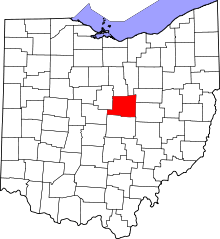 | |
| Villages | ||
| Townships | ||
| CDPs | ||
| Unincorporated communities | ||
| Ghost town | ||
| Footnotes | ‡This populated place also has portions in an adjacent county or counties | |