Mount Magnet, Western Australia
| Mount Magnet Western Australia | |||||||
|---|---|---|---|---|---|---|---|
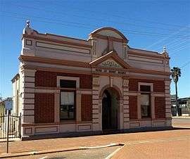 Mt Magnet Shire Office b.1898 | |||||||
 Mount Magnet | |||||||
| Coordinates | 28°3′36″S 117°50′46″E / 28.06000°S 117.84611°ECoordinates: 28°3′36″S 117°50′46″E / 28.06000°S 117.84611°E | ||||||
| Population | 532 (2011 census)[1] | ||||||
| Postcode(s) | 6638 | ||||||
| Elevation | 426 m (1,398 ft) | ||||||
| Location | |||||||
| LGA(s) | Shire of Mount Magnet | ||||||
| Region | Mid West | ||||||
| State electorate(s) | North West | ||||||
| Federal Division(s) | Durack | ||||||
| Website | Mount Magnet | ||||||
| |||||||
Mount Magnet is one of the Mid West region’s original gold mining towns, and the longest surviving gold mining settlement in Western Australia. The prominent hill that is adjacent to the current townsite was called West Mount Magnet in 1854 by explorer Robert Austin, having named a smaller hill 64 km away, East Mount Magnet (now called Carron Hill). Both hills had an extremely high iron content which affected the readings of his compass. West Mount Magnet had its Aboriginal name reinstated by the Surveyor General in 1972, 'Warramboo," meaning campfire camping place.[2] The magnetic variation at Mount Magnet is zero: magnetic north equals true north.[3]
Overview
Surrounding the town are remnants of old gold mining operations, and to the north east are significant Aboriginal sites being preserved jointly by the local community and the Western Australian Museum. Its history is sustained through the Wirnda Barna Arts Centre,[4] and the Mount Magnet Mining and Pastoral Museum.
The area once had three separate town sites - Mount Magnet, Boogardie, and Lennonville. Boogardie has since been swallowed up into the open cut mining operations at Hill 50. Lennonville was abandoned at the start of World War I, and the foundations of the bank and train station can still be seen.

There continues to be active gold mining in the area, notably by Ramelius Resources which acquired Mt Magnet Gold Pty Ltd in 2010. The company operates the Saturn and Mars pits, collectively referred to as the Galaxy mining area. The company also commenced the Perseverance open pit cutbacks in 2015 at the top of the Hill 50 underground mine which is 4 km north west of Mount Magnet.[5]
Unusual for such a large mining community, Mount Magnet never had a public battery (a type of mill machine that crushes material). The nearest battery was built 5 km west in Boogardie. The actual battery can now be seen at the Mount Magnet Mining and Pastoral Museum. However, evidence of Mount Magnet's gold-rush heyday can be seen in its very wide main street with three hotels and historic buildings.
Today, visitors can enjoy rounds at the Mount Magnet Golf Club, swimming at the Mount Magnet Memorial Swimming Pool and Fitness Centre on Hepburn Street, and racing at the Mount Magnet Racing Club which was inaugurated in 1970.
During the wildflower season (August to November) the Gascoyne-Murchison area attracts tourists viewing the abundant natural display of wildflowers. There are thousands of wildflowers and plant species that can be seen, including the emblematic scarlet red sturt desert pea, the royal purple mulla mulla by the roadside, and fields of white, yellow and pink everlastings.
During the lifetime of the Northern Railway to Meekatharra, Mount Magnet was an important railway junction (when the Sandstone Branch Railway was in operation), railway station and yard.
Mount Magnet is served by Mount Magnet Airport, where Skippers Aviation has services to and from Meekatharra and Perth.
Climate
The climate in Mount Magnet is an arid climate, also known as a desert climate that has a BWh classification according to the Köppen climate classification. The mean maximum temperature in Mount Magnet is 28.6 °C. The driest months are September to November with average monthly rainfall of 8.93mm. The hottest day recorded in Mount Magnet was 47.4 °C on 21 January 2015.
| Climate data for Mount Magnet AERO | |||||||||||||
|---|---|---|---|---|---|---|---|---|---|---|---|---|---|
| Month | Jan | Feb | Mar | Apr | May | Jun | Jul | Aug | Sep | Oct | Nov | Dec | Year |
| Record high °C (°F) | 47.4 (117.3) |
45.9 (114.6) |
42.0 (107.6) |
37.5 (99.5) |
35.1 (95.2) |
28.0 (82.4) |
27.9 (82.2) |
32.0 (89.6) |
35.6 (96.1) |
40.6 (105.1) |
43.6 (110.5) |
45.4 (113.7) |
47.4 (117.3) |
| Average high °C (°F) | 37.9 (100.2) |
36.8 (98.2) |
32.9 (91.2) |
28.8 (83.8) |
23.8 (74.8) |
19.9 (67.8) |
18.8 (65.8) |
21.4 (70.5) |
24.7 (76.5) |
29.6 (85.3) |
32.6 (90.7) |
35.7 (96.3) |
28.6 (83.5) |
| Average low °C (°F) | 23.5 (74.3) |
23.3 (73.9) |
20.1 (68.2) |
16.2 (61.2) |
11.7 (53.1) |
8.3 (46.9) |
7.0 (44.6) |
8.0 (46.4) |
10.4 (50.7) |
14.6 (58.3) |
17.9 (64.2) |
21.1 (70) |
15.2 (59.4) |
| Record low °C (°F) | 12.6 (54.7) |
13.5 (56.3) |
9.9 (49.8) |
5.1 (41.2) |
3.3 (37.9) |
0.5 (32.9) |
−0.2 (31.6) |
0.5 (32.9) |
3.0 (37.4) |
5.3 (41.5) |
8.1 (46.6) |
11.5 (52.7) |
−0.2 (31.6) |
| Average precipitation mm (inches) | 27.7 (1.091) |
35.4 (1.394) |
38.2 (1.504) |
19.7 (0.776) |
18.5 (0.728) |
19.9 (0.783) |
30.0 (1.181) |
16.6 (0.654) |
9.0 (0.354) |
6.4 (0.252) |
11.4 (0.449) |
21.9 (0.862) |
257.5 (10.138) |
| Average precipitation days | 4.8 | 5.0 | 4.8 | 4.8 | 5.0 | 6.1 | 7.8 | 5.7 | 4.1 | 3.0 | 3.2 | 3.7 | 58.0 |
| Average relative humidity (%) | 35 | 41 | 45 | 53 | 57 | 66 | 68 | 60 | 51 | 39 | 36 | 34 | 49 |
| Source: Bureau of Meteorology[6] | |||||||||||||
References
- ↑ Australian Bureau of Statistics (31 October 2012). "Mount Magnet (State Suburb)". 2011 Census QuickStats. Retrieved 20 October 2016.
- ↑ "Mount Warramboo" State Heritage Office. 28/05/97. Web. 01/04/16. http://inherit.stateheritage.wa.gov.au/Public/Inventory/Details/0abf1a0d-dcb6-4200-b4de-321e33dc7576
- ↑ "World Aero Data: MOUNT MAGNET -- YMOG". /worldaerodata.com.
- ↑ Wirnda Barna Artists - Aboriginal Art Centre Hub WA. http://www.aachwa.com.au/our-members/wirnda-barna-artists Accessed December 5, 2015.
- ↑ "Mt Magnet Gold Mine" Ramelius Resources. 2011. Web. 01/04/16. http://www.rameliusresources.com.au/projects/operations/mt-magnet-gold-mine
- ↑ "MOUNT MAGNET AERO". Climate statistics for Australian locations. Bureau of Meteorology. 31/03/16. Retrieved 2 April 2016.
External links
![]() Media related to Mount Magnet, Western Australia at Wikimedia Commons
Media related to Mount Magnet, Western Australia at Wikimedia Commons