Mossyrock, Washington
| Mossyrock, Washington | |
|---|---|
| City | |
 Location of Mossyrock, Washington | |
| Coordinates: 46°31′47″N 122°29′3″W / 46.52972°N 122.48417°WCoordinates: 46°31′47″N 122°29′3″W / 46.52972°N 122.48417°W | |
| Country | United States |
| State | Washington |
| County | Lewis |
| Area[1] | |
| • Total | 0.68 sq mi (1.76 km2) |
| • Land | 0.68 sq mi (1.76 km2) |
| • Water | 0 sq mi (0 km2) |
| Elevation | 656 ft (200 m) |
| Population (2010)[2] | |
| • Total | 759 |
| • Estimate (2015)[3] | 751 |
| • Density | 1,116.2/sq mi (431.0/km2) |
| Time zone | Pacific (PST) (UTC-8) |
| • Summer (DST) | PDT (UTC-7) |
| ZIP code | 98564 |
| Area code(s) | 360 |
| FIPS code | 53-47315 |
| GNIS feature ID | 1523412[4] |
| Website | www.cityofmossyrock.com |
Mossyrock is a city in Lewis County, Washington, United States. The population was 759 at the 2010 census.
History
The city began as a trading post named Mossy Rock in 1852, after a 200-foot (61 m) high moss-covered rock at the east end of Klickitat Prairie. The Indian name for the area of Mossyrock was Coulph.[5]
Mossyrock was officially incorporated on January 2, 1948.
Geography
Mossyrock is located at 46°31′47″N 122°29′3″W / 46.52972°N 122.48417°W (46.529844, -122.484269).[6]
According to the United States Census Bureau, the city has a total area of 0.68 square miles (1.76 km2), all of it land.[1]
Demographics
| Historical population | |||
|---|---|---|---|
| Census | Pop. | %± | |
| 1950 | 356 | — | |
| 1960 | 344 | −3.4% | |
| 1970 | 409 | 18.9% | |
| 1980 | 463 | 13.2% | |
| 1990 | 452 | −2.4% | |
| 2000 | 486 | 7.5% | |
| 2010 | 759 | 56.2% | |
| Est. 2015 | 751 | [7] | −1.1% |
| U.S. Decennial Census[8] 2015 Estimate[3] | |||
2010 census
As of the census[2] of 2010, there were 759 people, 272 households, and 196 families residing in the city. The population density was 1,116.2 inhabitants per square mile (431.0/km2). There were 302 housing units at an average density of 444.1 per square mile (171.5/km2). The racial makeup of the city was 71.0% White, 0.1% African American, 0.8% Native American, 0.1% Asian, 25.4% from other races, and 2.5% from two or more races. Hispanic or Latino of any race were 30.8% of the population.
There were 272 households of which 41.9% had children under the age of 18 living with them, 46.3% were married couples living together, 16.9% had a female householder with no husband present, 8.8% had a male householder with no wife present, and 27.9% were non-families. 22.4% of all households were made up of individuals and 7.3% had someone living alone who was 65 years of age or older. The average household size was 2.79 and the average family size was 3.24.
The median age in the city was 32.9 years. 30% of residents were under the age of 18; 8.9% were between the ages of 18 and 24; 27.4% were from 25 to 44; 21.2% were from 45 to 64; and 12.5% were 65 years of age or older. The gender makeup of the city was 51.5% male and 48.5% female.
2000 census
As of the census of 2000, there were 486 people, 187 households, and 115 families residing in the city. The population density was 1,112.5 people per square mile (426.5/km²). There were 215 housing units at an average density of 492.2 per square mile (188.7/km²). The racial makeup of the city was 90.3% White, 0.2% African American, 1.9% Native American, 0.2% Asian, 0.2% Pacific Islander, 3.5% from other races, and 3.7% from two or more races. Hispanic or Latino of any race were 6.8% of the population.
There were 187 households out of which 30.5% had children under the age of 18 living with them, 43.3% were married couples living together, 13.4% had a female householder with no husband present, and 38.5% were non-families. 28.9% of all households were made up of individuals and 12.8% had someone living alone who was 65 years of age or older. The average household size was 2.60 and the average family size was 3.20.
In the city the population was spread out with 29.6% under the age of 18, 11.3% from 18 to 24, 26.3% from 25 to 44, 19.3% from 45 to 64, and 13.4% who were 65 years of age or older. The median age was 32 years. For every 100 females there were 93.6 males. For every 100 females age 18 and over, there were 102.4 males.
The median income for a household in the city was $29,750, and the median income for a family was $33,542. Males had a median income of $30,938 versus $16,250 for females. The per capita income for the city was $12,216. About 18.6% of families and 19.5% of the population were below the poverty line, including 18.9% of those under age 18 and 18.2% of those age 65 or over.
Politics
The results for the 2004 U.S. Presidential Election were as follows:
- George W. Bush (Republican) – 115 (69.3%)
- John F. Kerry (Democrat) – 48 (28.9%)
- Michael Badnarik (Libertarian) – 2 (1.2%)
- Ralph Nader (Independent) – 1 (0.6%)
Notable residents
- Eli Kulp, chef
References
- 1 2 "US Gazetteer files 2010". United States Census Bureau. Retrieved 2012-12-19.
- 1 2 "American FactFinder". United States Census Bureau. Retrieved 2012-12-19.
- 1 2 "Population Estimates". United States Census Bureau. Retrieved June 29, 2016.
- ↑ "Mossyrock". Geographic Names Information System. United States Geological Survey.
- ↑ Phillips, James W. (1971). Washington State Place Names. University of Washington Press. ISBN 0-295-95158-3.
- ↑ "US Gazetteer files: 2010, 2000, and 1990". United States Census Bureau. 2011-02-12. Retrieved 2011-04-23.
- ↑ "Annual Estimates of the Resident Population for Incorporated Places: April 1, 2010 to July 1, 2015". Retrieved July 2, 2016.
- ↑ "U.S. Decennial Census". Census.gov. Retrieved June 7, 2013.
Municipalities and communities of Lewis County, Washington, United States | ||
|---|---|---|
| Cities | 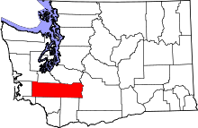 | |
| Town | ||
| CDPs | ||
| Other unincorporated communities | ||
| Ghost towns | ||