Morton, Washington
| Morton, Washington | |
|---|---|
| City | |
|
Main Street, Morton, Washington. | |
 Location of Morton, Washington | |
| Coordinates: 46°33′28″N 122°16′47″W / 46.55778°N 122.27972°WCoordinates: 46°33′28″N 122°16′47″W / 46.55778°N 122.27972°W | |
| Country | United States |
| State | Washington |
| County | Lewis |
| Area[1] | |
| • Total | 0.83 sq mi (2.15 km2) |
| • Land | 0.82 sq mi (2.12 km2) |
| • Water | 0.01 sq mi (0.03 km2) |
| Elevation | 948 ft (289 m) |
| Population (2010)[2] | |
| • Total | 1,126 |
| • Estimate (2015)[3] | 1,128 |
| • Density | 1,373.2/sq mi (530.2/km2) |
| Time zone | Pacific (PST) (UTC-8) |
| • Summer (DST) | PDT (UTC-7) |
| ZIP code | 98356 |
| Area code(s) | 360 |
| FIPS code | 53-47175 |
| GNIS feature ID | 1523383[4] |
| Website | www.visitmorton.com |

Morton is a city in Lewis County, Washington, United States. The population was 1,126 at the 2010 census.
History
Morton was first settled in 1871 by James Fletcher. It was later named after Benjamin Harrison's Vice President, Levi P. Morton,[5][6] in 1889. Morton was officially incorporated on January 7, 1913. Historic sources of revenue included logging, harvesting of cascara bark, and mining for cinnabar (mercury ore) in local mines. Morton was once known as the "tie mill capital of the world" in the 1950s. The longest railroad tie dock in the world ran along the railroad tracks east of Morton.[7]
The Loggers Jubilee is held every year since 1937 or 1938.[8]
Geography
Morton is located at 46°33′28″N 122°16′47″W / 46.55778°N 122.27972°W (46.557869, -122.279631).[9]
According to the United States Census Bureau, the city has a total area of 0.83 square miles (2.15 km2), of which 0.82 square miles (2.12 km2) is land and 0.01 square miles (0.03 km2) is water.[1]
Climate
This region experiences warm (but not hot) and dry summers, with no average monthly temperatures above 71.6 °F. According to the Köppen Climate Classification system, Morton has a warm-summer Mediterranean climate, abbreviated "Csb" on climate maps.[10]
Demographics

| Historical population | |||
|---|---|---|---|
| Census | Pop. | %± | |
| 1920 | 522 | — | |
| 1930 | 461 | −11.7% | |
| 1940 | 778 | 68.8% | |
| 1950 | 1,140 | 46.5% | |
| 1960 | 1,183 | 3.8% | |
| 1970 | 1,134 | −4.1% | |
| 1980 | 1,264 | 11.5% | |
| 1990 | 1,130 | −10.6% | |
| 2000 | 1,045 | −7.5% | |
| 2010 | 1,126 | 7.8% | |
| Est. 2015 | 1,128 | [11] | 0.2% |
| U.S. Decennial Census[12] 2015 Estimate[3] | |||
2010 census
As of the census[2] of 2010, there were 1,126 people, 461 households, and 283 families residing in the city. The population density was 1,373.2 inhabitants per square mile (530.2/km2). There were 535 housing units at an average density of 652.4 per square mile (251.9/km2). The racial makeup of the city was 94.2% White, 0.5% African American, 1.2% Native American, 0.6% Asian, 1.8% from other races, and 1.6% from two or more races. Hispanic or Latino of any race were 2.9% of the population.
There were 461 households of which 26.2% had children under the age of 18 living with them, 43.4% were married couples living together, 11.3% had a female householder with no husband present, 6.7% had a male householder with no wife present, and 38.6% were non-families. 29.9% of all households were made up of individuals and 17.3% had someone living alone who was 65 years of age or older. The average household size was 2.31 and the average family size was 2.83.
The median age in the city was 46.3 years. 20.3% of residents were under the age of 18; 8.2% were between the ages of 18 and 24; 19.5% were from 25 to 44; 25.8% were from 45 to 64; and 26.2% were 65 years of age or older. The gender makeup of the city was 48.1% male and 51.9% female.
Politics
Morton has voted Republican in the past, although less so than Lewis County as a whole. The results for the 2012 U.S. Presidential Election were as follows:[13]
- Mitt Romney (Republican) - 224 (52.95%)
- Barack Obama (Democrat) - 193 (45.63%)
- Other candidates - 6 (1.42%)
Education
There are two schools, Morton Elementary and Morton Junior-Senior High.
Centralia College East is adjacent to the Junior-Senior High facility.
Notable people
- Bill Bryant, Seattle Port Commissioner[14]
- Brandy Lynn Clark, Singer/Songwriter for many Nashville recording artists such as LeAnn Rimes and Reba McEntire[15]
References
- 1 2 "US Gazetteer files 2010". United States Census Bureau. Retrieved 2012-12-19.
- 1 2 "American FactFinder". United States Census Bureau. Retrieved 2012-12-19.
- 1 2 "Population Estimates". United States Census Bureau. Retrieved June 29, 2016.
- ↑ "Morton". Geographic Names Information System. United States Geological Survey.
- ↑ Majors, Harry M. (1975). Exploring Washington. Van Winkle Publishing Co. p. 122. ISBN 978-0-918664-00-6.
- ↑ Meany, Edmond S. (1923). Origin of Washington geographic names. Seattle: University of Washington Press. p. 172.
- ↑ LaVonne M. Sparkman, From Homestead to Lakebed (Spakrman Publications, 1994) p. 72. ISBN 0-89288-249-2
- ↑ http://www.loggersjubilee.com/historypage.htm
- ↑ "US Gazetteer files: 2010, 2000, and 1990". United States Census Bureau. 2011-02-12. Retrieved 2011-04-23.
- ↑ Climate Summary for Morton, Washington
- ↑ "Annual Estimates of the Resident Population for Incorporated Places: April 1, 2010 to July 1, 2015". Retrieved July 2, 2016.
- ↑ "U.S. Decennial Census". Census.gov. Retrieved June 7, 2013.
- ↑ Washington Secretary of State Results by Precinct
- ↑ "Governor Candidate Bill Bryant to Speak at Lincoln Day Dinner in Chehalis", The Chronicle, Centralia, Washington, February 22, 2016
- ↑
External links
- Morton General Hospital
- Morton Depot Project
- Fire Mountain Arts Council
- Morton Chamber of Commerce
- Morton School District
- Morton Logger's Jubilee
- Centralia College East
Municipalities and communities of Lewis County, Washington, United States | ||
|---|---|---|
| Cities | 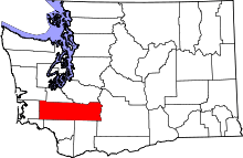 | |
| Town | ||
| CDPs | ||
| Other unincorporated communities | ||
| Ghost towns | ||